Curated OER
The Grand Canyon
Fourth graders study the Grand Canyon. They research the Grand Canyon and locate the Colorado River on the map of Arizona. They discuss erosion and read how sedimentary rock was formed. They view photographs of the Grand Canyon and...
Curated OER
Weathering Rocks
Fourth graders investigate what natural events cause rocks to break apart and differentiate between erosion and weathering. They conduct an experiment with plaster of paris to observe why some rocks are hard and others break, and...
NASA
Making Oxygen and Carbon Dioxide
Some like it hot! Scholars observe both exothermic and endothermic reactions as part of the carbon dioxide oxygen cycle. First, scientists demonstrate (or watch) a chemical reaction to create pure oxygen using fire for...
US Geological Survey
The Water Cycle for Schools: Intermediate Ages
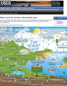
Water can travel from the highest mountain tops to the largest oceans. Using an interactive, young scientists trace the movement using an interactive online resource. They follow the water cycle by reading pop-up explanations on a...
Curated OER
Volcanoes!: The Mountain Blows its Top
Young scholars observe two demonstrations to conclude why bulge developed on the north flank of Mount St. Helens and conclude that when the "cap" was removed the pressure inside the volcano was suddenly released causing the violent...
Curated OER
Lesson 2 Activity 2: Mapping Mount St. Helens
Students use topographic map skills to interpret impact of the May 18, 1980 eruption of Mount St. Helens on the volcano's topography, and draw profile views of Mount St. Helens before and after the May 18, 1980, eruption.
Curated OER
Mapping Mount St. Helens
Students study topographic maps and contour lines and construct a simple three-dimensional model of Mount St. Helens before the May 18, 1980, eruption. They use topographic map skills to interpret the impact of the May 18, 1980, eruption...
Curated OER
The Properties of Water: "Dead Or Alive"
Students study the water cycle and create a booklet entitled: "Discover the Wonder of Water" They observe and record data regarding evaporation, condensation, and precipitation and how water moves from a solid to a liquid to a gas. They...
Channel Islands Film
Arlington Springs Man: Lesson Plan 2
West of the West's documentary Arlington Springs Man and a two-page scientific article about the same topic provide the text for a reading comprehension exercise that asks individuals to craft a one page summary of information gathered...
Curated OER
Enduring Patterns: Pre-Columbian Ecuadorean Textile Designs
Students examine Pre-Columbian Ecuadorean design motifs. They view examples of the designs, discuss the motif themes, and replicate the designs on modern fabric using authentic methods.
Curated OER
Greeks Around the World: A Case Study on Greek Diaspora
Students gain an understanding of the concept of Diaspora relating to Greeks. They use guided discovery to apply the geographic inquiry model to an examination of the reasons for Greek Diaspora.
Curated OER
Liquid Rainbow
Students develop their own techniques for drawing a small sample of solutions into a straw. They hypothesize ways to increase the density of water, and discuss how salt-free rainwater tends to float on top of salty seawater.
Curated OER
Oil: The Problem or Solution to the World's Economic Future
Students map the major oil producing and consuming countries and regions. They identify current and future topographic and political problems that could affect the production and transportation of oil.
Curated OER
Glaciers and Ice Wedging
Fourth graders observe buckling sidewalks and potholes before attempting to determine how these things are caused. They freeze water filled plastic cups that have been covered. As the water freezes, the students observe what happens to...
Curated OER
Location, Location, Location: Civilization's Ultimate Advantage
Students discover how geographical advantages, locational and regional, ultimately led to western Eurasian societies' disproportionate accounting of world power and innovation. They utilize a workbook which can be downloaded within this...
Curated OER
Geologic Age
Students investigate radioactivity as a tool for measuring geologic time and how geologists use this information to determine the absolute age of rocks or minerals.
Curated OER
Cartographer on Assignment: Creating a Physical Map of Africa
Students use geographic information to make an outline map of Africa, then demonstrate their understanding of the physical landscape of Africa by using a variety of materials to create a physical map of Africa
Curated OER
How Mountains Shape Climate
Students use raw data to make a climatograph; they explain the process of orographic precipitation and the concept of a rain shadow.
Curated OER
Salt: White Gold
Middle schoolers examine the importance of salt for trade routes and the economy of a community.
Curated OER
Create-a-Culture
Students examine the different characteristics of culture and write about a hypothetical culture of their own.
Curated OER
Blast It! (Learning About Copper)
Opening with background information on copper use and mining, this worksheet assesses junior geologists' reading comprehension. A map activity is available, but the map is not. There is a useful set of vocabulary matching cards and a...
Curated OER
Rain Forests: A Disappearing Act?
Students examine and locate rainforests on maps, and research the patterns of their destruction. They develop a bar graph of rainfall and temperature data, write a journal entry, and research the people, animals, and plants/products of...


