Curated OER
Cave Diagram
Students examine limestone cave geology and hydology. They study cave vocabulary.
Curated OER
Comparing Countries
Students compare facts about different countries. In this comparing lesson, students collect information about the US and another country and compare them. Students locate countries on the map and make a hypothesis about the lives of...
Curated OER
Around the World
Students discuss the major geographical and cultural differences in the world. In this social science lesson, students pretend they are traveling and research information about where they wish to stay by finding information about the...
Curated OER
Home Away From Home
Students discover some of the threats to tigers in the wild and some of the challenges of keeping them in wildlife preserves and zoos. They then sketch and explain their designs for sensible tiger enclosures in zoos.
Curated OER
Origami Paper Fun
Learners explore the art of Origami. They listen to various stories about Japan, create Origami shapes by following step-by-step directions, sing Japanese songs, locate Japan on a map, and take a quiz.
Curated OER
Through Time: Change in Sedona
Students locate events on a timeline of Sedona, Arizona and describe human and physical characteristics of the city. In this Sedona lesson plan, students locate the city on a map and listen to stories about Sedona.
Curated OER
Back-to-school ESL Ideas
Pupils share their countries and languages, flags, cultural identity, and pride in home culture.
Curated OER
Critters R Us or Crime Scene Critters
Learners identify nocturnal animals in their local area. Using the internet, they view animal tracks to determine which ones might be in around their school. In groups, they examine outside areas and record their observations. They...
Curated OER
Global Water
Students collect data on their household water use and calculate how many gallons of water a person uses per day. They investigate how students in different parts of the world get their drinking water.
Curated OER
Children in the United States and Japan
Students locate Japan on a map or globe and describe the relative location of Japan. They use the Internet to investigate cultural characteristics of children in the United States and in Japan. They use a Venn Diagram as an...
Curated OER
Paws in Jobland
Students explore jobs in different countries . In this lesson about different countries through research. Students are broken into groups and given a country to research. Each group is provided with a worksheet with 14 questions to be...
Curated OER
Yam and Eggs
Pupils gain knowledge about the different kinds of foods people eat around the world for breakfast. They look at a map and see if they can come up with reasonable answers as to why location may affect what people eat. Students also...
National Geographic Kids
National Geographic Kids: China
Click-through facts-and-photo file about China's geography, nature, history, people, culture, and government. Includes a map of the country that pinpoints its Asian location and a video that explains the desertification of...
Wonderville Media
Wonderville: The Great Wall of China
The construction of the Great Wall of China goes back roughly 3,000 years to the Western Zhou Dynasty. The original constructions were lines of fortresses that defended against attacks from nomadic tribes in north China. Learn more about...
Ducksters
Ducksters: Quiz: Geography of Ancient China
History Questions: Geography of Ancient China Quiz, Test, and WebQuest
Annenberg Foundation
Annenberg Learner: China Through Mapping
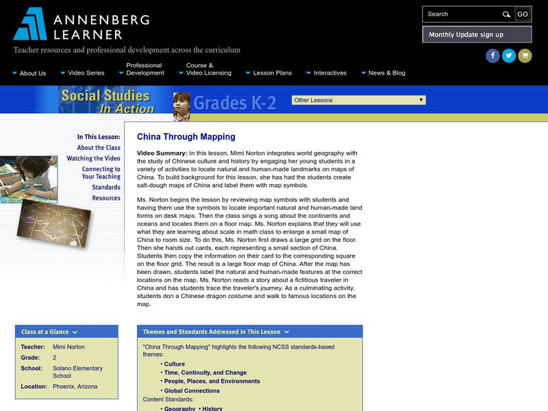
In this lesson, Mimi Norton integrates world geography with the study of Chinese culture and history by engaging her young students in a variety of activities to locate natural and human-made landmarks on maps of China. To build...
Read Works
Read Works: China Today: China's Population
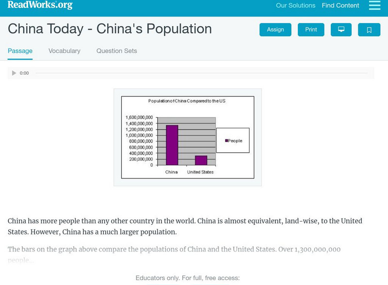
[Free Registration/Login Required] An informational text about the population grown in China. A question sheet is available to help students build skills in reading comprehension.
Read Works
Read Works: China Today: China's Biggest Cities
[Free Registration/Login Required] An informational text about Beijing and Shanghai, two large cities in China. A question sheet is available to help students build skills in reading comprehension.
Enchanted Learning
Enchanted Learning: Zoom School: China
Learn about the fourth-largest country in the world at this site from Zoom School. Explore China's Great Wall, its people, animals, and more, and find maps and basic information about its geography, flag, government, and so on.
Ducksters
Ducksters: Geography for Kids: China
The history, capital, flag, climate, terrain, people, economy, and population of China is described on this site.
Ducksters
Ducksters: Geography for Kids: Macau
Kids learn about the history, capital, flag, climate, terrain, people, economy, and population of Macau.
Ducksters
Ducksters: Geography for Kids: Taiwan
This site explores the history, capital, flag, climate, terrain, people, economy, and population of Taiwan.
National Geographic Kids
National Geographic Kids: Nepal
Nepal lies between China and India in South Asia. The country is slightly larger than the state of Arkansas. Nepal has the greatest altitude change of any location on Earth. The lowlands are at sea level and the mountains of the...
ClassFlow
Class Flow: National Geographic Survey
[Free Registration/Login Required] How much do you know about the world around us? Questions provided by National Geographic Survey. http://www.nationalgeographic.com/roper2006/findings.html
Other popular searches
- Ancient China Geography
- China Geography Powerpoint
- Geography of China
- China Geography Activity
- China Geography Word Search
- China Geography Great Wall
- China Geography Lesson Plans
- China Geography Games
- China Geography Puzzle
- China Geography Model
- Dbq on China Geography
- China Geography 3rd


