Information Technology Associates
Brazil Geography 2007
Detailed information describing the geography of Brazil. Click here to learn fascinating information about the dynamics of Brazil's geography.
Climate Zone
Climate Zone: Climate of Bangladesh
Tables for the different climate regions in Bangladesh show the average temperature, rainfall and snowfall in this Asian country.
Climate Zone
Climate Zone: Climate of North Korea
Tables for the different climate regions in North Korea show the average temperature, rainfall and snowfall in this Asian country.
Curated OER
Educational Technology Clearinghouse: Maps Etc: Movement of Armies, 1861
A map of the Washington-Richmond region showing the railroads and navigable coastline, illustrating the difficulties of moving large armies through the area at the time of the opening years of the American Civil War. The map shows major...
Latimer Clarke Corporation
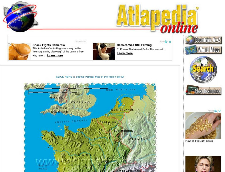
Physical Map of France
Map of France showing mountain ranges, rivers, and coastlines.
Curated OER
Educational Technology Clearinghouse: Maps Etc: Nile, 1903
This is a highly detailed map of the Nile River basin from the Tropic of Cancer south to the river's source at Victoria Nyanza (Lake Victoria). This map shows both the Blue Nile and White Nile river systems in 1903. Major cities, trade...
Curated OER
Etc: Alaska Boundary Controversy, 1867 1903
A map of southeastern border of Alaska and Canada showing the area of boundary dispute and the boundary established by the Hay-Herbert Treaty between Britain and the United States in 1903. The map shows the coastline and fjords of the...
Curated OER
Etc: Maps Etc: Viscaino's Map of the California Coast, 1602
A facsimile of an early map by Captain Sebastian Viscaino (1602) of the California coastline between Cape Mendocino and Monterey.
Curated OER
Etc: Maps Etc: San Francisco Bay and Vicinity in California, 1884
A sketch map from 1884 showing the relative positions of the several bays along the California coastline between Cape Mendocino and Monterey.
Curated OER
Educational Technology Clearinghouse: Maps Etc: Western Canada, 1916
A map from 1916 of western Canada (British Columbia, Alberta, Saskatchewan, and Manitoba) from the Pacific coastline east to the Ontario border, and from approximately latitude 60 degrees North to the International boundary with the...
Curated OER
Etc: Maps Etc: Vicinity of New Haven and Hartford, 1858
A map from 1858 of the vicinity of Hartford on the Connecticut River. The map covers central Connecticut from Hartford south to New Haven, Litchfield to Bolton, and the Long Island Sound coastline from Fairfield to Saybrook.
Curated OER
Educational Technology Clearinghouse: Maps Etc: Virginia, 1577
A facsimile of an early map (1651) showing the discoveries of Sir Francis Drake in North America, including the coastline of Ould Virginia and Maryland, the Bay of Checepiake (Chesapeake Bay), Lord Delaware Bay, Cape Hatteras and Cape...
Curated OER
Educational Technology Clearinghouse: Maps Etc: New England, 1631
A facsimile of an early map of New England in 1631 as observed by Captain John Smith in 1614. The map covers the coastline from Cape James (Cape Cod) and Stuards Bay (Cape Cod Bay) north to Pembrocks Bay and the Bay of Fundy. A...
Curated OER
Educational Technology Clearinghouse: Maps Etc: The Thirteen Colonies , 1776
A map of the thirteen colonies at the outset of the American Revolutionary War, showing major cities and towns, the Great Lakes, mountains, rivers, and coastline.
Curated OER
Educational Technology Clearinghouse: Maps Etc: Smith's Map of New England, 1616
A facsimile of an early map of New England as observed by Captain John Smith in 1616. The map covers the coastline from Cape James (Cape Cod) and Stuards Bay (Cape Cod Bay) north to Pembrocks Bay, and includes the inscription "The most...
Curated OER
Etc: Maps Etc: From Dudley's Arcano Del Mare, 1646
A facsimile of an early map from the Arcano del Mare (Robert Dudley, 1642) of the Nova Belgia (New Amsterdam) and New England coastline from Long Island to east of the St. Croix River.
Curated OER
Etc: Attempts at Huguenot Settlements in Florida, 1562 1565
A map of the southern Atlantic coastline showing the early attempts by the French Huguenots under Jean Ribault to establish settlements in the Spanish territory of Florida. The map shows the sites of Charles Fort (Charlesfort) South...
Curated OER
Etc: Maps Etc: Western Europe During the Third Inter Glacial Stage, 25,000 Bce
Map of Western Europe, at a time when sea levels were much lower and the British Isles were connected with the mainland. Major river routes are shown extending to the theoretical coastline of the period. According to the authors in 1916,...
Curated OER
Educational Technology Clearinghouse: Maps Etc: Brittany and Vendee, 1912
A Map of Brittany and Vendee along the west coast of France in 1912, showing the major cities, rivers, coastline and terrain of the region. This map shows the administrative departments at the time, including Manche, Calvados, Orne,...
Curated OER
Educational Technology Clearinghouse: Maps Etc: Georgia, 1906
A map from 1906 of Georgia showing the State capital of Atlanta, major cities and towns, railroads, lakes, rivers, and the Atlantic coastline.
Curated OER
Educational Technology Clearinghouse: Maps Etc: Georgia, 1909
A map from 1909 of Georgia showing the State capital of Atlanta, major cities and towns, railroads, northern mountains, lakes, rivers, and the Atlantic coastline.
Curated OER
Educational Technology Clearinghouse: Maps Etc: Georgia, 1919
A map from 1919 of Georgia showing the State capital of Atlanta, major cities and towns, railroads, northern mountains, lakes, rivers, and the Atlantic coastline.
Curated OER
Educational Technology Clearinghouse: Maps Etc: Georgia, 1922
A map from 1922 of Georgia showing the State capital of Atlanta, major cities and towns, railroads, northern mountains, lakes, rivers, and the Atlantic coastline.
Other popular searches
- Marine Coastlines
- Types of Coastlines
- Human Impact on Coastlines
- Coastlines and Beaches
- Ecosystems & Coastlines
- Geography Coastlines
- Australian 4 Coastlines
- Australian Coastlines
- Geography Coastlines


