Curated OER
Explore: 4th Grade Beaufort Wind Speed
Fourth graders measure wind speed, air pressure, humidity, temperature, and wind direction. They compare their observations with those of actual weather forecasts.
Curated OER
Around the World in 17 Days
Students examine geography while studying the 2006 Winter Olympics. Students keep track of the winners of each Olympic event by finding the results using the Internet or by reviewing the newspaper and discuss the country the medalist...
Curated OER
Virginia In the World: The Geography of Commerce
Students examine how Virginia connects with the world through export trade. Using a map, they use symbols to depict the value of trade and the direction of the flow of goods. They complete a scavenger hunt using electronic almanacs and...
Curated OER
Transcription and Translation Lab Activity
Students investigate DNA strands. They study the sequence to determine if it is DNA or RNA and write the mRNA nucleotide sequence. After stringing the beads together to create the mRNA sequence they translate it into an amino acid...
Curated OER
Binary Numbers
Students explore how a battery-powered light box demonstrates how to transmi timages.
Florida State University
Florida State University: Color Code Resistor
This resistor color code activity allows you to change the resistance value with a slider and then determine the third digit, multiplier, and tolerance, providing the final resistance in ohms. It allows you to view how the passing...
Other
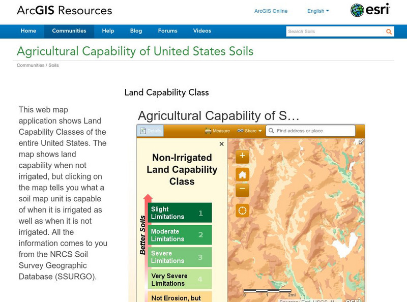
Esri: Arc Gis: Agricultural Capability of United States Soils
A sophisticated map tool that shows the capability of soils for agriculture, with or without irrigation, for the whole of the United States. Enter a location and a color coded map is shown, along with a key for interpreting it. The...
US Environmental Protection Agency
Epa: Ecological Regions of North America
A helpful map of North America which color codes its 15 ecological regions. Click on the different regions for a brief description of the area.
ClassFlow
Class Flow: 2 Letter State Abbreviation Codes
[Free Registration/Login Required] Students will use Internet resources such as the USPS website to locate the 2-letter state abbreviation codes. Using the floating keyboard and font/color tools, they will display the correct code on...
Curated OER
Etc: Maps Etc: United States and Confederate States, 1861
A map of the United States and Confederate States in 1861. The map is color-coded to show Free Union States, Slave Union States, Confederate States seceding before April 15, 1861, Confederate States seceding after April 15, 1861,...
Curated OER
Etc: Maps Etc: Distribution of Ethnicities in the United States, 1900
A map from 1907 of the United States showing concentrations and distribution of various European ethnic groups in 1900. The map is color-coded to show foreign populations where 8 percent or more of the inhabitants are Scandinavian,...
Curated OER
Educational Technology Clearinghouse: Maps Etc: The United States, 1890
A map from 1890 of the United States showing the territorial expansion from the original Thirteen Colonies to the states and territories of 1890. This map shows state capitals, railroads, lakes, and rivers. The map is color-coded to show...
Curated OER
Etc: Maps Etc: Freedom States and Slavery States, 1854
A map of the United States at the time of the Kansas-Nebraska Act (1854) which allowed settlers to determine whether or not slavery would be allowed in their territories. The map is color-coded to show the Free States (including...
Curated OER
Etc: Maps Etc: United States Expansion and the Railroads, 1880
A map of the United States and territories showing the expansion from the formation of the original states to 1880, and the railroad network in 1880. The map is color-coded to show the original states, the states admitted between 1791...
Curated OER
Educational Technology Clearinghouse: Maps Etc: The United States, 1821
A map of the United States in 1821 showing the states and territories which either accepted or abolished slavery after the Missouri Compromise of 1820. The map is color-coded to show absolutely free states, states undergoing gradual...
Curated OER
Educational Technology Clearinghouse: Maps Etc: The United States , 1860
A map of the United States in 1860 showing the states and territory boundaries at the time, and is color-coded to show the slave States and distribution of slaves, the free states, and the territories, all open to slavery under the...
Curated OER
Educational Technology Clearinghouse: Maps Etc: The United States, 1900
A map from 1900 of the United States showing the territorial expansion from the original Thirteen Colonies to the states and territories of 1900. The map is color-coded to show the original states, states admitted between 1791 and 1860,...
Curated OER
Etc: Maps Etc: The United States, September, 1850
A map of the United States at the time of the passing of the Compromise of 1850 (September, 1850). This compromise was a series of bills attempting to resolve territorial and slavery issues raised by the Missouri Compromise (1820) and...
Curated OER
Etc: Maps Etc: Reconstructed United States, 1870
A map of the United States and territories after the Civil War during reconstruction and readmission by 1870. The map is color-coded to show the 'Normal States’ (Union States), the 'Reconstructed States&’ (Confederate States), the...
Curated OER
Etc: Maps Etc: United States and the Slavery Prohibition Issue, 1850
A map of the United States and territories at the time of the slavery prohibition issue in 1850, after the Missouri Compromise of 1820. The map is color-coded to show the areas where slavery was prohibited by State Law, slavery was...
Curated OER
Etc: The United States Secession, 1860 1861
A map showing the secession of the Confederate States from the Union, from the secession of South Carolina (December 20, 1860) to the secession of Tennessee (June 8, 1861). The map is color-coded to show the Federal States and territory...
Curated OER
Etc: United States During the Civil War, 1861 1865
A map of the United Stated during the American Civil War (1861-1865) showing State and territory boundaries, with dates of statehood for the territories from 1796 to 1861. The map is color-coded to show the Union States, Confederate...
Curated OER
Etc: Maps Etc: United States at the Outbreak of the Civil War, 1861
A map of the United States and territories in 1861 at the outbreak of the Civil War. The map is color-coded to show the Union Free States, the Confederate States seceded before April 15, 1861, the Confederate States seceded after April...
Curated OER
Educational Technology Clearinghouse: Maps Etc: The United States, 1861
A map of the United States in 1861 after the secession of the Southern States. The map is color-coded to show the Free Union States, Union Slaveholding States, Confederate States, and the territories of Washington, Dakota, Nevada, Utah,...


