NASA
Hurricanes and Hot Towers with TRMM
Take cover because a wild presentation on hurricanes is about to make landfall in your classroom! An outstanding PowerPoint presentation is the centerpiece of this instructional activity. Not only does it provide information and...
Curated OER
Anza and Font in Search of Latitude
This is an integrated lesson that incorporates Social Studies, Science, and Mathematics. In Social Studies, 7th graders complete an online interview and complete an online worksheet about latitude of sites on the Anza trail. In Science...
Curated OER
Map Scale
Third and fourth graders are introduced to the concept of map scale. Using an illustration, they discuss if it shows the actual size of the object and why scale is used to represent areas. They use some items in the illustration to...
Curated OER
Mapping the Human Genome
Students study DNA and how it was discovered. In this biology lesson students see the effects of mapping the human genome would have.
Curated OER
Mapping Ancient Coastlines
Most of this lesson is spent working on the "Bathymetry Worksheet." It includes a graph of the changes in sea level over the past 150,000 years and a bathymetric map of changes in an imaginary coastline over time. Participants answer...
Curated OER
Unit III: Worksheet 2 - Motion Maps
Make motion maps, draw graphical representations, and determine displacement. These are the activities included in this physics assignment. This is a great review of velocity, position, acceleration, and displacement concepts.
Laboratory for Atmospheric and Space Physics
Charting the Progress of New Horizons
In 2006, New Horizons began its mission to fly to Pluto. As it continues its journey, scholars track its progress with the help of an informative website, all the while reinforcing measurement concepts with the construction of a scaled...
Curated OER
Activities in A Science Classroom
Learning Through Games and Activities Make Staying On Task in the Classroom Fun
Center for Learning in Action
Density
Explore the concept of density within states of matter—gases, liquids, and solids—through a group experiment in which young scientists test objects' texture, color, weight, size, and ability to sink or float.
Global Oneness Project
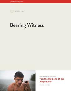
Bearing Witness
A controversial construction project in South America, the Belo Monte dam, is endangering local cultures, ecosystems, and communities. High schoolers create a concept map based on an online article they read before engaging in...
Curated OER
Science Inquiry Lesson: Mapping Project
Students explore the methods of creating maps. They create a map of Animas River Park using a compass and measuring tape, develop a single map from the team map sections, and devise another map of the Animas River Park using a GPS unit.
Curated OER
Maps In Our Everyday Lives
Learners break into groups and complete a chart about information on maps of their hometown.
Curated OER
Tying it all Together
Students study an article on drugs in their society. In this investigative lesson students create their own concept map.
Curated OER
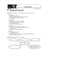
What's in the Air?
In this air activity, students will choose the correct definition for atmosphere, troposphere, stratosphere, and pollutant. Then students will complete a concept map showing what components make up air. This activity has 4 multiple...
Curated OER
SCIENCE AND TECHNOLOGY IN SOCIETY
Young scholars research scientific discoveries and technological innovations. They organize discoveries and innovations in life, environmental, physical, earth and space science categories. They analyze impact of selected discoveries...
S2tem Centers SC
Seasons
Winter, spring, summer, and fall—take the learning of the seasons beyond the elementary level to the middle school classroom. Curious learners begin by watching videos about the seasons and the rotation of planet Earth. Then,...
University of California
Hot! Hot! Hot!
Calories are not tiny creatures that sew your clothes tighter every night, but what are they? A science lesson, presented at multiple levels, has learners experiment with heat, heat transfer, and graph the function over time....
Curated OER
Christopher Columbus: The Man, the Myth, the Legend
Learn more about maps by examining Christopher Columbus's voyage to the New World. Kindergartners will learn about basic map skills and how to identify the compass rose, oceans, and land masses. They will also discover the purpose of...
Curated OER
Understanding Weather and Climate Patterns
Learners research the climate patterns of various locations and make predictions based on their findings. They determine the importance of latitude and longitude in weather and climate. Students create graphs displaying their collected...
University of California
Energy and Biomass Pyramids
Young scientists play tag as they act out the food pyramid in the ocean ecosystem. Energy circles pass from the smaller prey to the predators and at the end of the activity, a data chart and analysis questions allow pupils to apply their...
NASA
Astronomy Mission Module
Yes, scientists say, there is other life in our solar system! And the best place to look is on Europa, a moon of Jupiter. Here, learners mimic the techniques scientists use to gather information about objects in our solar system, write...
Curated OER
Weather Forecasting Unit
Students study weather concepts, mapping, characteristics in this series of lessons.
Curated OER
The Four-Color Problem: Concept and Solution
Take a walk through time, 1852 to 1994, following the mathematical history and development of the Four-Color Theorem. Learners take on the role of cartographers to study an imaginary world of countries that need to be...
Indian Land Tenure Foundation
Maps and Homelands
You are never too young to learn about maps. To better understand the concept of a homeland, students work together to construct a map of their local area out of paper puzzle pieces. They'll put the maps together and then add details by...

