Curated OER
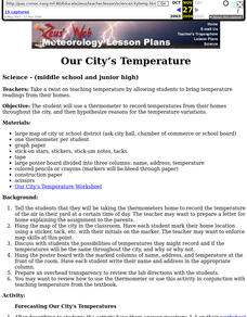
Our City's Temperature
Students use a thermometer to record temperatures from their homes throughout the city, and then hypothesize reasons for the temperature variations. They use a weather graph worksheet that's imbedded in this instructional activity to...
Curated OER
Relative Location
First graders use landmarks to describe relative locations of a place. In this geography and mapping lesson plan, 1st graders draw picture maps of their bedrooms to show an object's location in relation to other objects. As an...
National Wildlife Federation
I Speak for the Polar Bears!
Climate change and weather extremes impact every species, but this lesson focuses on how these changes effect polar bears. After learning about the animal, scholars create maps of snow-ice coverage and examine the yearly variability and...
Curated OER
What Causes Irregular Temperature Patterns?
Students examine common trends in climate across the U.S. They identify the anomalies in hot-cold temperature differences in the U.S and locate them on the map using latitude and longitude coordinates.
Curated OER
Climate in Our Back Yard
Students construct a "A Year in Pennsylvania" poster on which they creatively describe at least three examples of how the climate they live in shapes their lives during every season of the year.
Curated OER
Geology and the Battle of Gettysburg
High schoolers create geologic maps of the Gettysburg battlefield. For this geologic skills lesson, students consider the variations of Earth's surfaces and explore strategies employed by the North and South in the Battle of Gettysburg...
Curated OER
Weather and its Effect on the Environment and Settlement
Students, after choosing two diverse cities, collect data on weather for a month and construct a graph on temperature and precipitation. After collecting population data of said cities, and graphing it, they plot population on a large...
Curated OER
March of the Polar Bears: Global Change, Sea Ice, and Wildlife Migration
Students study global change and how these changes impact wildlife. In this polar bears lesson plan students analyze maps and data to understand climate change.
Curated OER
Strawberry Girl: Life on the Frontier
Students explore geographic changes by researching the state of Florida. In this Florida history lesson, students identify the storms and disasters that have created sinkholes in portions of Florida. Students read the book Strawberry...
Curated OER
Measuring Precipitation
A little engineering design is mixed into this lesson on precipitation measurement. Groups plan and construct a rain gauge, and use it to collect precipitation. As part of the PowerPoint presentation, learners view a satellite map of...
Curated OER
Housing: Types of Shelters
Students experiment with the construction of shelters and the various types of architectural designs. In this shelters instructional activity, students draw the building they live in. Students compare and contrast buildings...
Curated OER
Clouds
Young scholars observe and record different types of clouds. They use a cloud chart to discuss the three cloud types to see if students can identify the clouds they drew.
Curated OER
Scientist Tracking Network
Young scholars correlate surface radiation with mean surface temperature of several geographic regions. They observe how these parameters change with latitude and construct an understanding of the relationship of solar radiation to...
Curated OER
Biome Discovery Expedition
Students research similarities and differences among biomes online. They simulate job of zoo planners, and depart on expedition to decide which biome the city zoo should construct, as well as which plants and animals to include in it.
Curated OER
Learning Lesson: How To Make A Rain Gauge
Students discover that rainfall amounts are rarely uniform which means the amount of rain is different from location to location. They construct their own rain gauge using everyday materials.
Space Awareness
Continental Climate and Oceanic Climate
There's nothing better than a cool breeze blowing in from the ocean. Scholars explore how water affects change in temperature using a hands-on experiment on climate. They use measurement tools to compare the continental and oceanic...
Curated OER
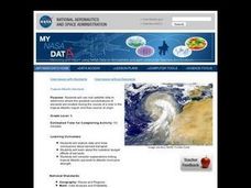
Troical Atlantic Aerosols
Learners explore the effect aerosols have upon he weather and climate. They observe NASA satellite images to explore and draw conclusions about aerosol transport. From studying the images, students track the path of aerosols. They...
Curated OER
Discovering the Physical Geography of Washington
Students develop a mental map of the state of Washington and draw it on paper. Using the Virtual Atlas, they identify the physical features of the state and draw them on their map. They also examine the populations and diversity of the...
Curated OER
Surface Air Temperature Trends of the Caribbean
Students investigate the seasonal changes to sea surface and near-surface air temperatures near the equator. They use actual satellite data to track and graph the differences in air and sea temperatures during different seasons in the...
Curated OER
Clouds
Students explore the characteristics of clouds, their formation, symbols used in their identification, and the relationship of clouds to weather. The lesson focuses on how they are formed and their classification.
Curated OER
Under The Sea
Second graders study how a tsunami is formed by underwater events such as earthquakes, volcanoes or landslides. They discuss what they knew about living and non-living things in the ocean.
Curated OER
Treasure Hunt Region
Students are introduced to new geography related vocabulary words. In groups, they focus on a different region of the school and develop a new name for it. They create a treasure map for another group to use in the region of the school...
Curated OER
Stratigraphy -- Layers of Time in the Earth
Students are introduced to the process of stratification. Using the internet, they read about the Richard Beene archeological site near San Antonio. Using a map, they color code the different layers present at this site and answer...
Curated OER
"Across Oregon On The 45th N Parallel" A Transect of Oregon
Students explore the physical geography of Oregon. In groups, students collect weather and elevation information on Oregon. They organize the data and create maps and graphs of the information. Afterward, students compare the...
