Curated OER
High Up in the Himalayas
Have your class supplement their knowledge on the Himalaya mountain range. In a brief handout, they read about the land masses that collided to form the Himalayas and other mountain ranges. It also touches briefly on the Earth's crust...
Curated OER
Investigating Our Place in the World
Students study the concept of geography in a year long unit. In this geography unit, students participate in different activities that explain the spatial sense of the world, the physical landmasses and bodies of water, geographic...
Curated OER
Giving Students a Little Latitude
Students use a world outline map to locate places using coordinates of latitude and longitude. They answer questions about places based on their knowledge of the map and on their research and make up more questions of this sort for each...
Curated OER
Places in My World
Second graders explore where they are located on the globe. In this maps and globes lesson, 2nd graders use a map to show where they live and show the cardinal directions. Students identify characteristics of mountains, flat land,...
Curated OER
Where in the World Am I?
Students are introduced to geography skills. They answer questions on a worksheet using the internet and maps. They examine the area of Japan as well.
Curated OER
Where in the World is Tacky the Penguin?
Students complete an art activity and a classroom graph that coincides with the Tacky the Penguin Series by Helen Leste.
Curated OER
Yo-ho, Yo-ho a Viking's Life for Me
Students complete a unit of lessons on the Vikings. They analyze maps, read and discuss myths, summarize the main ideas from resource materials, watch videos, sing a song, draw a picture to illustrate Norse mythology, and define key...
Curated OER
Mapping West Virginia
Fourth graders explore West Virginia. In this Unites States geography lesson, 4th graders discuss the type of land and the cities in West Virginia. Students create two overlays, with transparencies, that show the natural land and the...
Curated OER
World's Biggest Lakes Quiz
In this online interactive geography quiz activity, students examine the chart that includes the area of 20 of the world's largest lakes. Students identify the names of the lakes in 4 minutes.
Curated OER
Motivating Activities for Geography Week
Here is a great way to pique your students' interest in geography, and help them learn about their world.
Curated OER
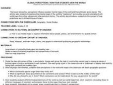
Global Perceptions: How Your Students View the World
Pupils examine their own perceptions and attitudes about places around the world. Using their mental maps, they compare and contrast it with a world map from different periods in history. They review the various types of map projections...
Curated OER
New Perspectives
Students examine maps that are designed to give different perspectives. They create mental maps that illustrate their own perspectives and those of people from other parts of the world.
Curated OER
Statue of Liberty
Students discuss aspects of the Statue of Liberty and create their own personalized statue. Students use symbols to represent themselves in their own drawings of the Statue of Liberty.
Curated OER
Water and Land 207
Learners examine maps of different projections, mathematically calculate distortions, and note the advantages and disadvantages of each map. They study the different maps and transfer the map to graph paper.
Curated OER
Tooling Around Arizona: Reading Arizona Maps
Students study geography. For this Arizona maps lesson, students develop their map reading skills. They have class discussions and work independently with various copies of Arizona maps to practice those skills. This lesson mentions...
Alabama Learning Exchange
Forces that Change the Land
Students conduct Internet research find information about the following landforms: mountains, canyons, and valleys. They create travel brochures of their findings.
Curated OER
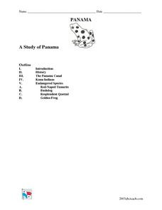
A Study of Panama
In this worksheet on Panama, students read an introduction about Panama, then read about its history, The Panama Canal, the Kuna Indians and the Endangered Species of Panama. After each selection, students answer a set of related questions.
Curated OER
Country: Austria
Students access a variety of Austria themed websites. They locate information about history, geography, climate, people and culture. They view a live webcam of different parts of Austria and read about famous personalities from Austria.
Curated OER
Getting to the Core of World and State Geography
Students create topography relief maps. In this geography skills lesson, students review geography core knowledge skills, design and make a state relief map, and compile a student atlas.
Curated OER
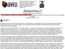
Antarctica I
Students explore exploring and expiditions then simlate their own on campus. They divide into small "expedition groups." Have each team report back to the class about their expeditions, using written, oral, or videotaped presentations.
Curated OER
The Interconnectedness of Ancient Peoples Map Study
Seventh graders begin this lesson by viewing various maps of the Ancient World. As a class, they take notes on the changes of different areas in Europe and Asia as their teacher lectures to them. They answer questions about the...
Curated OER
Happy Lesson: The Earth's Crust
This PowerPoint provides a multiple choice and fill-in-the-blank format for reviewing vocabulary and related content following an "earth's crust" science unit. The information is concise and age-appropriate and the font and colors are...
Curated OER
Traveling Through North America
Students identify places and landmarks in North America, specifically Canada and the United States, by using and constructing maps. Six lessons on one page; includes test.
Curated OER
Africa: Introduction and Study Guide
In this Africa worksheet, 7th graders answer 26 questions about the geography, economy and climate of the nations of Africa.
Other popular searches
- Oceans and Continents
- 7 Continents and Oceans
- Continents and Oceans Map
- Continents Oceans Landforms
- Label Oceans and Continents
- World Continents and Oceans
- Identify Continents Oceans
- Earths Oceans and Continents
- Canada Oceans and Continents
- Oceans and Continents Maps
- Continents Oceans Rating=3
- Map of Continents and Oceans


