Hi, what do you want to do?
Ducksters
Ducksters: Geography for Kids: South Africa
The history, capital, flag, climate, terrain, people, economy, and population of South Africa is on this site.
Ducksters
Ducksters: Geography for Kids: Spain
Study the history, capital, flag, climate, terrain, people, economy, and population of Spain on this website.
Ducksters
Ducksters: Geography for Kids: Sweden
On this site, learn about Sweden's history, capital, flag, climate, terrain, people, economy, and population.
Ducksters
Ducksters: Geography for Kids: Turkey
Learn about the history, capital, flag, climate, terrain, people, economy, and population of Turkey on this website.
Ducksters
Ducksters: Geography for Kids: United Kingdom
Explore the United Kingdom's history, capital, flag, climate, terrain, people, economy, and population on this website.
Ducksters
Ducksters: Geography for Kids: United States
Explore the history, capital, flag, climate, terrain, people, economy, and population of the United States on this website.
Ducksters
Ducksters: Geography for Kids: Vietnam
Learn about Vietnam's history, capital, flag, climate, terrain, people, economy, and population on this website.
Ducksters
Ducksters: Geography for Kids: Afghanistan
Kids learn about the Geography of Afghanistan on this site. The history, capital, flag, climate, terrain, people, economy, and population.
University of Pennsylvania
University of Pennsylvania: Mali
View a country map, a capital map, travel advisories, visit the Mali Embassy in the U.S. site, and find links to more information about the country.
University of Illinois
University of Illinois: Early American Trade With China: Emperor Quianlong's Response [Pdf]
In 1793, the King of England sent a mission under Lord Macartney to China to open regular diplomatic and commercial relations with China. The King instructed Macartney to deliver a letter tothe Emperor requesting, among other things,...
Texas Instruments
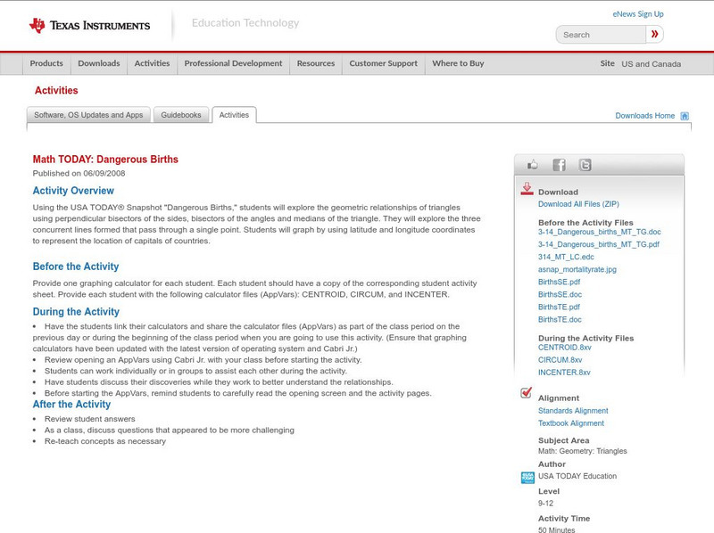
Texas Instruments: Math Today Dangerous Births
In this activity, using the USA TODAY Snapshot "Dangerous births" students will explore the geometric relationships of triangles using perpendicular bisectors of the sides, bisectors of the angles and medians of the triangle. They will...
Antonio Salinas and Maria Jesus Egea
Vedoque: Geografia De Europa
This game is about the various countries of Europe. It has a set of questions about their locations on the map, their capitals and their flags.
Virtual Bangladesh
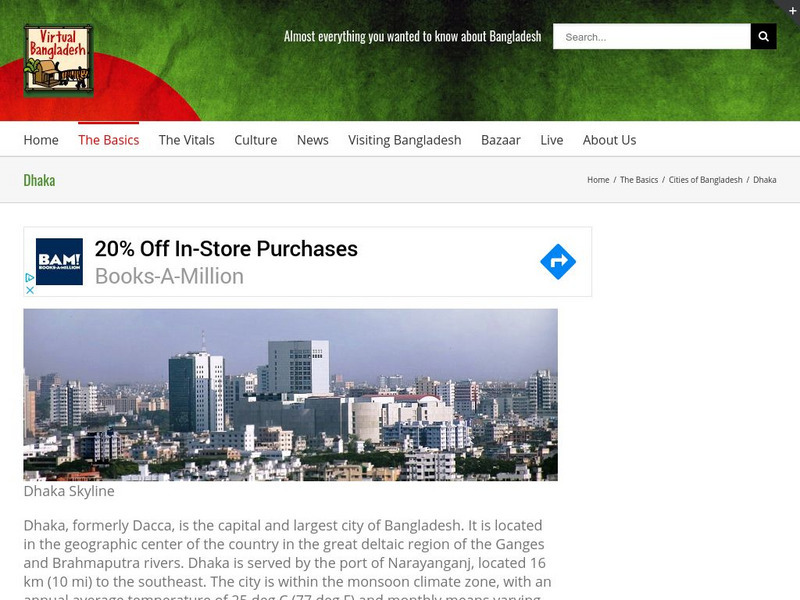
Virtual Bangladesh: Dhaka
This Virtual Bangladesh site provides information on Dhaka, Bangladesh. Formerly called Dacca, Dhaka is the capital and largest city of Bangladesh, located in the geographic center of the country. Here you will find not only a...
Council for Economic Education
Econ Ed Link: Balance of Payments (Bop)
International trade allows countries to buy and sell both domestic and foreign goods, as well as services and financial assets. A country's transactions are summarized in a set of accounts called the Balance of Payments (BOP). Learners...
CommonLit
Common Lit: "Kenyan Discovery: Let There Be Lights to Save Lions" by Nina Gregory
Kenya is a country in East Africa; the capital city, Nairobi, is well-known for its National Park: the world's only game reserve found within a major city. The park's large wildlife population includes baboons, rhinos, gazelles, zebras,...
A&E Television
History.com: How Interstate Highways Gutted Communities and Reinforced Segregation
America's interstate highway system cut through the heart of dozens of urban neighborhoods. Congress approved the Federal-Aid Highway Act of 1956, authorizing what was then the largest public works program in U.S. history. It promised to...
Houghton Mifflin Harcourt
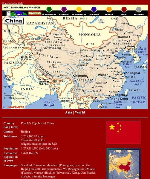
Holt, Rinehart and Winston: World Atlas: China
See a map of China and surrounding countries, and get basic facts and stats about China: capital, total area, population, languages, and more.
Other
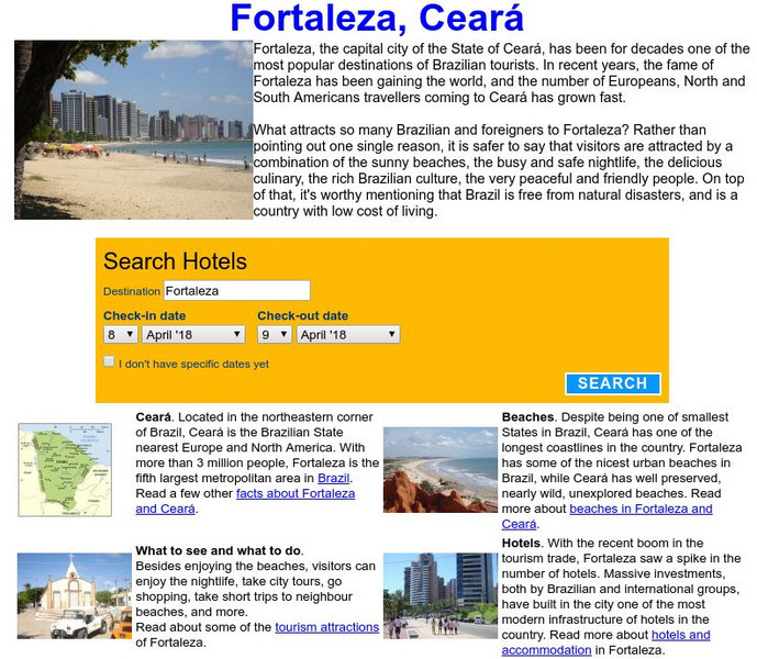
Visit Fortaleza: Fortaleza, Ceara, Brazil
Information on Fortaleza which is the capital city of Ceara, Brazil. It has become one of the top tourist attractions in the country.
Curated OER
Etc: Maps Etc: Babylonia Before the Semitic (Chaldaean) Conquest, About 4000 Bc
A map of Babylonia, in current Iraq, before the Semitic (Chaldaean) Conquest, about 4000 B.C. This map shows the early territories of Makan and Melucha between the rivers Tigris and Euphrates, with the Makan capital Ur inhabited by the...
Curated OER
Educational Technology Clearinghouse: Maps Etc: Northeast China, 1971
"Northeast China - the provinces of Heilungkiang, Kirin, and Liaoning - is the most important region of the country and a nationally significant and still-developing center of agricultural production. Most of the Northeast remained...
Curated OER
Etc: Land of the Hebrews, 971 931 Bc
A map of the Hebrew lands in the time of King Solomon, around 971 to 931 BC. The map shows the land of Canaan, with the boundaries of Phoenicia, Israel, Philistia, and Judah, the important coastal cities of Sidon, Tyre, Joppa, Ashdod,...
Curated OER
Etc: Maps Etc: Mexico, Central America and the West Indies, 1852
A map from 1852 of Mexico, Central America, and the West Indies. The map shows territorial boundaries at the time, including the Mexican States, capitals and major cities and ports, railroads, rivers, lakes, mountain systems, and terrain...
Curated OER
Eternal Egypt: Memphis
Before 3000 BC, Egypt was divided into two kingdoms, Lower and Upper Egypt. After the unification of these two parts by King Menes, it was necessary to establish a new capital for the unified country. Starting from the Old Kingdom, the...
Curated OER
Etc: Maps Etc: Africa Before the Berlin Conference, 1884
This is an interesting map of Africa showing the continent before the Berlin Conference of 1885, when the most powerful countries in Europe at the time convened to make their territorial claims on Africa and establish their colonial...


![University of Illinois: Early American Trade With China: Emperor Quianlong's Response [Pdf] Primary University of Illinois: Early American Trade With China: Emperor Quianlong's Response [Pdf] Primary](https://static.lp.lexp.cloud/images/attachment_defaults/resource/large/FPO-knovation.png)


