Curated OER
Earth from Space Maps
Students use photo images from space to create a large map of the United States or the world, find where they live and label other places they know. They are exposed to a Web resource that allows them to view photo images of Earth taken...
Curated OER
A Place of My Own: A Study of Maps
Students investigate maps. They demonstrate their knowledge about maps and place landforms in the proper place as they create salt dough maps. They create a geography folder as well.
Curated OER
An Introductory Lesson on Maps
Students identify what a map is. They draw their own map using a simplified overhead view. After hearing the book, "Nikk's Adventure," students create their own maps.
Curated OER
N is for Natural State
For any pupils who live in the state of Arkansas, this would be a fabulous educational experience to help them get to know their state better. Through the use of activities in literature, art, mathematics, science, social studies, and...
Curated OER
North Carolina Salt Dough Map Social Studies Project
In this lesson, North Carolina Salt Dough Map, 4th graders create a salt dough map of North Carolina, Students use dough to form the shape of the state of North Carolina. Students label the three regions of North Carolina and all of...
Curated OER
Mapping the News
Students explore cartography. In this map skills and map making lesson, Students work in groups to create wall size world maps including legends, compass roses, latitude and longitude, and physical features. Students collect current...
Curated OER
Empire State-Building
Students explore how empires around the globe have impacted the world in which they have existed. They analyze whether or not the United States is an imperialist nation and create their own empires based on their understanding of empires...
Curated OER
A High-Interest Novel Helps Struggling Readers Confront Bullying in Schools
Bully, bullied, or bystander? Paul Langan's The Bully is the anchor text in a unit that examines bullying and violence. After a close reading of the text, readers imagine themselves as the characters and consider how they would react in...
Curated OER
States And Shapes
Students work together and investigate the shapes of 50 states. They identify the states that they find hardest to recognize. The group then list the states in order from most difficult to just difficult to recognize and create a...
Classics for Kids
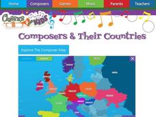
Composers and Their Countries
How many of the world's greatest composers were born in Austria? Or Germany? Or the United States? An interactive map provides young musicians with information about prominent composers in the last few centuries, as well as the periods...
Curated OER
Mapmaker, Make Me a Map!
Students are introduced to the state quarter program and examine the Colorado state quarter. They locate Colorado on a map and create a map with a key. They discuss the state motto and examine pictures of the state's geographical features.
Curated OER
Map Skills
Students examine the nations, battlefields, troop movement of the Germans through Belgium and the location of both fronts during World War I by creating a map. They visualize the strength of the Germans early in the war.
Curated OER
Story Hour with Lincoln
Students explore the life of Abraham Lincoln. In this Abraham Lincoln lesson plan, students create a Lincoln beard and hat to wear. Students view the penny and discuss why he was chosen to be pictured on the penny. Students create...
Curated OER
Visual Messages: Creating a Photomontage
Young scholars create a photomontage. In this lesson on photography as a means of conveying emotion, students use images gathered from the Internet to create a photomontage comparing how water is used in Africa and the U.S.
Curated OER
U.S. Geography: The Northeast
Students investigate U.S. Geography by creating a map in class. In this natural resource lesson, students create a map of the United States and research the Northeast based on their resources and recyclable materials. Students utilize...
Curated OER
The Constitution: A New Federation
Students explore political parties by researching world history in class. In this Australian government lesson, students identify the term "federation" and discuss the elements of Australian politics. Students analyze a map of Australia...
Curated OER
Mexico: One Land, Many Cultures
Students, through a variety of activities, discover the geography and culture of Mexico. They make maps, read folktales, write a journal, create pinatas and other artistic pieces, and review the history of Mexico.
Curated OER
Where in the Latitude Are You? A Longitude Here.
Students distinguish between latitude and longitude on the map. In this mapping lesson, students participate in mapping skills to recognize spatial relationships, and where to find natural resources on the map. Students create their own...
Curated OER
Texas, Our Texas
Students explore U.S. geography by completing a coloring activity in class. In this Texas history lesson, students utilize the web to locate Texas on a map of the U.S. Students view a PowerPoint presentation which showcases the state...
Curated OER
Be a Watershed - Create a Living River
Young scholars investigate water ways by conducting an experiment with classmates. In this natural resources lesson, students define a watershed and identify where large ones are located within the United States. Young scholars utilize...
Curated OER
ESRI Live Earthquake Site
Students examine a World map and find earthquakes near plate boundaries. They locate and describe earthquakes in the United States and California.
Curated OER
Big Blue Sky- Based on the Montana Quarter Reverse
Students use a Montana quarter to help describe geographical features such as landforms and bodies of water. Students read an article about Montana as a group and discuss examples of landforms and bodies of water. After reading,...
Curated OER
States with Attitude, Latitude and Longitude Dude
Sixth graders identify states whose boundaries are formed by lines of latitude and longitude or natural borders such as rivers. They trace a map of the U.S., and fill in borders, rivers and lines of latitude and longitude.
Curated OER
Native Pottery Replicas
Students study ancient Native American traditions and practices. They select one type of Native American pottery to duplicate in a hand-made replica. Afterward, they create a map of the United States and label where indigenous peoples...


