Curated OER
U.S. Geography- The Northeast
Students investigate the geography of the Northeast states. In this map skills lesson, students are shown a map of the Northeast states and identify the state names and borders. Students construct individual maps of the Northeast using...
Curated OER
Northwest Ordinance
Pupils examine the area where the Northwest Territory was located. They discover the steps territories need to follow to become states. They create a map of the Northwest Territory and label the states that came out of that region.
Curated OER
In Mr. Lincoln's Shoes
Students demonstrate basic map skills. In this US history lesson, students review cardinal directions and use a compass rose while at the same time discuss what life was like for Abraham Lincoln.
Curated OER
The Southeast Region
Students write a song about the southeast region. In this southeast region lesson plan, students view pictures of landforms, hear music, look at maps of states, and more.
Curated OER
Climb a Mountain, Raft a River on Your Own Land
Students are introduced to the characteristics of a map. As a class, they discuss the uses of public lands in their community and develop symbols for each feature. They use the symbols to create a map showing the recreational uses of...
Curated OER
MAP UNIT
First graders investigate how maps are used to identify different locations. They will also appreciate how there are different types of maps for their purposes. Finally students study how maps contain symbols that represent real places.
Curated OER
Follow the Yellow Brick Road
Students watch a portion of "The Wizard of Oz" and discuss how a map could be useful to Dorothy. They identify key components of maps and design a map of their classroom, including a key.
Curated OER
Discovering Prehistoric Trails
Eighth graders examine prehistoric terrain. In this geography lesson plan, 8th graders discover necessary resources for settlers. Students work in small groups to create a trail crossing the state of Kansas.
Curated OER
Traveling with Flat Stanley
students use the internet to gather geographical data about a state of their choice. Using new vocabulary, they describe the features present in the state, its climate and attractions. They develop a PowerPoint presentation to share...
Curated OER
Hands-On Weather Data Collecting
Fifth graders study weather in their community, in the United States, and around the world. They use thermometers, the beaufort wind scale, and simple weather symbols to measure and record the weather outside their school. They also look...
Curated OER
Philadelphia and the Constitutional Convention "Heat Up"
Students explore the Constitutional Convention of 1787. In this U.S. Constitution lesson, students role play the parts of delegates in a simulation of the convention.
Curated OER
Geological Development of Indiana and the Movement of Peoples Across the State
Fourth graders examine the geological development of the state of Indiana. Using the internet, they interact with the United States Geological Survey. They identify earthquake zones and energy resources in the state. They work...
Curated OER
Comparing Ethnic Groups
Eleventh graders explore the relationship between the United States and the Native Americans from after the Civil War to the early 1900's. They evaluate the actions of the United States towards Native Americans and compare the actions to...
Curated OER
The Golden Door: U.S. Immigration Through Ellis Island
Students complete a unit covering various aspects of immigration to the United States through Ellis Island. They plan a fictional trip to America, entering at Ellis Island. and actually visit Ellis Island and the Statue of Liberty.
Curated OER
Flat Stanley
Students read Flat Stanley, and make a poster board Flat Stanley which they sent out to family members in different states. They create an adventure for their Flat Stanley based on his "travels" and map out his trip.
Curated OER
Sailin' Through Time...Rhode Island, The Ocean State
Fourth graders explore the history of Rhode Island. They research famous people who brought change to the state. They explore the state song, natural resources, and colonies of the state. In groups, 4th graders create a travel brochure...
Curated OER
What Would Pink Say
Students create Venn diagrams of similarities and differences between two main characters in Pink and Say by Patricia Polacco.
Curated OER
Influence of Union and Confederate Resources in 1860 on the Civil War
Eighth graders compare/contrast population, railroad mileage, manufacturing plants, and industrial workers between the Union and Confederate States in 1860; students analyze effects of the resources of the Union and Confederate Forces on...
Curated OER
What and Where is Puerto Rico?
Learners explore Puerto Rico. They create K-W-L charts of their prior knowledge of Puerto Rico and observe maps of Puerto Rico. They code the map for measurements and land and water forms. They explore websites to gain background on...
Curated OER
Women in the Civil War
Pupils study the Civil War era in the US with a concentration on women during this time through literature and biographies. They create a timeline or multimedia presentation as one product of this series of lessons.
Curated OER
Learning from Maps and Timelines Time Travel
Students create timelines depicting the important events in the lives of the groups that arrived at the Fort St. Louis. They include the fate of La Salle and the colonists.
Curated OER
Creating Your Own Rock Art
Eighth graders look at early art. In this visual arts lesson, 8th graders investigate the attributes of rock art, examine rock art, and create their own examples of rock art. Analysis and instructional worksheets are included.
Curated OER
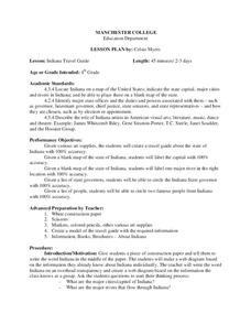
Indiana Travel Guide
Fourth graders, after exploring and researching the state of Indiana, create a travel guide about the state of Indiana including its capital, major rivers, governors and two famous people from the state. They utilize a variety of art...
Curated OER
Comparing Countries
Students compare facts about different countries. In this comparing lesson plan, students collect information about the US and another country and compare them. Students locate countries on the map and make a hypothesis about the lives...


