Curated OER
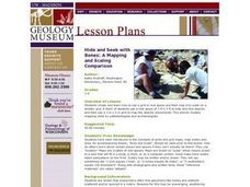
Hide and Seek with Bones: A Mapping and Scaling Comparison
Students examine and simulate how paleontologists map objects. They hide and find objects using a grid to map the objects' placements.
Curated OER
Identifying Watersheds with Topographic Maps
Students model a watershed and delineate one using topographic maps. In this hydrology lesson, students use aluminum foil to model a landscape and observe how water moves on it. They also observe the features of a topographic map and use...
Curated OER
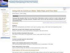
Using GIS to Construct Water Table Maps and Flow Nets
Pupils examine how to use GIS software to analyze patterns of groundwater flow. Seepage lake elevation data from the Sand Hills of Nebraska is used to construct a water table map and flow net using Esri's Arc Map software.
Curated OER
Volcanoes: Second Grade Lesson Plans and Activities
Young geologists explore volcanoes with a series of engaging geology activities. First, they learn the difference between magma and lava before coloring and labeling the parts of a volcano. During the lab, individuals watch a...
NOAA
Into the Deep
Take young scientists into the depths of the world's ocean with the second lesson of this three-part earth science series. After first drawing pictures representing how they imagine the bottom of the ocean to appear, young scholars...
Curated OER
Volcanoes: Sixth Grade Lesson Plans and Activities
Bring a set of pre-lab, lab, and post-lab lesson plans on volcanoes to your earth science unit. Sixth graders explore the three types of volcanoes found on Earth, plot the specific locations of these volcanoes on a map, and...
Curated OER
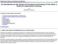
An Introduction to the Marine Environment and Geology of City Point: A Model for Experiential Teaching
Young scholars begin the lesson by researching the history of City Point, Connecticut. Using a map, they color areas they were asked to find and discuss why the areas are important to the community. As a class, they are shown recent...
Curated OER
Mapping Potato Island
Learners create their own topographical map using a potato. In this hands on instructional activity students construct a topographical map and explain what contour lines are using a potato.
Curated OER
Understanding Topographic Maps
Students are introduced to the characteristics and uses of topographical maps. Using a worksheet, they examine the use of specific terminology and use cutouts to create their own topographical map of an area. They answer discussion...
Curated OER
Hill of Fire
Students examine Paricutin eruptions. In this science lesson, students locate Paricutin on a map and take a virtual tour of volcanoes around the world. Students email questions to a geologist and create a news report on the original...
Curated OER
The Rocks Under Illinois
The goal of this fine geology lesson is to have learners create a map that shows how the rock layers are arranged far underground where they can't be seen. The ambitious lesson plan requires high schoolers to learn the law of...
Curated OER
Rocks in our Backyard
Students examine igneous and sedimentary rocks. They observe and identify geological formations in their community, analyze igneous and sedimentary geological layers using a geological map, and use GPS to locate geological formations.
Population Connection
The Human-Made Landscape
Agriculture, deforestation, and urbanization. How have human's changed the planet and how might we mitigate the effects of human activity on the planet? To answer these questions class members research the changes in human land use from...
Curated OER
Good Vibrations Remote Sensing data Collection: Thermal Emission Spectrometer
The Mars Global Surveyor spent two years creating a mineral map of the planet Mars using thermal emission spectrometry. To help young astronomers understand this remote sensing instrument, have them simulate how data is collected and...
Australian Government
The Great Artesian Basin
Covering 23% of the continent and holding 64,900 cubic kilometers of water, the Great Artesian Basin is the primary source of water for much of inland Australia. Using detailed student worksheets, experiments, and case studies,...
K-State Research and Extensions
Water
How are maps like fish? They both have scales. The chapter includes six different activities at three different levels. Scholars complete activities using natural resources, learn how to read a map, see how to make a compass rosette,...
Curated OER
Our Earth: Storehouse of Natural Resources
Students listen to an explanation of the science of the mining industry and create a geological map of Africa. They discuss the uses of minerals and resources and research a natural mineral resource in their part of the world.
Curated OER
Classify Rocks
Young scholars classify different types of rocks. In this earth science instructional activity, students test different rock samples and construct a chart to record observations. They create a concept map that answers essential questions.
National Wildlife Federation
Quantifying Land Changes Over Time Using Landsat
"Humans have become a geologic agent comparable to erosion and [volcanic] eruptions ..." Paul J. Crutzen, a Nobel Prize-winning atmospheric chemist. Using Landsat imagery, scholars create a grid showing land use type, such as urban,...
Curated OER
Geological Forces and Topography
Students discuss and research the Earth's geological processes. In this geology activity, students study maps of Utah and the United States to learn about geological features. Students then complete the research cards for each area of...
Curated OER
Anatomy of an Earthquake
In this earthquake activity, students read and study earthquake maps and statistics. They complete 8 short answer questions that follow.
Curated OER
Surveying the Land
Students explore the different kinds of maps and the purpose of each. For this Geography lesson, students work in small groups to create a map which includes the use of a map key.
Channel Islands Film
Island Rotation: Lesson Plan 1
How do scientists provide evidence to support the theories they put forth? What clues do they put together to create these theories? After watching West of the West's documentary Island Rotation class members engage in a series of...
Messenger Education
Look But Don’t Touch—Exploration with Remote Sensing
Mars is home to the tallest mountain in our solar system, Olympus Mons. In this set of two activities, learners review geologic land formations through the analysis of aerial maps. They then apply this knowledge to aerial maps of objects...


