Curated OER
Canada's Landform Regions
Students use a atlas to identify and describe Canada's Landform region. Using the information they collect, they create a thematic map of the region and describe all of the physiographic regions and the processes that formed them. They...
Population Connection
The Human-Made Landscape
Agriculture, deforestation, and urbanization. How have human's changed the planet and how might we mitigate the effects of human activity on the planet? To answer these questions class members research the changes in human land use from...
Curated OER
A Visit to China
Sixth graders study the history of China. They explore the Chinese people, the Great Wall of China, religions, government and Dynasties. In groups, 6th graders collect information on China. They write a report on their findings and...
Curated OER
Tying it all Together
Students study an article on drugs in their society. In this investigative lesson students create their own concept map.
Curated OER
Tallahassee Project
Sixth graders gather information from technological sources such as TV, radio, and Internet as well as from newspapers and maps and produce a final printed report. They use the data to create a spreadsheet and read a Florida state...
Curated OER
A Picture's Worth a Thousand Notes
Students listen to classical music and create a listening map for each piece. In this classical music lesson, students select a piece of classical music and create a visual map for the piece. Students set their pictures to music in a...
Curated OER
Population Density
High schoolers examine world population density and population distribution. They create pie charts showing population distribution and analyze population patterns in the United States and major regions of the world. They identify...
Curated OER
Geography of the Study of the Spanish-speaking People of Texas
Students identify the physical features, demographic characteristics, and history of the four Texas towns featured in Russell Lee's photo essay, "The Spanish-Speaking People of Texas." They conduct Internet research, and create a travel...
Curated OER
Executive Branch of the U.S. Government
Fourth graders create a K-W-L chart of what they know about the executive branch of government. They access the Internet to research a specific level of government. They create a PowerPoint presentation with a minimum of eight slides.
Curated OER
Beary O'Mometer Learns About Careers In Meteorology
Students explore the field of meteorology. In this meteorology lesson, students explore weather-related careers as they research the field of study as well as various weather concepts. Students interview meteorologists, write business...
Curated OER
Mapping Lab and Lead Poisoning
High schoolers are introduced to GIS and its uses. They make predictions before viewing the actual lead poisoning cases by location of Dade County. Pupils use actual Miami-Dade County spatial data to explore basic principals. Students
Curated OER
Human Impact on the Everglades Environment
Third graders research changes the Army Corps made in Everglades, focus on the human impact on the environment, design graphic organizers, summary statements, develop a Florida map of the Everglades region and give a presentation about...
Curated OER
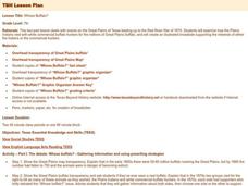
Whose Buffalo?
Seventh graders examine how the Plains Indians vied with white commercial buffalo hunters for the millions of Great Plains buffalo. They create an illustrated broadside supporting the interests of either the Indians or the commercial...
Curated OER
Park Brochures
Sixth graders investigate natural environments by researching national parks. In this brochure making lesson plan, 6th graders explore a specific national park and research it's information by utilizing the web. Students create travel...
Curated OER
Hip Hop and Geography
Young scholars study the various geographic regions of the U.S. and discuss how popular music is influenced by cultural/regional factors. Groups choose East Coast, West Coast, Midwest, or South in rap/hip hop music and create a...
Curated OER
Travel the Nile
Students create a game board that lists the cities along the Nile River with markers of boats, cars, camels, feet, train, etc.
Curated OER
On the Road Again
Students examine migration patterns in Africa and China. They watch excerpts from a documentary, define key vocabulary words, complete various student organizers, and create a poster.
Curated OER
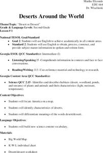
Deserts Around the World
Second graders explore the deserts around the world. They use a map and locate America on the map. Students discuss and identify the characteristics of deserts and differentiate the meanings of the word desert and dessert. Students...
Curated OER
Natural Regions of Texas Archeology
Seventh graders, in groups or individually, research Texas archeological sites and create a mural of the natural regions and the sites found in them. They conduct online research to discover the importance, age, and the inhabitants of...
Curated OER
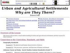
Urban and Agricultural Settlements Why are They There?
Seventh graders identify types of human settlements, urban and agricultural, and determine geographic influence on why people settle where they did by use of maps and charts. They, in groups, identify the needs of a new settlement, which...
Curated OER
Canada's Landform Regions
Students identify and describe the processes that created the landform regions in Canada. They map the regions and research one region to discover more about it. They present their findings to the class.
Curated OER
Science: Draining the Land - the Mississippi River
Students use topographic maps to identify parts of rivers. In addition, they discover gradient and predict changes in the channels caused by variations in water flow. Other activities include sketching a river model with a new channel...
Curated OER
As Simple as Beans: Canada's Population
Students gather facts about Canada from various maps. In this Canada instructional activity, students use beans to relate the populations of the U.S. and Canada. Students create population distribution maps based on the placement of the...
Curated OER
Learning About Our World
Learners explore their world using the book "This is the Way We Go to School." They predict information about the story based on the title and pictures. Students label a world map with the names of continents and oceans. They write a set...


