Curated OER
What is Climate?
Students explore the differences between climate and weather. For this introductory lesson of a climate unit, students discuss the vocabulary and concepts associated with weather and climate. They build their information base for the...
Curated OER
Climate
Students explore climate and weather conditions. Using the Internet, and other activities, students examine climate maps and the factors that affect climate. They examine how climate affects clothes, shelter, food, transportation,...
Curated OER
Life In the Flood Zone
Students discover how floods occur by visiting the Weather Channel's website. They examine the areas of the United States which are more vulnerable for flooding. They research the history of previous floods and how to protect themselves.
Curated OER
Tracking Weather Over Time
Young scholars gather, analyze and interpret data. They explain scientific inquiry. They plot points on a map and report information from a spatial perspective.
Curated OER
Special Education Fitness Challenge
Make fitness a part of each and every day. Special Ed young scholars are given charts with maps and record keeping information. They are given a 20-week period (late October to late March, when the weather is cool enough) to walk that...
Curated OER
In the Rain Shadow
Students, while utilizing a large wall map, experiment recording the annual precipitation for cities on the east and west sides of the Cascade Mountains. They discover that volcanic mountains do not have to erupt to affect the atmosphere.
Curated OER
Tissue Paper Geography
Pupils explore geographic features of the desert and apply their understanding of the topography of the desert by creating a tissue paper painting.
Curated OER
The Rainforests
Students visit various rainforest websites and answer questions about the rainforest in Spanish. They create an oral and visual presentation on the rainforests, urging conservation of the rainforests.
Curated OER
Where Does Your Garbage Go?
The objective of this lesson is to teach students about the importance of recycling. Initially, students have a chance to think about their impact on our planet by following the path that garbage takes. Students then learn about how...
Curated OER
What's Up With the Water Cycle?
Students explore the water cycle. Students identify the stages in a water cycle and create a PowerPoint presentation based on their knowledge.
Curated OER
Exploring and Comparing Other Communities
Third graders search TDC database for images of physical geography maps, weather maps, natural resources maps, and old travel brochures. They create a new travel brochure of an area of their choice using the information they gathered.
Curated OER
It's Rainin', It's Pouring
Students take a quick examine part of the water cycle, and the combined gas laws. The lesson lead them through the conditions necessary for cloud formation and allow them to create clouds in three different hands-on activities.
Curated OER
Infrared-Hot
Students describe how the sun heats the Earth, explain the nature of infrared light, explain how thunderstorms are formed and use infrared maps to predict severe weather.
Curated OER
Fabulous Funnels
Students explore what tornados are, how they are created and measured, and what their effects are on communities. They keep a journal of their activities and explorations as part of an ongoing process of learning.
Curated OER
Writing the Wind
Students make a windmill. In this wind lesson, students learn background information about the windmill, complete an activity where they create a windmill, discuss using wind as a natural resource and brainstorm other inventions...
Curated OER
Geography of the Study of the Spanish-speaking People of Texas
Young scholars identify the physical features, demographic characteristics, and history of the four Texas towns featured in Russell Lee's photo essay, "The Spanish-Speaking People of Texas." They conduct Internet research, and create a...
Curated OER
Map-Making Basics
Students study maps. For this geography and art lesson, students create their own map of the classroom.
Curated OER
Weather, Climate and Environmental Change
Learners study the complexities for getting definitive answers for past and present happenings in our environment. They discover past global changes on earth and the evidence for why these changes took place before believing everything...
Curated OER
Great Lakes Snow Analysis Collaborative Network
Learners interpret data on snow cover and analyze trend patterns. In this snow lesson plan students compare data and locate their school's GPS coordinates.
Astronomical Society of the Pacific
Getting Ready for the All American Eclipse!
Give your pupils a front row seat at the biggest light show in the sky this year! In addition to admiring the total solar eclipse, young astronomers can explain the phenomenon with a little help from an inquiry-based instructional...
Curated OER
Cloudy With a Chance of Meatballs
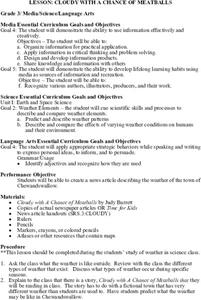
Third graders discuss the weather and how it changes during the different seasons. They listen to a read aloud of Judy Barrett's, Cloudy With a Chance of Meatballs. They write and illustrate a news article about the weather that is found...
Curated OER
El Nino
Young scholars explain what El Nino is, where it is located and how it is created. They describe the weather changes caused by El Nino. They draw the patterns of El Nino on a world map. They predict economic effects El Nino has on the...
Curated OER
Climographs
Students identify trends and characteristics of climate zones and specific places within. Then, they graph annual climate trends (primarily Temperature and Precipitation) and create, interpret and extrapolate information based on...
Curated OER
Landforms: Geomorphology of Arkansas
Second graders create large, salt dough maps of Arkansas and the natural regions in the state created by geographical and morphological features.


