Curated OER
Salt Relief Map of Virginia
Fourth graders create a salt relief map of the four regions of Virginia. They indentify land forms and bodies of water, and summarize how they made their project.
Curated OER
Children's Literature Across the Curriculum Ideas-Polar, The Titanic Bear
Learners read Polar, The Titanic Bear by Daisy Corning Stone Spedden. They complete a variety of cross-curricular activities surrounding this true story of a toy bear that survived the sinking of the Titanic. Included are reading, art,...
Curated OER
Scaling the Map
Students practice determining map distances using the map scales. They discover how much an area represents on the map in relation to the actual area. They decide on the best place to build their cavern.
Curated OER
Stellar Navigation Curriculum
Students investigate the concept of star mapping and how it is used in space navigation. They conduct various activities to see the effect of mapping. Also the teacher uses models and demonstrations in order to communicate the main...
Curated OER
Making a Map of the Classroom
Students create a map of the classroom using the computer programs AppleWorks and iChat in this math-based technology lesson. Lesson extension ideas include a scavenger hunt and maps of other school buildings.
Curated OER
Research Report on Earth Science Topics
Sixth graders are given a variety of Earth Science topics which be covered during the year. They select one of their choices to research and work in class and at home to meet the guidelines for their report.
Orange County Water Atlas
Location, Location, Location…
Young geographers discover not only how to read and recognize coordinates on a map, but also gain a deeper understanding of latitude and longitude and how climate changes can vary significantly across latitudes.
Glynn County School System
Earth's Magnetic Field and the Moon
The surface of the moon has an amazing tale to tell. Learn about the moon's story with a PowerPoint presentation that describes the unique features of the moon's surface as well as explains its movement in relation to Earth.
Curated OER
Where is Here?
Students are shown the very basics of navigation. The concepts of relative and absolute location, latitude, longitude and cardinal directions are discussed, as well as the use and principles of a map and compass.
Curated OER
What's the Matter? (Grade 3)
Third graders organize information about the three types of matter and to reinforce concepts learned in the matter unit of the science curriculum. They use Inspiration software to create a concept map of the three types of matter.
Curated OER
Ecozones Project
Learners examine, detail and produce a display about a particular ecozone in Canada. They produce a detailed wall map, written report and a summary sheet.
Curated OER
The Coldest Place at the Bottom of the World
Students research and trace Shackleton's actual and intended route on an area map. They analyze the altitude changes involved in a trek across Antarctica and complete a worksheet comparing Antarctica to their own state.
Curated OER
The Watershed Quest
Students examine their connection to local watersheds. They describe the water cycle and list species living in their local watershed. They also draw a map of their community.
Curated OER
Topo Triangulation
Students investigate how to read a topographical map and triangulate with just a map. They convert a compass measurement to a protractor measurement, reverse a bearing direction, and using a worksheet take a bearing of certain landmarks...
Curated OER
Trichinella Forensics
Students engage in DNA manipulation using forensics techniques. Students investigate topics involved in forensics studies such as cloning, electrophoresis, gene mapping, replication, and transcription.
Curated OER
African Adventures
Students access the Internet to gather information. They record their observations of African habitats. They create either an electronic slideshow or mural to present a science experiment.
Curated OER
Heading South
Students look at the migration of different birds. In this migration lesson, students discuss why an animal migrates and problems that can occur during migration. They look at several downloadable maps that show the specific routes of...
Curated OER
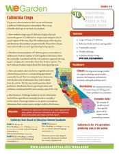
California Crops
Students explore agriculture by researching the native food crops of California. Students define a list of agriculture vocabulary terms and analyze maps of California which explain which foods come from which area. Students write a...
Curated OER
The Desert Alphabet Book
Students explore world geography by researching a science book with their classmates. In this desert identification lesson, students utilize a U.S. map to locate the geographical locations of deserts. Students create an oral report based...
Curated OER
Geography: examining the Glacial Features of Cape Cod
Students examine satellite images of the glacial features of Cape Cod. They analyze where human activity is located in terms of those features. Students make models of the features, including kettle holes. They also use contour maps...
Curated OER
Exploring National Marine Sanctuaries
Young scholars research marine ecosystems by creating class presentations. For this oceanography lesson, students research the different locations of marine sanctuaries by identifying them on a transparency map in class....
Curated OER
Would You Like A Desert With That?
Students explore the four different deserts in the United States and their characteristics. They discuss the four different types of deserts in United States and their characteristics, and locate them on a map.
Curated OER
The Birds and the Beaks
Students explore the adaptations that birds have. In this adaptations lesson students view a video and create a concept map of birds and their adaptive traits.
Curated OER
Weather Watchers
Second graders discuss what weather is and list words that can be used to describe weather. In this science lesson, 2nd graders develop symbols for each type of weather and record the weather for two weeks at the same time and the same...
