Curated OER
Historical Atlas
Sixth graders evaluate how revolutions have affected the world throughout history (i.e. boundaries of nations, culture, economics, etc...) through the research for and creation of a historical atlas for assigned countries.
Curated OER
Map-Making Basics
Students study maps. For this geography and art lesson, students create their own map of the classroom.
Curated OER
CASTLE ROCK PUEBLO: A TRIP THROUGH TIME
Students use a map to respond to a series of questions. They determine how much time it would take to travel to Castle Rock Pueblo from different pueblos and locate modern pueblos on the Indian Country map.
Curated OER
Salinity and Brackish Water Systems
Young scholars are able to tell the difference between brackish and salt water. They also are able to distinguish water qualities specific to each type of water. Students answer various questions about all types of water.
Curated OER
A Special Relationship: Connecticut and Its Settlers
Pupils study both geological and geographical features of Connecticut and the New Haven area. They focus on map works and rock formation.
Curated OER
Decisions, Decisions, Decisions
Students examine graphs to find the most appropriate for various kinds of data. In this graphing lesson, student create bar, line and circle graphs. Students create graphs electronically and manually interpreting the data.
Curated OER
The First North Americans
Students identify and interpret the different North American Indian groups, by region, and the type and impact of their interaction with Europeans.
Then they complete an overview of one main Native American group during the age of...
Curated OER
ADULT ESOL LESSON PLAN--Transportation and Travel
Students, after defining a list of vocabulary words on the board, review and identify basic types of transportation (bus, taxi cab, car, plane, and ship) in the United States. In addition, they make a graph of all the different ways that...
Curated OER
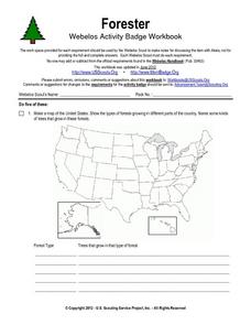
Forester
In this forester worksheet, students illustrate a map that shows the types of forests growing in various parts of the country. They also identify six forest trees common to the area where they live and explain how both wildlife and...
Curated OER
Interactive Atlas
Second graders examine the different ways people move from place to place in a neighborhood. Using the interactive online atlas MapQuest, they identify the various ways people move around their own neighborhood by creating a map and...
Curated OER
Return to Kangaroo Island
In this speaking and listening skills worksheet, students explore, participate and experience in groups of two a treasure map with a hidden treasure as they return to Kangaroo Island.
Curated OER
Dual place names in Australia
Students discuss landmarks commonly found on maps. They are divided into two groups, and asked to draw a map for a friend who hasn't been to the area. Group A may use street and place names, group B may not. Students discuss the role of...
Curated OER
Park Brochures
Sixth graders investigate natural environments by researching national parks. In this brochure making lesson, 6th graders explore a specific national park and research it's information by utilizing the web. Students create travel...
Curated OER
Human Impact on the Everglades Environment
Third graders research changes the Army Corps made in Everglades, focus on the human impact on the environment, design graphic organizers, summary statements, develop a Florida map of the Everglades region and give a presentation about...
Curated OER
Using Venn Diagrams to Compare Two Ecosystems
Learners explore the distribution of two ecosystems on a global scale; and map the distribution of tropical and temperate rain forests throughout the world. They use a Venn Diagram to describe these ecosystems and the differences between...
Curated OER
Using Vegetation, Precipitation, and Surface Temperature to Study Climate Zones
Students begin their examination of the climate zones found around the world. Using a software program, they identify the relationship between the vegetation, climate and temperatures of the different zones. They also plot coordinates...
Curated OER
Water: A Necessity for Life
Students examine types of aquifers and make a model landfill. In this water usage instructional activity, students determine the difference between confined and unconfined aquifers. They build a model landfill, observe it for two weeks,...
Curated OER
Bog Science
Students study bogs. They tour, collect physical, chemical, and biological data and analyze a pristine bog community. Using the data, they draw a map and a cross section of the bog.
Curated OER
Forecast the Weather
Students analyze different weather conditions before creating their very own first-person report from the eye of a storm. They use maps to analyze different weather conditions, record an online weather script
and write a first-person...
Curated OER
Watershed Tourist
Learners recognize and categorize different bodies of water. In this watershed and water environments lesson, students "Follow the Water from Brook to Ocean." Learners define the different bodies of water and sort from smallest to...
Curated OER
Little Pig, Little Pig
First graders compare versions of the Three Little Pigs. In this comparison lesson, 1st graders read several version of the Three Little Pigs and compare the situations, characters, settings, solutions, emotions and costumes. ...
Curated OER
Operation Anitbody
Students identify the types of cells that are important in the immune system. They investigate the different mechanisms used by white blood cells as they protect the body from foreign invaders. Students are given five case studies,...
Curated OER
Using Primary Sources to Discover Reconstruction
Fifth graders discover how reconstruction had an impact on racial issues in the United States. In this Reconstruction instructional activity, 5th graders are introduced to primary vs. secondary resources and then rotate through...
Curated OER
The Open Ocean, What is it and How Does it Change?
Students investigate the ocean environment. In this ocean lesson, students discover the physical properties of the ocean. Over two days, students work in small groups investigating ocean maps and creating water currents.

