Curated OER
Educational Technology Clearinghouse: Maps Etc: East Indies, 1920
A map from 1920 of the Indonesian region showing the political boundaries and foreign possessions at the time for the Sunda Islands, Borneo, Celebes, the Moluccas, the Philippines, the Province of Malay Peninsula, and portions of Siam...
Curated OER
Educational Technology Clearinghouse: Maps Etc: Drawing North America, 1872
A map exercise from 1872 for drawing North America. The map shows the general outline of the coasts, major waters and rivers, and a vertical profile cross-section of the continent from the San Francisco Bay area to Cape Hatteras....
Curated OER
Educational Technology Clearinghouse: Maps Etc: The United States, 1800
A map of the United States in 1800 showing the territorial claims of the states at the time, the British and French possessions, and territory disputes. The map shows the frontier lines or extent of settlement from the coast of Maine to...
Curated OER
Educational Technology Clearinghouse: Maps Etc: North America, 1858
A map from 1858 of North America showing the boundaries at the time for Russian America (Alaska), Greenland, British America or New Britain, Canada East and Canada West, the United States, Mexico, Central America, and the West Indies...
Curated OER
Educational Technology Clearinghouse: Maps Etc: Oregon Controversy, 1792 1846
A map of the Oregon Territory between the time of exploration by George Vancouver (1792) and the Oregon Treaty of 1846. The map is color-coded to show the disputed claims of the British and United States, the Russian American line of...
Curated OER
Educational Technology Clearinghouse: Maps Etc: Roman Britain, 55 Bc to Ad 449
A map of England (Britannia) under the Roman Empire, from the time of the first invasion by Julius Caesar (55 BC) extending to the invasion of the Saxons (AD 449). The Roman Period of control of Britannia is generally considered AD 43 to...
Curated OER
Educational Technology Clearinghouse: Maps Etc: Oregon Controversy, 1792 1846
A map of the Oregon Territory between the time of exploration by George Vancouver (1792) and the Oregon Treaty of 1846. The map is color-coded to show the disputed claims of the British and United States, the Russian American line of...
Curated OER
Educational Technology Clearinghouse: Maps Etc: Hong Kong, 1912
A map from 1912 of the Pearl River delta from Canton (Guangzhou) to Hong Kong and Macao on the China Sea. At this time, Hong Kong was a possession of Great Britain, and Macao was officially a Portuguese colony. This map shows the river...
Curated OER
Educational Technology Clearinghouse: Maps Etc: Canton and Hong Kong, 1919
A map from 1919 of the Pearl River delta from Canton (Guangzhou) to Hong Kong and Macao on the China Sea. At this time, Hong Kong was a possession of Great Britain, and Macao was officially a Portuguese colony. This map shows the river...
Curated OER
Etc: West Florida Under the English, 1763 1780
A map of West Florida as a British possession between 1763 and 1780. In 1763, the King of Great Britain by royal proclamation limited West Florida on the west by the Mississippi River, on the north by the 31st parallel, on the east by...
Other
Van Gogh Museum: Vincent Van Gogh: The Letters
Explore this exhibit of over nine hundred letters to and from Van Gogh. The archive is searchable by period, correspondent, and place. Additional navigation takes you directly to letters with sketches, which deftly demonstrate Van Gogh's...
Other
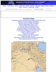
Aina: A Brief History of Assyrians: Geography
This is a brief article describing the geography of Assyria and its extent across the Middle East. Click on the word Assyria to take you to a map the region.
English for Everyone
English for Everyone: Sentence Completion 3 [Pdf]
English for Everyone provides a printable quiz to assess vocabulary words that are adjectives and words associated with map directions.
English for Everyone
English for Everyone: Sentence Completion 3: Level 3 [Pdf]
English for Everyone provides a printable quiz to assess the recall of words associated with map directions. Level 3 adjectives and adverbs are also emphasized on this assessment.


