New York State Education Department
US History and Government Examination: January 2018
It's time to test those skills! Assess pupils' knowledge of US history and government with short answer questions, multiple-choice items, and essays. The resource serves as a standardized test that functions well for a final exam....
Illustrative Mathematics
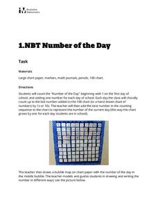
Number of the Day
Daily routines not only help to manage classrooms, they can also provide learners with rich opportunities for learning. This activity supports young learners in developing their number sense by counting up the school days on a class...
Laboratory for Atmospheric and Space Physics
Where Are We Going?
Come take a ride on the space bus! Scholars go on an imaginary trip to pick up their peers from the inner and outer planets while reinforcing math skills. First, learners round decimals to identify each planets' distance from Earth....
Curated OER
Treasure Hunters
Students design an on campus treasure hunt to find various architectural vocabulary words which they then create definitions for on the blog page on the Environmental Design website.
Curated OER
The Oregon Trail
In this Oregon Trail worksheet, students practice their map skills while they explore the states of Oregon, Missouri, Idaho, Nebraska, and Wyoming. Students us a map of the US to plot six points on the map that show the Oregon Trail.
Curated OER
Finding Their New World
First graders place stickers on maps indicating their understanding of the cardinal directions. They locate Jamestown, England, the Atlantic, and Virginia.
Curated OER
Math and Measurement
Engage the class in exploring linear measurement and map scales. They work in groups to measure various distances in the classroom and convert measurements to other units as directed by the teacher. To access this Word document, click on...
Curated OER
That's NorthEastWestSouth to Me!
Students demonstrate north, south, east and west. In groups, students participate in games to decide what directions a specific bear must travel. They play a "Simon Says" game to develop single step directions. Students listen to and...
Curated OER
Latitude on World Maps - World Map Activity 2
Students explore the concept of latitude. In this geography lesson, students discover the global grid system and complete a map activity which require them to record the latitude of various cities in the world.
Curated OER
Put Me in My Place: Using Alphanumeric Grids to Locate Places
Students practice locating points on a large wall grid and create and label a neighborhood map. In this geography lesson, students spell and discuss places as the teacher places them on the map. They discuss the concept of an...
Curated OER
Hemingway Hangouts
Learners use printed maps and websites to estimate driving distances and plan routes to Hemingway's home. They visit several locations online and record facts about each location.They calculate, distances, driving time, and other factors.
Curated OER
World Projections
Students identify map projections and examine polar maps. In this map skills lesson, students use a flat world map to identify various projections and calculate the distances between locations by using a map scale.
Curated OER
Europe Before and after WWI
Eighth graders compare and contrast maps of Europe before and after World War I. In this World War I activity, 8th graders color and label maps of Europe prior to the war and after it. The historical maps can be accessed online.
Curated OER
Getting To Know Germany
In this getting to know Germany worksheet, students use map skills (map not included) to answer 14 questions, then draw a map of Germany labeling the capital and major cities.
Curated OER
Spatial Connections
Students use maps, scales, and describe locations in order to learn about spatial sense. In this spatial sense lesson plan, students participate in many activities for this spatial sense unit that should last throughout the year.
Curated OER
Globe Skills Lesson 11The Vietnam War
Students develop their globe and map skills, In this geography lesson, students examine the Vietnam War as they complete an activity that requires them to plot latitude and longitude.
Curated OER
Globe Skills Lesson 4 The Colonial Period
Learners practice their map skills. In this Colonial geography instructional activity, students complete an activity that requires them to locate English colonial locations using latitude and longitude coordinates.
Curated OER
South America Layered
Seventh graders create an overlay map of South America. They show the relationships between population, landforms and economies with their maps.
Curated OER
U.S. Geography- The Northeast
Students investigate the geography of the Northeast states. In this map skills lesson, students are shown a map of the Northeast states and identify the state names and borders. Students construct individual maps of the Northeast using...
Curated OER
Where is Flat Stanley?
Students create a story map of the basic elements and significant events of the book Flat Stanley. Students brainstorm places they would like to visit if they had been flattened and then, write about an imagined experience. Students...
Curated OER
Following Plans
Students learn to follow a specific plan in order to do something or get somewhere. In this following directions activity, students explore key vocabulary related to following plans, complete fun activities that require attention to...
Curated OER
The Gold Rush
Learners identify the routes involved in the Gold Rush on a map. In this map skills lesson, students use a United States map to locate the routes used to travel to California during the Gold Rush. Learners demonstrate how to use the map...
Curated OER
Cattle Trails
Students identify and locate cattle trails on a globe. In this map skill lesson, students use a marker to locate Texas and Montana and use the map scale to calculate the distance of the cattle trail.
Curated OER
Globe Skills Lesson 8 Dust Bowl Travelers
Students develop their globe and map skills, In this geography lesson, students examine the Dust Bowl as they complete an activity that requires them to plot latitude and longitude.


