Curated OER
TE Activity: The Trouble with Topos
Learners study the uses of topographical maps including the many forms that they take. They discover that the map features show its intended use such as city maps, wilderness maps, and state maps. They complete a worksheet in which they...
Curated OER
Plant Life of the Rainforest
Students study pictures of tropical rainforests and discuss its stratified character. Students then work with a partner to make a scale drawing of the rainforest strata.
Curated OER
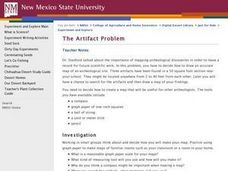
The Artifact Problem
Students work in small groups and make a map of a familiar room. In this artifact lesson plan, students decide on a suitable scale for their maps, the tools they will use and how they will make it and decide on strategies they would use...
Curated OER
Medieval Castles
Second graders design a scale model of a medieval castle and its surroundings including the following items: castle, moat, bailey, drawbridge, turrets, dungeon, grounds, and outer walls. A perfect lesson for those kids who are fascinated...
Curated OER
Know Your Area
Students investigate transit by analyzing their school surroundings. In this local geography lesson, students identify their school in relation to the rest of their state, country and globe. Students discuss their personal travel habits...
Curated OER
GPS Art
Students design their own logo or picture and use a handheld GPS receiver to map it out. They write out a word or graphic on a field or playground, walk the path, and log GPS data. The results display their "art" on their GPS receiver...
Curated OER
A Look at the Population Density of the United States
Students acquire census information and create maps of the population density of the United States on different scales. They role play the roles of workers of a retail company and they use the population data to market to their customers.
Curated OER
Rosie's Walk
Students use maps and globes to locate and describe locations, directions and scale. Using the maps, they identify man made or natural features of different environments. They practice using geographical terms to describe a specific...
Curated OER
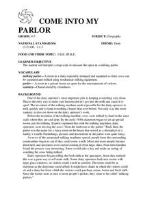
COME INTO MY PARLOR
Students interpret a map scale to measure the space in a milking parlor. They reveiw the process of using a map scale to calculate distances. Students are given worksheets, they read the information in the box together. They draw an...
Curated OER
Outlandish Landforms
Seventh graders examine landforms. In this world Geography lesson, 7th graders research and create a physical model of a chosen landform. They then draw a 2-d paper map of that model.
Curated OER
Land Use Over Time
High schoolers view aerial photos and topographic maps of their local area. They compare and contrast major land use patterns over time by comparing these images to maps that are at least 50 years old. They analyze them using the four...
Curated OER
Troical Atlantic Aerosols
Learners explore the effect aerosols have upon he weather and climate. They observe NASA satellite images to explore and draw conclusions about aerosol transport. From studying the images, students track the path of aerosols. They...
Curated OER
The Greatest Survival Story of All Time
Learners use the Internet to read about an explorer's survival in the Antarctic. They try to find a better route for him to have taken.
Curated OER
Similar Triangles - Applied Problems
Students differentiate between similar and congruent triangles. In this geometry lesson, students identify the angles of triangles using the similarity theorem. They apply concepts of triangles to the real world.
Curated OER
Design-A-Room Project (Part 3 of 3)
Young scholars culminate a unit on measurement with a focus on area and perimeter. They design a floor plan of their dream room on graph paper showing the proper area and perimeter. They plan the budget for their room and make a 3-D...
Curated OER
Carving Mountains
Students explore geography by participating in an illustration activity. In this land-form lesson, students define vocabulary terms associated with glaciers and forests. Students utilize pens, cardboard and pottery clay to draw and...
Curated OER
Poetic Justice: A Study of Poe's Famous Works
Students explore Edgar Allan Poe's most famous short stories. In this Edgar Allan Poe lesson, students complete a 25 page packet of activities where they recognize the features of genres and literary devices Poe uses. Students read "The...
Curated OER
The Island of The Blue Eagles
Sixth graders read the book CALL IT COURAGE by Armstrong Sperry. They use the Internet to research and work in groups to write ocean chants. They construct dioramas and build a sea turtle withK'NEX.
Curated OER
Working for Water
Students examine the ways that government works to help improve aquatic habitats. In this water habitats lesson students view a video and plan a school restoration project.
Curated OER
Driving Currents
High schoolers conduct a variety of investigations to see how water, heat, and salinity affect the flow of the world's ocean currents,as well as, explore many factors that affect the flow of the world's ocean currents. They also describe...
Curated OER
Refugees
Sixth graders use the internet as well as personal interviews to research refugees and refugee status from a Canadian and international perspective.
Curated OER
Our Energy
Fifth graders research energy sources used in the United States. In this energy sources lesson, 5th graders work in teams to research various energy sources. Students complete a worksheet for the research and make a short video of a...
Curated OER
Magellan
Students identify the route of Magellan's voyage. In this map skills instructional activity, students use a globe to identify various coordinates where Magellan traveled.
Curated OER
Change for the future: Redesigning Maquoketa
Sixth graders research a problem to be solved in their town, develop a rationale as to why they should act on this problem, and present their ideas to the class and their community. In this problem solving lesson plan, 6th graders...


