Curated OER
Cartography
Students follow directions to draw a map of an island. They complete the island map adding their own details using symbols and a legend.
Curated OER
Shake, Rattle And Roll: Studying the Effects of an Earthquake
Learners gauge earthquake intensity by reviewing firsthand accounts. They use the Modified Mercalli Intensity Scale and newspaper articles to estimate the strength and effects of a past earthquake.
Curated OER
It's Greek to Me!
Students explore Greek Mythology. In this Greek Mythology unit, students read myths, pantomime vocabulary words, practice research skills, create city-states, and demonstrate knowledge of ratios and proportions. This unit includes many...
Curated OER
Volcano Contour Models Activity and Tracing the Highs and Lows in San Francisco
Pupils investigate how to draw topographic contours and read topographic maps.They examine the topography of San Francisco and contrast the elevation of different points within San Francisco.
Curated OER
Mapping A Stream
Students participate in mapping an actual waterway. They include reach lengths, transects, compass reading, and scale determinations. They include windfalls, plant cover, types of streambed composition, and landmarks such as trees and...
Curated OER
The Tale of Scale
Eighth graders, using a range of data, produce three bar graphs for various scales along the y-axis.
Curated OER
From Home to School, GPS Style
Students are introduced and increase proficiency in the use of the hand held GPS system. They explore the meaning of longitude and latitude lines, then identify the parts of the map.
Curated OER
Missouri Time Scale
Students plot events that happened years ago beginning with volcano activity. In this investigative lesson students are introduced to the different eras and plot them on a map.
Curated OER
Globe Lesson 13 - When the Day Changes
Students explore the patterns of day and night. In this geography skills lesson plan, students read brief selections and examine diagrams that note the transition of day and night around the world. Students respond to the questions...
Curated OER
Cookie Topography
Students construct a cross section diagram showing elevation changes on a "cookie island." Using a chocolate chip cookie for an island, they locate the highest point in centimeters on the cookie and create a scale in feet. After tracing...
Curated OER
Unit V: Worksheet 2 - Constant Force
Physics learners studying force and acceleration practice solving eight problems with this assignment. They calculate acceleration and deceleration, net force, and distances required for stopping a moving object. Kinematics equations and...
Curated OER
Find a Cave
Students locate their own communites and the nearest caves on a United States map. They calculate the distance to the nearest cave using rough scale.
Curated OER
ExplorA-Pond: 1st Grade Shapes
Young explorers review the basic shapes (circle, triangle, square, rectangle) and practice putting them together to make new shapes. Given an outline of a pond, they recreate it by combining other shapes.
Curated OER
Measurement 4: Linear Measure
In this measurement worksheet, learners use a ruler to measure, in inches, the distance of various line segments. Then, using the scale drawing, they determine the actual distance in miles. Students may use their knowledge of proportions...
Curated OER
Angles, Bearings and Maps
In this secondary mathematics worksheet, high schoolers determine how many independent angles are in a diagram, bearings, and flight paths. The four page worksheet contains seven problems. Answers are provided.
Curated OER
Gridding a Site
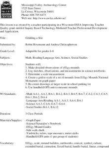
Students make observations of effigy mounds and record them in a notebook. In groups, they must determine the scale of measurement and create their own grid to scale part of the Effigy Mounds National Monument. They also practice using...
Curated OER
Blazing the Trail
Learning about proportions through measuring and mapping distances is the focus of this real-world math instructional activity that doubles as an activity. Mathematicians complete a course designed to measure and map locations in order...
Curated OER
Why is a salt marsh important?
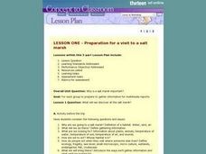
Young scholars discuss the salt marsh. They define the following terms: habitat, water, land and air. Students work in small groups. They are asked why are they going to a salt marsh? Young scholars discuss whose habitat is it at the...
Curated OER
Exploring History Through Photographs
Fifth graders compare and contrast photographs from the 1800s to those of 2003. In groups, they create drawings of how society has changed over time and use maps to locate local streets. Individually, they practice measuring the...
Curated OER
Geography: Map Making
Students, working in groups, share notes and maps collected during a study of the Lewis and Clark Expedition. They draw large composite maps of the western United States on butcher paper including land formations, bodies of water, and...
Curated OER
Mapping the Village
Learners measure, weigh, and document the amount of trash and garbage generated by the school for one day. They brainstorm solutions for trash in the area and assist with the school-wide recycle program.
Curated OER
Grid it, Map it
Students participate in designing a city layout using grids and coordinates. They work on a city space and create a grid on a life size layout on the gym floor.
Curated OER
Motion of the Sun and Earth: Using a Playground Model to Explore Rotation and Revolution
Students experience the rotation of the Earth and the Sun and the Earth's revolution around the Sun, using a playground mode.


