University of Wisconsin
What’s a Square Foot Anyway? Laying Out the Design Plan
Clever! Participants don square-foot cardboard shoes to mark out the rain garden plot that they have spent the last few weeks designing. In this way, they are practicing scale modeling as well! Note that this lesson is part of a unit,...
Curated OER
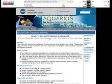
Sea Water Mixing and Sinking
Learners investigate the role of temperature and salinity in determining seawater density. They use a Temperature-Salinity Diagram to examine the effects of mixing on density.
Curated OER
Northwest Hawaiian Islands
Students compare and contrast places around the world. Students analyze the effects of human activity on the physical environment and devise plans to address the consequences. Students also focus on geographical topics such as formation...
Curated OER
What's Up With the Water Cycle?
Students explore the water cycle. Students identify the stages in a water cycle and create a PowerPoint presentation based on their knowledge.
Curated OER
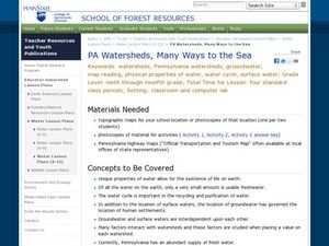
PA Watersheds, Many Ways to the Sea
Students examine the water cycle and the factors that interact with watersheds. In this watersheds activity students describe the purification process, trace the flow of infiltrate water through aquifers, and research the Internet...
Curated OER
Snow Cover By Latitude
Students create graphs comparing the amount of snow cover along selected latitudes using data sets from a NASA website. They create a spreadsheet and a bar graph on the computer, and analyze the data.
Curated OER
Cartography
Students research about cartography and how to be a cartographer. In this math activity, students draw a map of their classroom. They use a robot to explore navigation using a compass rose.
Curated OER
On the Surface
Students draw and label the 15 major rivers in Texas. They then draw and label another map with the major lakes and reservioirs of Texas. Students use the maps and locate and label the location of the following major Texas cities:...
Curated OER
Surface Water Supplies And The Texas Settlements
Students engage in a lesson that is concerned with the allocation and finding of water resources. The location of different settlement areas is considered as one looks how the water is distributed. They map some of the early Spanish and...
Curated OER
Watershed Management
Students investigate the concept of a watershed. They conduct research into the concept using a variety of resources. Students take a field trip to a local watershed to make observations. The outcome is a report concerning the outside...
Curated OER
Water Resources
Students explore the differences between surface water and ground water. They collect data using maps and graphs and investigate a Texas river basin and a nearby aquifer. They complete a written report of their findings regarding the...
Curated OER
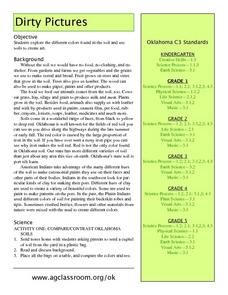
Dirty Pictures
Students investigate how food, clothing and shelter come from soil after they examine soil from their own backyards. They map soils on the color wheel before making glue and soil pictures and tie-dying T-shirts in red soil.
Curated OER
Water, Water Everywhere, and Nary a Drop to Drink!
Students sing the continent song and locate oceans between the continents on a map. They read "They Earth is Mostly Ocean" and copy notes into their journals. They watch a demonstration of water and saltwater evaporated to see what is...
Curated OER
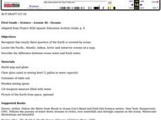
Oceans
First graders recognize that nearly three quarters of the Earth is covered by ocean. They locate the Pacific, Atlantic, Indian, Arctic and Antarctic oceans on a map. They describe the difference between ocean water and fresh water.
Curated OER
Meteorology
Seventh graders examine the job of meteorologists. They decide which characteristics of the atmosphere that meteorologists focus on. They use local weather maps from newspapers to predict weather in their area.
Curated OER
Geographic Information Systems
Learners examine the concept of geographic information systems (GIS) and its basic components. They explore an application program using GIS technology and list the various uses for GIS.
Curated OER
Deforestation
Students identify the different tropical rainforests in the world using a map. In this ecology lesson, students describe the different methods of deforestation. They create a memo and present it to class.
Curated OER
Weather Predictions
Fourth graders explore meteorologists. They explore symbols on a weather map and make five day forecasts.
Curated OER
Adapted to Fire
Fourth graders explore forest species' adaptations to fire by participating in a scavenger hunt and mapping a burned forest. Students create maps and explore how indigenous species adapted to living with fire.
Curated OER
A Brand New Day
Students locate Maine on a classroom map and discuss if Maine is where the nation's first light is found, where would the nation's last light be seen. They explore the idea of the sun rising in the east and setting in the west.
Curated OER
A Coin Out of Water
Students examine the Michigan state quarter and identify land and water on the quarter. They locate the Great Lakes and other bodies of water on a map. They compare and contrast streams, rivers, ponds, lakes, and oceans.
Curated OER
Global Climates and Seasons
Students look at the differences that exist in all four seasons. The resources of animation are available to be used to illustrate scientific concepts in a media that is engaging to students.
Curated OER
Stellar Navigation Curriculum
Students investigate the concept of star mapping and how it is used in space navigation. They conduct various activities to see the effect of mapping. Also the teacher uses models and demonstrations in order to communicate the main...
Curated OER
Earthquakes and Seismic Waves
Students investigate the Richter scale and seismology in a teacher-led lab in which they are introduced to the concept of seismic waves and epicenter location. They further investigate the inner workings of a seismograph and practice...

