Curated OER
Latitude and Longitude
Students explore longitude and latitude lines to discover locations. In this finding locations lesson students construct a model showing the latitude and longitude lines on Earth.
Curated OER
Using Star Charts and Maps
Students study star charts and describe locations of objects. In this scientific models lesson students use coordinates and identify characteristics.
Curated OER
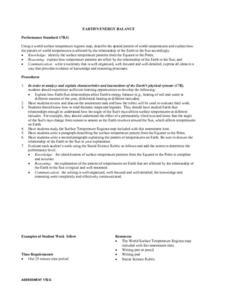
Earth's Energy Balance Performance Standard
Students examine how Earth-Sun relationships affect Earth's energy balance and the pattern of world temperatures. Students study a Surface Temperature Regions map and write a paragraph describing the temperature pattern from the Equator...
Curated OER
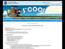
Creating a Thematic Map Using S'COOL Data
Students observe weather patterns, collect data, and make a weather predictions for various locations on a map.
Curated OER
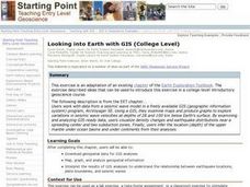
Looking into Earth with GIS
Students work with data from a seismic wave model in a freely available GIS (geographic information system) program, ArcVoyager SE. Using a GIS, they examine maps and produce graphs to explore variations in seismic wave velocities at...
Curated OER
Circle the Earth - Explore Surface Types on a Journey around Earth
Students use CERES percent coverage surface data with a world map in locating landmasses and bodies of water at Earth's Equator.
Curated OER
Scaling the Map
Students practice determining map distances using the map scales. They discover how much an area represents on the map in relation to the actual area. They decide on the best place to build their cavern.
Curated OER
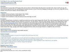
Path Map for the Lake Bonneville Flood
Students use a digital atlas of Idaho to explore the effects of the Lake Bonneville Flood. They become familiar with how floods shape our earth and change landscapes. Students graph a a timeline of the rise and fall of Lake Bonneville.
Curated OER
A Sense of Location: The Mental Map
Students consider the ways a mental maps of geographic landmarks can help migrating animals stay on the correct course.
Curated OER
November Science
Students review that all people, plants, and animals live on Earth. They classify objects found in the environment as living or nonliving.
Curated OER
THE GULF STREAM
Students explore how to describe the Gulf Stream, how Benjamin Franklin charted it, and correctly plot it on a map.
Curated OER
Ocean Currents and Sea Surface Temperature
Students use satellite data to explore sea surface temperature. They explore the relationship between the rotation of the Earth, the path of ocean current and air pressure centers. After studying maps of sea surface temperature and ocean...
Curated OER
Studying Snow and Ice Changes
Learners compare the change in snow and ice over a 10 year period. In this environmental science lesson, students use the live data on the NASA site to study and compare the monthly snow and ice amounts on a map of the entire...
Curated OER
Voyage to Kure Viewing Guide
Students complete a worksheet while viewing a video about the oceans. They locate the oceans on a map and identify positive and negative ways in which humans have impacted them. They discuss any questions at the end of the lesson.
Curated OER
Deadly Shadow of Vesuvius
Students view a video clip about volcanoes. They collect data and create maps to see the relationship between volcanoes, earthquakes and plates. They share their maps with the class.
Curated OER
You Can Die Here
Students examine Death Valley including the amount of precipitation and winds that it gets. In this climate based lesson plan students explain the reasons for the amount of precipitation and windward patterns in Death Valley.
Curated OER
Flight Paths of Orbiting Satellites
Students examine the path a satellite follows as it orbits the earth. For this space science lesson, students use a globe as they illustrate a satellite in its orbital plane, then plot points on the satellite's path on the globe to see...
Curated OER
Michigan Food: From Farm to You
Students recognize Michigan on a map and understand how its climate is affected by the Great Lakes. In this Michigan food lesson, students play a trivia game to identify the produce of Michigan. Students relate the climate in each part...
Curated OER
Biodiversity in an Estuary
Students investigate the biodiversity in estuaries. In this estuary lesson plan, students use Google Earth to explore the Rookery Bay National Estuarine Research Reserve. They produce a biodiversity concept map and portray the life of a...
Curated OER
Volcanic Activity in the U.S.
Young scholars locate and map ten volcanoes in United States, create chart comparing volcanoes by last eruption, type of volcano, location, and interesting fact, and create Powerpoint slide show describing basic
information about...
Curated OER
Earthquakes And Fault Lines
Students discuss major causes of earthquakes and identify famous fault lines, access and map information about ten largest earthquakes in world from 1989 to 1998, and theorize about location of these earthquakes as they relate to Earth's...
Curated OER
Meet Meteorology
Students explore meteorology, discuss Earth's atmosphere, create drawings of the water cycle, create meteorology journals, and role play forecasters. Nine lessons on one page; includes unit test.
Curated OER
Using Venn Diagrams to Compare Two Ecosystems
Learners explore the distribution of two ecosystems on a global scale; and map the distribution of tropical and temperate rain forests throughout the world. They use a Venn Diagram to describe these ecosystems and the differences between...
Curated OER
Meteors and Meteorites
Students create Earth boxes containing some of Earth's biomes--desert, forest, tundra, ocean, and mountains. They simulate Earth's encounter with a comet trail and the resulting meteor shower. They present their Earth boxes to...


