Curated OER
Science: Studies of Earth
Using a digital camera to document local landscapes as they are today, students will explore how changes in human land use are impacting local environments. Students will also explore some of the social impacts of various land uses in...
Curated OER
Four Color Map
Young scholars explore geometry by completing a color puzzle. In this shape identification lesson, students utilize deductive reasoning to complete a Google SketchUp puzzle with trapezoid, triangles and rectangular shapes. Young...
Curated OER
Central Park Field Trip
Students visit the park to observe signs of spring in the forest and pond environments. In this field trip lesson, students explore the park for various items
Curated OER
What is the Rock Cycle and Its Processes?
Geology beginners examine three different rock samples and determine their origin by their characteristics. By making and recording observations, they become familiar with features of igneous, metamorphic, and sedimentary rock types....
Curated OER
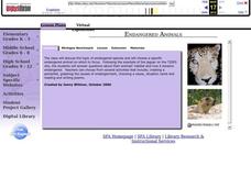
Endangered Animals
Students listen to a teacher led lecture on jaguars, their habitats, and how they became endangered. Using a specified web site, they choose an endangered animal to research. After gathering information, students participate in...
Curated OER
Introducing NatureMapping
Students model the NatureMapping program in order to study habitats and biodiversity.
Curated OER
Our Earth: Storehouse of Natural Resources
Young scholars listen to an explanation of the science of the mining industry and create a geological map of Africa. They discuss the uses of minerals and resources and research a natural mineral resource in their part of the world.
Curated OER
Paleogeographic Mapping (o.k. Fossils Are Neat But What Good Are They?)
Learners examine how evidence from fossils can be used in paleogeographic interpretation. They gain experience in developing multiple hypotheses.
Curated OER
What in the World?
Eighth graders plot points of longitude and latitude on a world map. In groups, they create a model of the earth's interior and label the parts,
Curated OER
Hurricane Strength: Spatial Association of Wind Speed and Water Temperature
In this hurricane worksheet, students read and analyze satellite images of hurricane Rita. They complete 4 short answer questions about it.
Curated OER
Introducing Biodiversity
Young scholars investigate biodiversity by creating reports with their classmates. In this ecosystem lesson, students utilize the Internet to research the different types of life in our environment and different locations around...
Curated OER
and and Ocean Views of Earth by Remote Sensing
Young scholars explain how satellites help scientists to see more than with the unaided eye and how Landsat technology works. Students identify vegetation and fire sites in the rainforest and detect erosion along rivers. They are able to...
Curated OER
Science: Trouble in the Troposphere
Students research a NASA Website and record information about an assigned city's tropospheric ozone residual monthly climate. In groups, they graph the information for the past year. They form new groups and compare their city's...
Curated OER
Mapping Dinosaurs in Place and Time
Third graders study the continents that specific dinosaurs lived on. They compare the continent's location and climate when dinosaurs live there with its current location.
Curated OER
Earth Day-Conservation Walk/Ride
Students explore the relationship between conservation of our resources and the use of other modes of transportation (walking, biking and roller blading). They show respect for their environment by picking up garbage in the area. They...
Curated OER
Science: Down Home Dinosaurs
students participate in hands-on activities to discover the different types of fossils. Using teacher-provided materials, they make models of cast and trace fossils. After writing essays describing how traces are formed, students plan a...
Curated OER
Radiation Comparison Before and After 9-11
Using the NASA website, class members try to determine if changes could be detected in cloud cover, temperature, and/or radiation measurements due to the lack of contrails that resulted from the halt in air traffic after the attacks...
PHET
Soda Bottle Magnetometer
Introduce learners to set of complete instructions that describe how to build a magnetometer that works just like the ones professional photographers use to predict auroras. The diagrams are wonderfully descriptive, and the written...
PHET
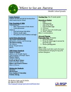
Where to See an Aurora
Where can you see an aurora in North America? After completing an astronomy activity, scholars can locate the exact coordinates. Pupils plot points of the inner and outer ring of the auroral oval and answer questions based on...
University of Wisconsin
Noting Notable Features for Rain Gardens
Eight groups in your class are each responsible for a different aspect of surveying the campus for a suitable rain garden location. Features to consider include water flow, topography, sun/shade patterns, land surface, vegetation,...
Monroe City Schools
Clouds! Clouds! Clouds!
Here is a beautiful instructional activity on clouds designed for your 1st graders. Learners study three different types of clouds. They construct drawings of cumulus, cirrus, and stratus clouds. The Cloud Book, by Tommie dePaola is...
Curated OER
Earthquakes: Third Grade Lesson Plans and Activities
Introduce third graders to energy waves with a hands-on geology activity, in which they answer questions and compare seismograms in the San Francisco Bay area. After a demonstration that shows how bigger waves indicate a...
Curated OER
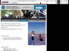
Trends of Snow Cover and Temperature in Alaska
Students gather historical snow cover and temperature data from the MY NASA DATA Web site. They compare this data to data gathered using ground measurements from the ALISON Web site for Shageluk Lake. They graph both sets of data and...
University of Colorado
Are All Asteroids' Surfaces the Same Age?
There are more than 600,000 asteroids in our solar system. Pupils analyze images of two asteroids in order to determine if they are the same age. They count craters for each asteroid and compare numbers.


