Curated OER
Hemispheres & Continents
Students learn in cooperative learning groups to determine how the equator and the Prime Meridian divide the earth into hemispheres and use Venn diagrams. Students will locate and label the hemispheres, continents, and oceans.
Curated OER
Map Making
Learners use a tennis ball and paper to construct a student-made globe. They sketch in continents and major map features and then compare a flat map to a globe.
Curated OER
Rock My World
Middle schoolers conduct a hands-on experiment designed to demonstrate how continents and oceans formed and why the manner of formation is relevant to a study of volcanoes.
Curated OER
The Earth is an Orange
Students examine and identify the various types of maps. Using two types of maps, they compare the data that can be gathered from each one. They also identify and locate the continents and the oceans. They review the purposes of each...
Curated OER
Geography: Continents
First graders identify basic geographical facts about the world they live in and distinguish between land and water on a globe. They research the continents and information associated with each one focusing on building their map skills.
Curated OER
Incorporating 3D Visualizations into Your Classroom
Students make observations through 3-D visualizations. They explore scientific and geologic processes through the use of 3-D pictures.
California Academy of Science
Tropical Belt
Where in the world is the equator? Explore a world map with your class, coloring in oceans, continents, and rainforests while locating the three major lines of latitude: the equator, Tropic of Cancer, and Tropic of Capricorn. Discuss how...
Curated OER
Plate Tectonics & Land Forms
Fourth graders discuss the different interactions of plates and the ways mountains are created. In this plate tectonics lesson plan students complete an activity in groups.
Curated OER
Introduction to the Globe
Students investigate how to use a globe. In this map skills lesson, students define what a globe is and locate the various continents on the globe. Students are also asked to locate the four oceans on the globe.
Curated OER
The Globe Game
Students locate continents, oceans, and major mountain ranges on the globe. In this globe lesson, students play a toss the globe game. They name the continent, ocean, or major mountain range that is located closest to their right thumb...
Curated OER
Leapin' Landmarks: Locating 10 Man-made Landmarks Around the World
Third graders label continents, oceans, and major mountain ranges on maps and use the maps to write an informational report about landmarks. In this landmarks lesson plan, 3rd graders write about 1 major landmark.
Curated OER
Paper Mache Globes
Third graders create a paper mache model of the earth. At the conclusion of a discussion about the earth, they are given paper mache materials, they create their globe and appropriately draw and label landforms, bodies of water and the...
Curated OER
Pangaea Puzzle
Students explore plate tectonics and the formations of the Earth's surface and why maps are distorted. In this Earth's surface lesson students complete a lab and answer questions.
Curated OER
A Model of Earth's Atmosphere
Middle schoolers make a model of the four layers of Earth's atmosphere that represents the characteristics of each layer.
Curated OER
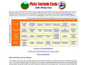
Plate Tectonic Cycle
Students explore the Earth's movements by completing worksheets. In this plate tectonics activity, students define such natural disasters as volcanoes, earthquakes, tsunamis and mudslides and discuss their connections to plate tectonics....
Curated OER
Continents and Oceans on the Move
Students create an awareness of the vast percentage of water covering the earth. They relate similarities/differences between topographical maps and other maps of various time periods. Students examine how to use a topographical map.
Curated OER
The Volcano Factory
Collaborative groups work together to report on the volcanic activity leading to island formation and construct models to demonstrate the process. Consider having each group present their project to the rest of the class. There are many...
Curated OER
My Friend, the Volcano
Working in cooperative groups, young scientists research and report on how undersea volcanic activity may benefit marine ecosystems. There are many links to websites that you can use to stimulate curiosity or for pupils to use for...
National Wildlife Federation
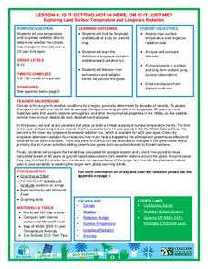
Is It Getting Hot in Here, or Is It Just Me?
Currently, only 2.1% of global warming is felt on continents, while over 93% is felt in the oceans. The fourth lesson in the series of 21 on global warming is composed of three activities that build off one another. In the first...
Curated OER
Watercolor Ways
Students investigate the concept of being part of a global community. In this global community lesson, students learning the definition of stewardship as it relates to taking care of the Earth. They listen to the lyrics of the song,...
Curated OER
Map Puzzles
Students make puzzles from world maps, dramatizing how much of the globe is covered by ocean.
Curated OER
Modelling Ocean Currents
Students construct a replica of the Atlantic ocean given certain parameters. In this earth science lesson, students draw their own map of ocean currents. They answer questions related to the activity.
Curated OER
Recent Volcanoes And Earthquakes:
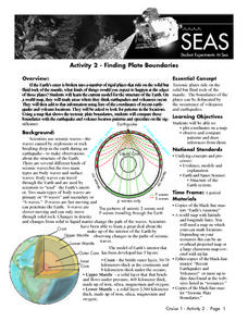
Students investigate the current model for the structure of the Earth. On a world map, they mark areas where they think earthquakes and volcanoes occur and compare those areas with earthquake and volcano location patterns.
Curated OER
A Book Is A Window To the World
Second graders listen to pieces of literature that take place in different regions of the world. Using a map, they identify and locate the continents and oceans mentioned in the story. They describe the physical and human characteristics...


