NOAA
Ocean Exploration
Sea explorers and scientists have found that because of temperatures being two to three degrees Celsius at the bottom of the ocean, most animals are lethargic in order to conserve energy. In this web quest, pairs of learners read about...
Curated OER
Jamestown in Context: The Colonization of North America
Pupils analyze the significance of Jamestown in the broader picture of colonization and analyze a historical document to determine the effects of previous explorations on the expectations of the Jamestown colonizers
Curated OER
Revolutionary Money
Examine paper money from the American revolution! Historians study the paper bills and discuss the history of money. How has money changed over the times? Activities are included.
Curated OER
"You Shall Do Your Best Endeavor" - Working With Primary Documents
Students read and interpret primary source documents regarding historic Jamestown. In small groups, they read the primary documents, answer questions, and view online maps of Jamestown Island and Virginia.
Curated OER
U.S. Quiz Questions
In this ESL United States worksheet, students answer a set of 25 questions about the United States. The answers to each question are written beneath each.
Curated OER
Social Studies Quiz B-Grade 4
In this grade 4 social studies quiz instructional activity, 4th graders complete a 15 question multiple choice quiz covering a variety of grade 4 concepts.
Curated OER
Frederica: An 18th-Century Planned Community
Young scholars explore life as early settlers in Frederica by pretending to be crafts/tradesmen there and writing letters describing the fort/town to a friend or family member still in Great Britain, debating reconstruction vs....
Curated OER
Queen Anne's War and Its Impact on Deerfield
High schoolers researchhow Queen Ann's War of Europe affect Native Americans in New England. After reading excerpts from History of Deerfiel by George Sheldon and Nuthatch's Dilemma, a story about a Pocumtuck woman, students are prepared...
Curated OER
The Art of the Puerto Rican People
Students study Taino Art and identify their crafts and stone carvings. They read the life of Campeche as presented and discuss with their teacher the economic and political situation of Puerto Rico in the eighteenth century and how...
Texas Education Agency
Texas Gateway: Exploration and Colonization of America
Given short summaries about the reasons for European exploration and colonization of North America, students will compare English and Spanish settlements in the New World.
Curated OER
National Park Service: John White Colony
This site from the National Park Service details John White and the colony of Roanoke.
Unite for Literacy
Unite for Literacy: Saving Animals From Extinction: A Nest for African Penguins
Learn some facts about the African penguin in this book. Includes audio narration in English and Spanish with text in English.
A&E Television
History.com: The Native American Chief Who Drove Out Spanish Colonists and Nearly Expelled the English
In the summer of 1561, Spanish explorers abducted Opechancanough, a Powhatan Indian youth from the Chesapeake Bay tidewater region and brought him to the royal court of Spain. The kidnapping set off a chain of events that would alter the...
Annenberg Foundation
Annenberg Learner: United States History Map: Colonists
Use these interactive maps to see and read about the colonization of the New World by several European nations. When you are finished looking at the maps, test your skills with the European Colonies Challenge.
Instituto Latinoamericano de la Comunicacion Educativa
Acta De La Independencia (1811)
Declaration of Independence for Venezuela, July 5, 1811. English and French available on the homepage.
National Humanities Center
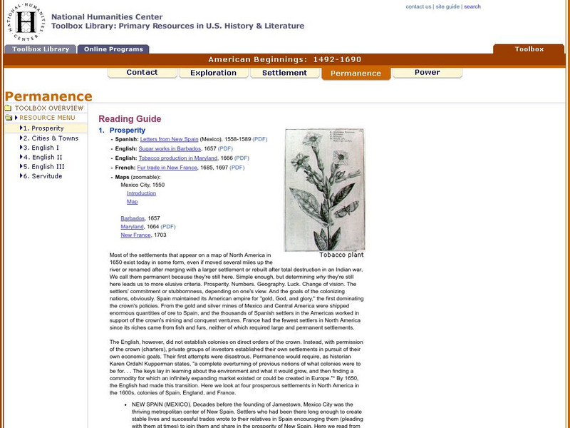
National Humanities Center: Toolbox Library: Prosperity, American Beginnings: 1492 1690
Four original source accounts, and four related maps, of successful English, French, and Spanish settlements in North America and the Caribbean that explain the qualities of these settlements and their reasons for permanence and prosperity.
Other
University of Georgia: Georgia History
This site has great links to the history of Georgia. Categories of links include: Prehistoric Period, Spanish Georgia, French Georgia, Georgia as an English Colony, American Revolution to the Civil War, Reconstruction to the 20th...
Library of Congress
Loc: American Memory: Colonial Settlement 1600s 1763
The settlement of the colonies in America is the focus of this article. The course of events is divided into topics and time periods, making it easier to understand. Note is made of the effects to the already present Native Americans as...
Independence Hall Association
U.s. History: Britain in the New World
Read about the early English explorers and find out why other countries did much more early exploration than the British. The defeat of the Spanish Armada turned the tide. Discover why the English now could explore and plant colonies.
National Humanities Center
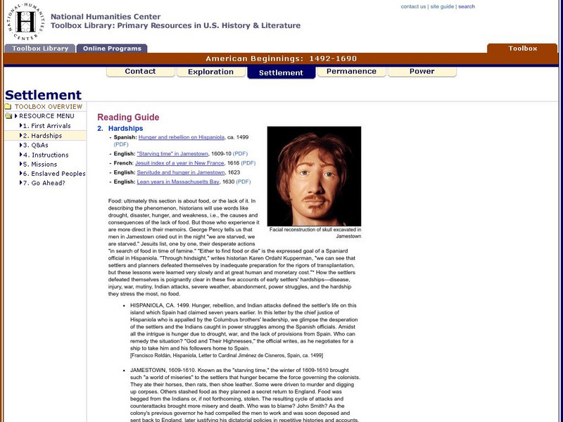
National Humanities Center: Toolbox Library: Hardships, American Beginnings: 1492 1690
Three English, a French, and a Spanish primary account of the staggering losses, misery, and deprivation that characterized early European settlement as well as the resilience needed to overcome those challenges.
National Humanities Center
National Humanities Center: Toolbox Library: First Arrivals, American Beginnings: 1492 1690
Numerous visual images of artifacts from English settlements at Jamestown and at Plymouth, and from Spanish settlement in Hispaniola, and three original accounts of each of those early settlements that describe the possibilities and the...
National Humanities Center
National Humanities Center: Toolbox Library: Go Ahead, American Beginnings: 1492 1690
A Spanish, an English, and a French account of the enormous challenges in maintaining a colonial presence in North America and of the potential national loss-of pride, wealth, and possibility for expansion-if nations abandoned these...
Library of Congress
Loc: Exploring the Early Americas: Competition for Empire
Part of a larger site, the primary sources here deal with the competition among the European countries in establishing a foothold in the New World.
Annenberg Foundation
Annenberg Learner: America's History in the Making: Colonial Designs [Pdf]
Scroll down through this unit for teacher facilitators to Appendix E and F to find maps of colonial settlement in eastern North America in 1600 and 1660. From Oregon Public Broadcasting.


