Curated OER
Arbor Day Across the United States
Students perform research about hardiness zones used to guide planting. They read a hardiness zone color-key map and create their own color-key maps to show when different states celebrate Arbor Day.
Curated OER
Heavy Breathing
Students investigate asthma and air quality, and then map or graph the incidence of asthma by county and air quality information by county in the state of Maryland. They attempt to see any correlations and note any limitations of the data.
Curated OER
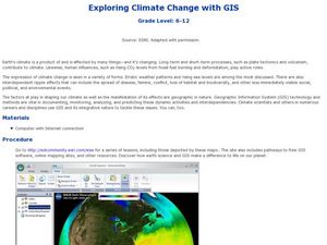
Exploring Climate Change with GIS
Students investigate climatological changes that are occurring to the Earth. For this climate change lesson, students access an assigned web site to view maps and lessons that show how climate change makes a difference to life on Earth.
Curated OER
Lake Billy Chinook
Students explore aerial photographs and maps of Round Butte Dam. They examine the land modifications necessary to create a dam. After reading a book about building a dam, students compare the environmental impact of Lake Billy Chinook to...
Curated OER
Choose Your Own Soil Adventure
Ninth graders will use a soil survey to make management decisions and by interpreting geologic maps. The importance of different soil types is discussed and the implications of how soil can be useful for our communities.
Curated OER
And Your Point Is . . .? Part I
Students, in groups, complete a WebQuest titled "Love Canal Debate". They follow the WebQuest to research and write papers on different points of view regarding the Love Canal environmental disaster.
Curated OER
Groundwater Pollution Site Assessment
Students study how a geologist examines a hazardous waste spill using an actual site. They use site data to map the spill, find its source and determine how fast the spill is spreading.
Curated OER
State Of The Bay
Middle schoolers investigate the environmental problems that surround the Chesapeake Bay area. They use an environmental handout as a resource that should be supplemented with research. Also students ask specific questions to report...
Curated OER
Kincaid Shelter Stratigraphy
Seventh graders illustrate how archeologists use stratigraphy to help determine environmental changes in a specific area since the Pleistocene Era, and to point out that these changes have affected the animals living in that area.
Curated OER
Storm Busters
Middle schoolers investigate hurricanes and invent a way to diffuse or redirect a hurricane before it becomes destructive in this technology-based science project. Cooperative learning groups are emphasized.
Curated OER
Show Me The Dinos
Pupils explore a site of numerous fossil excavations. Using an interactive quarry map, they locate dinosaur specimens and individual bones. In groups, students use "Show Me" cards to answer questions, compile information, and create...
Curated OER
Hyperlink Habitats
Students explore a series of Web pages designed to illustrate the interconnectedness of a tropical rainforest ecosystem. They discuss their research, create maps and research a local ecosystem.
Curated OER
Green Space in the City
Students identify the different kinds and uses of green space that exist in an urban area. They create maps of local parks and research the history of each park. They conduct a survey of residents near the park and interview a park...
Curated OER
Repopulating Michigan's Waterways
Eleventh graders identify the parts of an ecosystem and how communities change over time. In this ecology lesson students formulate a habitat restoration plan.
Curated OER
Scientist Tracking Network
Young scholars correlate surface radiation with mean surface temperature of several geographic regions. They observe how these parameters change with latitude and construct an understanding of the relationship of solar radiation to...
Curated OER
Using Vegetation, Precipitation, and Surface Temperature to Study Climate Zones
Students begin their examination of the climate zones found around the world. Using a software program, they identify the relationship between the vegetation, climate and temperatures of the different zones. They also plot coordinates...
Curated OER
Here Today, Gone Tomorrow
Young scholars explore erosion. Through multi-media and hands-on activities, students identify the effects of wave erosion and hurricanes on a barrier island. Young scholars watch a video and create a cause and effect chart of their...
Curated OER
Habitat Art: Florida Panthers
Students discover the lifestyles of a Florida Panther by investigating its habitat. For this wild animal lesson, students utilize the Internet to research the habits of a Panther and what their habitat is. Students create an...
Curated OER
Where In the World Are the Resources?
Students use the internet to research the amount of natural resources in a specific area on Earth. In groups, they locate the supply of each natural resource on a map in that area and what can be done to reduce their usage. They also...
Curated OER
How Many Trees Can You Grow?
Students solve a story problem about how many trees can be planted in a given area. Using a map, they gather information about the size of the area and the dimensions of an acre. They use a specific equation to determine the area of...
Curated OER
Island Culture: Puerto Rico
Students explore the culture of Puerto Rico. They create maps of Puerto Rico and the Caribbean. They work in small groups to research a decade in history and add drawings and pictures to a timeline of their decade. They practice...
Curated OER
3-D Model of Lake Benthos
Young scholars create 3-D models of Lake Benthos. In this scale drawing lesson, students create a 3-D model of Lake Benthos. Young scholars work in groups to create the models. Students use the models to to encourage people to conserve...
Curated OER
Watershed Tourist
Learners recognize and categorize different bodies of water. In this watershed and water environments lesson, students "Follow the Water from Brook to Ocean." Learners define the different bodies of water and sort from smallest to...


