Central Intelligence Agency
Cia: World Factbook: Regional and World Maps
Maps of major areas of the world can be downloaded here. The maps have excellent detail and are in color.
University of Texas at Austin
The Perry Castaneda Library Map Collection
This collection contains more than 250,000 maps covering all areas of the world, and ranging from political and shaded relief maps to the detailed and the historical. Select from a region of the world or an area of highlighted interest.
University of Texas at Austin
Perry Castaneda Library Map Collection: Historical Maps of Europe
This collection from the University of Texas Library Online of historical maps contains a wide variety of maps from various parts of Europe and from different parts of history. Each map is accompanied by a brief description and is clear...
Other
Cartographic Images: Late Medieval Maps 1300 1500
Find some incredible maps of early cartographers. What did they know of the world then? Did they know it was round? Take a look at this site.
Other
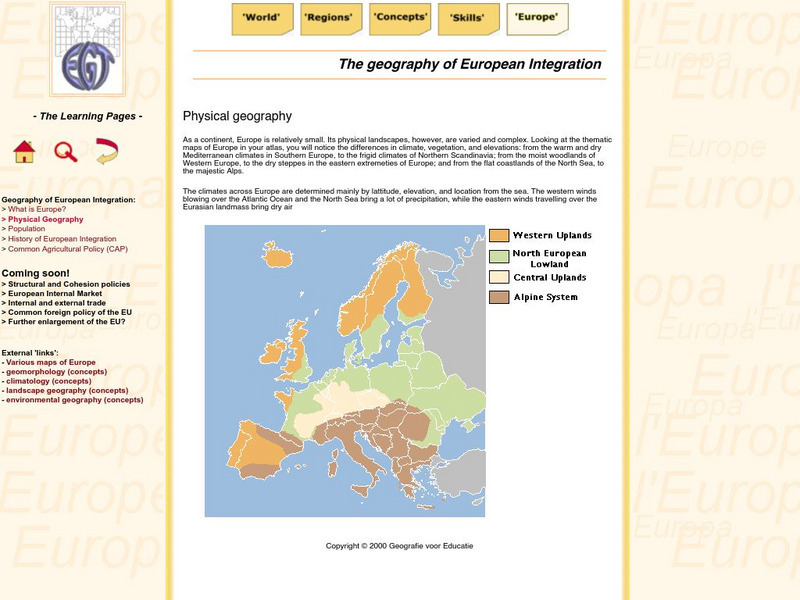
The Learning Pages: Geography of European Integration
This page has a map showing the 4 different types of land located in Europe. Information is provided on Europe as well as links to more maps and information.
Ancestry
Europe 1820
Although there is no key, the map shows provinces, country boundaries, and the German Confederation boundary of 1820.
Other
David Rumsey Historical Map Collection
The collection of more than 150,000 maps focuses on rare 18th and 19th-century maps of North and South America, although it also has maps of the World, Asia, Africa, Europe, and Oceania. The collection includes atlases, wall maps,...
Ancestry
Europe After the Congress of Vienna, 1815
Map of Europe after the Congress of Vienna of 1815, showing the gains of Prussia, Russia, Sardinia, and Austria, as well as the boundaries of the German Confederation.
Curated OER
Harper College: Map Quiz Tutorial
A great way to learn about and then test yourself on Europe's geography. Includes three map tutorials. Good tool for visual learners!
Curated OER
National Geographic: Europe: Poland
Welcome to Poland! Follow this interactive overview of the country's history, geography, people, government, nature, and more. A map andvideo are included. Adobe Flash Required.
Curated OER
National Geographic: Europe: Sweden
Welcome to Sweden! Follow this interactive overview of the country's history, geography, people, government, nature, and more. A map andvideo are included. Adobe Flash Required.
Curated OER
Etc: Maps Etc: Physical and Cultural Geography of Europe, 1915
Six maps of Europe showing the average rainfall, the major climate zones, agricultural products (rye, corn, wheat, rice, and sugar beets), industrial products (iron, textile, and coal), ethnic groups, and religions.
Curated OER
Carver, Jonathan 1781, New Map of North America
"The David Rumsey Historical Map Collection focuses on rare 18th and 19th century North and South America cartographic history materials. Historic maps of the World, Europe, Asia and Africa are also represented. The collection categories...
Other
Atlas of World History
This interactive historical map focuses on the history of Europe, Africa, Asia to the year 1000 CE. Click on a region to learn historical facts about each location. Requires JavaScript. Offers map translation into Greek, Turkish, Serbian...


