Curated OER
Brave New World
Students view a video about the effects of World War II on the map of Europe. They discuss the video and answer questions. They work together to identify accomplishments that best represent American culture.
Curated OER
Traveling the Silk Road
Pupils take a virtual trip down the Silk Road. Using a map, they trace the location of the trade route and others that were developed later. They use different spices and goods to trace how they came to the Americas. They answer...
Curated OER
Number the Stars Geography
In this geography and literature worksheet, students explore the location of the 3 countries mentioned repeatedly in Lois Lowry's novel Number the Stars. Students color the countries on a map of Europe and create a key to match the...
Curated OER
Open Cities: Migration
In this open cities: migration worksheet, 10th graders identify European cities on a map and from photographs, answer 13 questions about the cities, complete 5 sentences and write 7 examples of urban growth.
Curated OER
Powerful Potato
Students are introduced to the growth process of a potato. As a class, they place a potato on a plate and observe how long it takes for the eyes to appear. In groups, they follow a recipe to make potato soup that is shared with the...
Curated OER
Mapmakers' Perspective
Students examine several maps and consider mapmakers' perspective in early depictions of North America.They determine how the spherical shape of the earth makes any north-south and east-west orientation a matter of perspective. For...
Curated OER
The Geography of Renaissance
Pupils use the internet to research the geography of the Renaissance. Using maps of Europe, they identify at least three key cities during the time period and discuss the main types of transportation. They research the various customs...
Curated OER
Anne Frank: Courage and Responsibility
Sixth graders explore, examine and trace the development of modern Europe from 1900 to the present. They identify and assess the attitudes during this time period toward discrimination and become more aware of their sensitivity to...
Curated OER
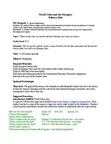
World Cities and the Olympics
Young scholars examine the various cities in which Olympics have been held. Using a map, they describe the reasons why those cities were chosen and choose their own city for the Olympics and state the reasons why. They examine...
Curated OER
Charles Lindberghs's Flight to Paris
Young scholars practice map skills. In this map skills instructional activity, students locate the cities of New York and Paris on a map. Young scholars read about the flight made by Charles Lindbergh in May 1927 from New York to Paris....
Curated OER
World War II Review
Ninth graders review previously presented material on World War II and discover how the world was at that time. They, in groups, participate in map work designed to explain Axis and Allied countries using toy army men.
Curated OER
History/Geography
Students review North America, Africa, Europe and Asia. They identify Australia as the smallest continent. They identify Australia as an island continent nicknamed "the land down under." They color a map of Australia.
Curated OER
Who Dropped What into the Melting Pot?
Students show the movement of people to the United States from other countries on maps. They study the geographic cultural roots of foods that contribute to the melting pot of food in America. They research where an ingredient comes from...
Curated OER
Introduction to the World Globe
Learners examine a globe and the world map to see what constitutes the differences. In this world map introductory lesson plan, students discuss what they see when they view the globe. Learners then, look at a world map and compare the...
Curated OER
Colony Brochure
Students, after studying the 13 colonies, create a brochure advertising one of the colonies. The purpose of the brochure, they were told, would be to urge people in Europe to come to America and settle in their particular colony.
Curated OER
Poland's Next Step
Learners investigate the history of Poland. They explore various Polish historical websites, explore an interactive online map of Polish cities, answer discussion questions, and locate newspaper articles about Poland.
Curated OER
Spiritual, Educational, and Physical Resistance in the Warsaw Ghetto
Students review the organization of the ghettos in Eastern Europe. Using the internet, they gather more insight on the people who lived in the ghettos. They discuss the reaction of some members to join resistance movements. They also...
Curated OER
Ottoman Lyric Poetry
Pupils explore the Ottoman style of poetry. They view a video, Suleyman the Magnificent, and view maps of Europe, Asia, Africa and the Mediterranean Sea. They research the Ottoman Empire and keep a journal. They read various Ottoman...
Curated OER
The Inventions and Effects of the Industrial Revolution
Students understand that the Industrial Revolution began in England, spreading to the rest of Western Europe and the United States and with it came an increased demand for raw materials from the Americans, Asia, and Africa.
Curated OER
The Spanish Armada
In this Spanish Armada study guide worksheet, students discover the background and significant details of this event in world history. Students read 7 sections of information and examine photographs and maps.
Curated OER
Choosing Plymouth - Pilgrim Study Unit
Students identify the principal physical features the Pilgrims considered when choosing the location of Plymouth. They create a postcard to send to a friend in Europe as if they were a Pilgrim; illustrating one aspect of the settling in...
Curated OER
What the Empire Lost: The Ottoman Empire
In this Ottoman Empire worksheet, students read a 1-page selection about the decline of the empire, examine the provided map on the topic, and then respond to 5 short answer questions about the information presented.
Curated OER
Traveling Through North America
Students identify places and landmarks in North America, specifically Canada and the United States, by using and constructing maps. Six lessons on one page; includes test.
Curated OER
Native People of the Caribbean
Eleventh graders use a map and locate and define the Caribbean region and then work in groups to read the passage and timeline. The groups' reader will read the passage aloud and the recorder makes a list of why colonists used slave...
Other popular searches
- Maps of Europe
- Blank Maps of Europe
- Outline Maps of Europe
- Geography Maps of Europe
- Maps of Europe 1914
- Map of Europe
- Maps of Europe Political
- Maps of Europe Ppt
- Maps of Europe Pot
- Medieval Europe Outline Map
- Medieval Europe Map
- Maps of Europe 1919


