Curated OER
Europe Map
In this blank outline map instructional activity, students explore the political boundaries of the continent of Europe. This map may be used in a variety of classroom activities.
Curated OER
Europe at Exploration 1500
In this world empires and trade in 1500 worksheet, students examine a world empire map, world trade map, and Europe map. All maps display information from 1500.
Curated OER
Blank Europe Outline Map
In this blank outline map learning exercise, students explore the political boundaries of the continent of Europe and those of the countries located there. This map may be used in a variety of classroom activities.
Curated OER
Blank Europe Outline Map 2
In this blank outline map worksheet, students explore the political boundaries of the continent of Europe and those of the countries located there. This map may be used in a variety of classroom activities.
Curated OER
European Country Map
In this Europe political map worksheet, students examine the national boundaries. The country names are labeled on the map.
Curated OER
Europe Outline Map (Labled)
In this blank outline map worksheet, students study the political boundaries of the labeled European nations.
Curated OER
Europe Labeled Map
In this Europe political map worksheet, students examine the national boundaries. The map also highlights each of the nation's capitals with a star. The countries and capital cities in this map are labeled.
Curated OER
Europe: Political Map
In this Europe political map learning exercise, students examine each country's boundaries. The map also highlights each of the nation's capitals with a star.
Curated OER
Europe 1914
In this Europe 1914 map worksheet, students note the 9 regions of the Europe labeled on the map and their relevance to World War II.
Curated OER
European Map
In this blank outline map activity, students explore the political boundaries of the continent of Europe and those of the countries located there.
Curated OER
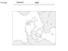
Denmark Outline Map
In this blank outline map learning exercise, students explore the political boundaries of Denmark located in Europe. This map may be used in a variety of classroom activities.
Curated OER
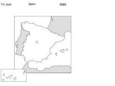
Spain Outline Map
For this blank outline map worksheet, students explore the political boundaries of Spain located in Europe. This map may be used in a variety of classroom activities.
Curated OER
Europe Physical Map
In this Europe physical map worksheet, students make note of the major landforms and bodies of water located on the continent.
Curated OER
Europe Outline Map
In this outline map worksheet, students examine the political boundaries of the continent of Europe. The map may be used in variety of activities that individual teachers create to accompany it.
Curated OER
Europe Outline Map
In this blank outline map worksheet, learners explore the political boundaries of the continent of Europe and those of the countries located there.
Curated OER
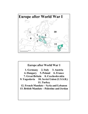
Europe after World War I
In this Europe after World War I map worksheet, students note the 11 regions of the Europe labeled on the map.
Curated OER
Religions of the World
In this world religions map learning exercise, students note the 12 regions of the world and the religious beliefs practiced by the majority of people in those regions.
Curated OER
The Spanish Armada
In this Spanish Armada study guide worksheet, students discover the background and significant details of this event in world history. Students read 7 sections of information and examine photographs and maps.
VIF Learning Center
Languages as Reflection of Cultures and Civilizations: French Speaking Countries
Expand your class's vision of the French-speaking world by conducting this research project. Pupils focus on building 21st-century skills while they look up information about a French country and put together presentations.
Curated OER
Constitutions and Mindmap of Government
In this European Union studies worksheet, students examine governments in the United Kingdom and other European nations as they respond to 10 short answer questions and complete a graphic organizer.
Curated OER
Causes of World War One Question Overview
In this causes of World War I worksheet, high schoolers respond to 14 fill in the blank questions and complete a graphic organizer. A word bank and glossary are provided.
Curated OER
Unemployment in the UK
In this unemployment learning exercise, students use the 16 sentences provided in the answer bank to complete a graphic organizer pertaining to unemployment in the United Kingdom.
Curated OER
Germany : 1500-present
In this German history study guide worksheet, students read a brief overview pertaining to the history of Germany from 1500 to the present.
Other popular searches
- Maps of Europe
- Blank Maps of Europe
- Outline Maps of Europe
- Geography Maps of Europe
- Maps of Europe 1914
- Maps of Europe Political
- Maps of Europe Ppt
- Maps of Europe Pot
- Maps of Europe 1919
- Maps of Eastern Europe
- Maps of Medieval Europe
- Western Europe Maps


