Curated OER
United States Map
Students describe cities they are familiar with. In this United States Map lesson, students understand how cities are listed on a map. Students become aware of a map legend and the information in it.
Science Matters
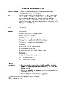
Wattsville and Mercalli Booklet
There has been an earthquake! Can you listen to the description of damage given by callers in order to determine the epicenter? The 11th of 20 lessons has pupils read a script of one emergency caller. The class records the information on...
Reporters Without Borders
2017 World Press Freedom Index
Freedom of the press was seen as a right so important that the Founding Fathers listed it as part of the first amendment to the United States Constitution. Americans pride themselves on this freedom, but just how free are American...
Curated OER
Making Sense Of A Round World On A Flat Surface
Students engage in a lesson plan that is concerned with the development of geography skills. They take part in a number of activities that center around finding and traveling to different locations. The lesson plan has resource links...
Curated OER
Waldseemüller’s Map: World 1507
Students take a closer look at historical maps. In this primary source analysis lesson, students examine the first world map produced by Martin Waldseemuller. Students complete the included map analysis worksheet and then write letters...
Curated OER
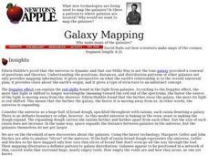
Galaxy Mapping
Young scholars research the constellations and discuss their findings. Then they construct their own maps of the galaxy using paper, black paint, aluminum foil, etc. They make a 3-D map of their chosen constellation.
Curated OER
MAKING CONNECTIONS WITH MAPS
Students define choropleth map. They construct a choropleth map. They interpret a choropleth map. They present geographic information.
Curated OER
Topographic Maps
In this topographic map worksheet, students learn how to read a topographic map and create a topographic map of their own using clay or Play-Doh. Students include contour lines by layering the clay. Students answer 6 questions about...
Curated OER
Maps Can Help Us
First graders explore the geography of Montana by analyzing geographic maps of the area. In this Native American reservation lesson, 1st graders discuss the similarities and differences between reservations in the state of Montana....
Curated OER
Me on the Map Lesson 1
Young scholars use maps, globes, geographic information systems and other
sources of information to analyze the nature of places at a variety of scales. They identify on a map and determine the population
of the city, county, state,...
Curated OER
Maps, Charts, and Graphs
Pupils define key geographic terms and track a hurricane on a map. They examine various types of maps and find locations on them,including rivers, cities and mountains.
Curated OER
Map Puzzles
Students make puzzles from world maps, dramatizing how much of the globe is covered by ocean.
Curated OER
A Visit to China
Sixth graders study the history of China. They explore the Chinese people, the Great Wall of China, religions, government and Dynasties. In groups, 6th graders collect information on China. They write a report on their findings and...
BrainPOP
Latitude and Longitude Differentiated Lesson Plan
Scholars warm-up their map skills with a discussion using location words to describe familiar places. An engaging video informs class members about latitude and longitude. Three leveled activities extend the learning experience for...
University of Southern California
What Is The Ocean?
Go on a tour of the ocean through the lens of a scientist. Learners read maps of the ocean floor, study tide behavior, examine wave motion, and analyze components of soil. Each lesson incorporates a hands-on component.
Curated OER
Finding Meaning in the Badge
Children who are three to five years old study two rank badges from the Qing dynasty to develop an understanding of social rank, language skills, and symbolism. The lesson is discussion-based and requires learners to compare and contrast...
Curated OER
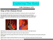
Map of the Human Heart
Click on this link and find two animated graphics of the pumping human heart. The path of blood-flow is listed in steps. The connection to the "teacher lesson plan information" does not work, but there are other links to superb resources...
Curated OER
Map It With Pixie
Fourth graders use the computer program 'Pixie' to create a topographic, detailed map for the state they live in. In this mapping skills lesson, 4th graders use Pixie to make a map of their state that includes topographic features, state...
Curated OER
Finding Latitudes and Longitudes
Students analyze Columbus' rationale for sailing west, and find the latitude and longitude of modern and ancient place names.
Curated OER
Through the Forest and Home Again: Maps Help Us Find Our Ways
Students read Little Red Riding Hood, focusing on her path home to Grandma's house. In this language arts and geography lesson, students perform a reader's theater, re-creating the walk home and possible routes that could have been...
Curated OER
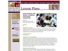
Hide and Seek with Bones: A Mapping and Scaling Comparison
Students examine and simulate how paleontologists map objects. They hide and find objects using a grid to map the objects' placements.
Curated OER
Maps! Maps! Maps!
Third graders examine and identify different types of maps. They review the types of projections and which maps are better for different information. They answer comprehension questions at the end of the lesson.
Curated OER
Me on the Map: Homes, Neighborhoods, and Communities
Young scholars read a book about maps and identify the differences between a picture and a map. In this maps lesson plan, students also label maps of their home, neighborhood, and community.
Curated OER
Introduction to Maps
Learners develop their map skills. In this geography lesson, students participate in an activity that requires them to survey their social studies book in order to find different types of maps and purposes for their uses.


