Curated OER
Rock On!
After five class sessions, young scientists will be able to identify common rock types: igneous, sedimentary, and metamorphic. This plan involves hands-on activities, includes various handouts and worksheets, and requires there to be...
Curated OER
Famous Rock Groups
Students define igneous, metamorphic, and sedimentary, and use rock identification books to identify igneous, metamorphic, and sedimentary rocks. Students then discuss which rocks early man would have found useful for tool creation.
Curated OER
I Can Find that Where? - A Study of Landforms
First graders make landform maps of the United States. In this landform lessons, 1st graders participate in a discussion of local landforms and make a landform map of the United States. They follow the teacher's directions to add plains,...
Curated OER
Landforms of Illinois
Fifth and sixth graders are introduced to the primary landforms of Illinois and discover how they were created. Landform cards are made for each pupil. They use the twenty-questions format until they have identified each one. Then,...
Curated OER
Time for All Ages
Fourth graders discover time keeping by analyzing technological advances in history. In this time lesson plan, 4th graders create and complete a KWL chart based on their research of a famous timekeeping invention, such as a...
Curated OER
How Volcanoes Grow
Students create models of the three major types of volcanoes and determine how a volcano's shape is related to the type of material erupted. They then observe a demonstration that simulates the nature of two volcanic materials: lava and...
Curated OER
Landforms of Illinois
Young scholars discover the primary landforms of Illinois. They examine how those landforms were formed as well. In groups, they research one of the landforms from their vocabulary list. They create their landform in a shoebox and...
Curated OER
Landforms
Second graders identify all the geographical landforms along the pioneer trail. They study, and present to the class, at least one geographical landform along the pioneer trail.
Curated OER
Mastering the Keyboard
Sixth graders view an animated program showing how the continents fit together millions of years ago. In groups, they compare and contrast the distribution of rocks and fossils based on how the continents fit together. After reading a...
Curated OER
The 50 States and its Holidays
Though the format of this ELL lesson is confusing (the standards listed are for plate tectonics, yet the objectives are for American geography and holidays), a teacher could glean some ideas from the main idea. Here, pupils complete a...
Curated OER
Volcanic Activity in the U.S.
Students locate and map ten volcanoes in United States, create chart comparing volcanoes by last eruption, type of volcano, location, and interesting fact, and create Powerpoint slide show describing basic
information about volcanoes and...
Curated OER
A Special Relationship: Connecticut and Its Settlers
Students study both geological and geographical features of Connecticut and the New Haven area. They focus on map works and rock formation.
Curated OER
Our Water Resources
Students build a model aquifer to study groundwater zones and water table formation. Students use the models to measure the movement of polluted groundwater.
Curated OER
Edible Coal Mining
Learners explore the concept of bituminous coal and the role it plays within our world. In this economic and earth science activity, young scholars discover and model the extraction methods with hands-on activities. Learners...
Curated OER
Sunken Millions
This PowerPoint provides a game show format with multiple choice questions about fresh and salt water. Topics include sources of water, water geography, uses of water, and the water cycle.
Curated OER
Cavern Geology: Speleothem Construction
Students discover how underground rock formations grow. They perform various activities based on grade level.
Curated OER
Indiana Ice Investigations
Fourth graders create a model of the formation of Indiana by glaciers. Working in groups with appropriate materials, they create a model documenting how glaciers moved through the land and formed the geological structure and land masses...
NOAA
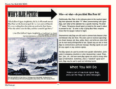
Who’s Blue Peter?
Scholars discover who Blue Peter is and how sailors used nautical signal flags on the open waters in order to create their own set of nautical signal flags and send messages to peers.
Curated OER
Geology and the Battle of Gettysburg
Students create geologic maps of the Gettysburg battlefield. In this geologic skills lesson, students consider the variations of Earth's surfaces and explore strategies employed by the North and South in the Battle of Gettysburg to...
Curated OER
Sustainable Southern Belize: Coral Health Lesson Plan
Fifth graders investigate coral reefs and the dangers they face by labeling and drawing. In this oceanography lesson, 5th graders view a PowerPoint presentation of photographs of coral reefs in Belize. Students investigate...
Curated OER
Hoosier Artists
Students examine the paintings of various Indiana artists. Using the internet, they relate the landscapes shown to the history of the state and how it affected Native Americans. Using the information they gathered, they write story...
Curated OER
Language Arts: Mississippi River Brochure
Students create brochures about recreational activities along the Mississippi River. Focusing on points of interest, they research attractions and create maps of the surrounding area. Once students write descriptions of their...


