Curated OER
Eye From the Sky
Learners are introduced to the concept of aerial perspective and scale. Students will use satellite technology to view their neighborhoods and sketch the area surrounding their schools. They will take part in a neighborhood walk to view...
Curated OER
Slavery and the Underground Railroad
Fourth graders examine the experiences of the slaves on the Underground Railroad. They analyze maps depicting slaves' routes, calculate the mileage travelled, and write an essay and create an illustration about the Underground Railroad.
Curated OER
Earthquakes: Getting Ready For The Big One
Middle schoolers devise a plan to prepare a city for an earthquake. In this lesson on earthquakes, students differentiate between the different types of earthquakes, examine the impact they can have on a city, and write a proposal on how...
Curated OER
City Life In Europe
Young scholars explore Paris. In this geography skills lesson, students watch "City Life in Europe," and conduct further research on the city of Paris and the country of France. Young scholars create postcards that feature Parisian...
Curated OER
Observing the Sky
Middle schoolers explore astronomy. In this astronomy instructional activity, students discuss the history of the movement of celestial bodies and then communicate with other middle schoolers regarding the movements that they observe in...
University of California
Hot! Hot! Hot!
Calories are not tiny creatures that sew your clothes tighter every night, but what are they? A science lesson, presented at multiple levels, has learners experiment with heat, heat transfer, and graph the function over time....
Curated OER
Through the Looking Glass: Recognizing Developing and Industrialized Countries
Students examine the regions of the world, and identify the basic characteristics of industrialized and developing countries. They conduct Internet research on the economic and population characteristics of industrialized and developing...
Curated OER
What is a Tornado? How are Tornadoes Created? How are Tornadoes Measured?
Explore the concept of tornadoes with your class. They will research what to do during tornadoes and how to measure tornadoes. Multiple resources are included.
Curated OER
Slaves, the Labor Force, and the Economy
Students examine critical role that slaves, freemen, and plebeians played in the Roman Empire. They complete creative writing that addresses how the Roman class system and the use of slavery contributed to the downfall of the Roman Empire.
Curated OER
Native American Music: Call-and-Response
Students are introduced to call-and-response form of Native American song and dance. They identify and describe a call-and-response form as used in "0 Hal'Lwe."
Male students will perform "0 Hal'Lwe" in call-and-response style with drum...
Curated OER
Ancient Greek Philosophers:Socrates, Plato, and Aristotle
Students discover the famous Greek Philosophers. In this Greek lesson, students find the contributions of Ancient Greece and their philosophers. This lesson includes brief bios on Socrates, Plato, and Aristotle
Curated OER
Gonna Take a Sedimentary Journey
Learners collect water samples from a local source, test it, filter it and identify the materials suspended in it. Students disucss the possible sources of sediment in their watershed.
Curated OER
Alaska's Physical Systems and History
Middle schoolers read about Alaska's physical systems and determine how Alaska's physical makeup has impacted its history. They create timelines of their particular physical system.
Curated OER
Snail Observation Exercise
Students are given a pond snail in a clear glass and asked to make observations on the snail's form and behavior. One of the key ideas is that seemly common subjects (like snails) often have surprising or interesting properties.
CK-12 Foundation
Ck 12: Algebra: Scale and Indirect Measurement Applications
[Free Registration/Login may be required to access all resource tools.] Use map scales and proportions to solve for unknown distances.
Columbia University
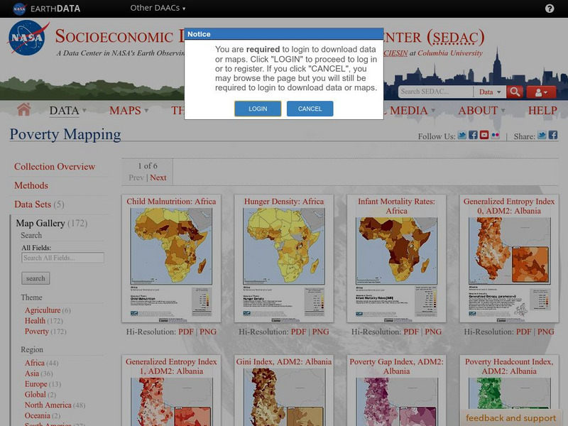
Nasa: Sedac: Poverty Mapping: Map Gallery
[Free Registration/Login Required] Included is a large array of maps showing poverty on a global scale as well as maps of individual countries. The maps show poverty measured in several different ways. PDF files may take awhile to download.
CK-12 Foundation
Ck 12: Measurement: Scale Factor to Find Actual Dimensions
[Free Registration/Login may be required to access all resource tools.] Use scale factor to find actual dimensions from scale models, drawings or maps.
CK-12 Foundation
Ck 12: Measurement: Unit Scale to Find Actual Dimensions
[Free Registration/Login may be required to access all resource tools.] Use unit scale to find actual dimensions from scale models, drawings or maps.
ClassFlow
Class Flow: Map Sense
[Free Registration/Login Required] This flipchart reviews the basic components of maps: legend, scale, Compass rose and labels. Clips from United Streaming video are included to illustrate these concepts. Student assessment and a student...
Curated OER
Educational Technology Clearinghouse: Maps Etc: Pre Colonial Africa, 1872
A map of Africa showing the continent prior to the Berlin Conference of 1885, when the most powerful countries in Europe at the time convened to make their territorial claims on Africa and establish their colonial borders at the start of...


