Curated OER
Oh, the Regions
Focus on the geography of Oklahoma. In this activity, learners compare different geographic regions in Oklahoma, create a collage to share their results, and identify important landforms throughout the United States, such as the Rocky...
Curated OER
Geography
Students engage in a study of geography while studying a foreign language. They write complete sentences to identify and describe geographical features. Students also use a map in order to use the key to find geographic features that are...
Curated OER
Informational Brochure
Students design and create brochures for a foreign country. They select a foreign country where their target language is spoken. They research the natural resources, location, geographical features, climate, tourist attractions and...
Curated OER
Overland Trails To The West
After observing a map of trails that settlers took in the 1800s, your class will write a journal with the perspective of a settler. In their journals, they must describe the trail they traveled, geographical features they saw, states and...
Curated OER
USA State Tag / Mississippi River Shuffle
Students are given the opportunity to play a tag game while studing geographical sites in the U.S.A. (relative to the Mississippi River or to other geographic features you may choose).
Curated OER
WANTED EXPLORERS
Students create their own country and explore other unknown lands. Students identify past explorers and complete the included case of the missing trunks webquest. Students research resources and geographical features for their created...
Curated OER
A Feature Presentation - Geographic Landforms
Students investigate, identify and compare the various geographic terms that can be used to describe the landforms occurring in the Hawaiian islands.
Curated OER
Indus Valley Geography and Civilization
Students study the geographical features of the Indus Valley to determine how the location of this valley contributed to the growth of an ancient civilization. They work in groups to research the area before completing map work that...
Curated OER
Africa's Geographic Features
Fourth graders work in pairs and use atlases to locate specific geographic features in Africa. They use the Internet to view these geographic features.
Curated OER
U.S. Geography: The South
Young geographers complete a research project. They list the physical features found in the American South. They then discuss the economy, culture, and geography found in the South. They work in groups to research one of the five...
Messenger Education
Look But Don’t Touch—Exploration with Remote Sensing
Mars is home to the tallest mountain in our solar system, Olympus Mons. In this set of two activities, learners review geologic land formations through the analysis of aerial maps. They then apply this knowledge to aerial maps of objects...
Curated OER
Early Explorers
Fifth graders study early explorers. For this World history lesson, 5th graders draw an outline of a map labeling each part, build geographical features out of dough, and paint each of the land and water features.
Edgate
Journal Maps
Inspire your class to look at their environments as if they were seeing them for the first time in order to gain a better understanding of the concept of perspective. After exploring their communities and keeping a journal of major...
Public Schools of North Carolina
Democratic Republic of Congo - Map Skills
Work on your map skills with a packet of activities about the river basins in the Democratic Republic on Congo. Learners study the maps provided before answering the geography questions and writing an acrostic poem about the region.
Curated OER
Underwater Mountains & Trenches
Students determine Earth's deepest trench, outline continents, major ocean mountains, and trenches on color-key map using Crayola Erasable Colored Pencils, identify oceans' geographic features, locate significant oceanic features around...
Curated OER
What's Along the Coast?
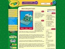
Students research an area with at least one dominant geographical feature. Then they display their findings in a realistic 3-dimensional presentation. Students also prepare ancillary material to support their project. Finally, they chart...
Curated OER
Tissue Paper Geography
Students explore geographic features of the desert and apply their understanding of the topography of the desert by creating a tissue paper painting.
Curated OER
Silk Road Caravan
Young scholars determine how the geographic features of the Silk Road trade route contributed to the economic development and diffusion of culture in both Eastern and Western Civilizations.
Curated OER
Tibet and the U.S.
Young scholars examine the relationship between Tibet and the United States. They explore the political relationship between the two countries. Students identify geographical features and political boundaries of the Tibetan and Chinese...
Curated OER
Place Names
Students investigate the meaning of various Native American names. In this Native American language lesson, students locate state names that come from Native American descriptions and mark them on a map. Students then suggest a name for...
Curated OER
Geography of Southeast Asia
Ninth graders study the geography and culture in ten Southeast Asian countries. They examine the development of the culture of these countries and how it is affected by their geographic locations.
Curated OER
Watershed Island
Students make a clay model and a geographic map of a watershed. They talk about the differences between the two representations and the potential human threats to watersheds.
Curated OER
Landscape Diversity in the Yukon Territory
Learners review and analyze a satellite image of the Yukon territory.
Curated OER
Physical Features
Students draw physical land features using ClarisWorks or Kid Pix, write their definitions, create slideshow, and create class geography book.
Other popular searches
- Egypt Geographic Features
- Geographical Features of Utah
- Geographic Features of Congo
- World Geographical Features
- World Geographic Features
- Earth Geographic Features
- Geographic Features Map
- Egypts 3 Geographic Features
- Africa/geographical Features
- Missouri Geographical Features


