Curated OER
Postcards from California: A Unit on Geography, Social Studies, History and California's Resources
Fourth graders examine patterns that influence population density in the various regions of California. The unit's three lessons utilize graphic organizers for the interpretation and presentation of data.
Curated OER
Welcome to New York State
Students choose one region of New York state, and create a travel brochure that includes information such as geographical features, tourist attractions, accesibility, economic features, and historical events that occured in that region.
Curated OER
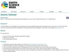
Seismic Calendar
Young scholars discover how often earthquakes happen in a region of their choice. In this science lesson, students use online resouces to help them do their investigations. Young scholars make their own map of their region and show how...
Curated OER
The Lewis and Clark Expedition
Students examine the Lewis and Clark expedition. They develop skills for historical analysis. They locate a variety of geographic features encountered by the expedition, and create a timeline that documents Lewis and Clark on their journey.
Curated OER
China
Sixth graders become more aware of how land features, climate, and vegtation affect civilization. Students are divided into groups and research one of China's regions. They make a relief of their designated area.
Curated OER
Geography Tutor: Five Themes of Geography: DVD-Video Assignment
In this geography skills worksheet, students watch the National Geographic video "Five Themes of Geography." Student then respond to 8 short answer questions about content of the video.
Curated OER
Adventure Writing: Oregon's Landscape as a Setting
Students identify geographical features of different regions encountered by migrants on the Oregon trail. Students research how the Oregon landscape may have affected life and 19th century westward migration. Students write a narrative...
Curated OER
Klondike Fever
Students consider the geographical aspects of the gold rush. For this gold lesson, students research just what gold is and where it has been found. Students create maps that highlight the regions of the world where gold has...
Curated OER
Geographic Themes From The Air: MOVEMENT
Learners observe a slide showing a shopping mall and the surrounding transportation network from an aerial perspective. They are asked to determine where stoplights would be located and predict future stoplight intersections.
Curated OER
Regions: Meet the Experts Presentation
Students gather information and create a web site on prairies and plains using a variety of resources, including the internet.
Curated OER
Mapping Geographical Skills
Eighth graders use technology to make a map of Canada in 1867 and 1873.
Curated OER
A Geographic Study of Florida's Diverse Community
Eighth graders identify major population centers and their demographic features using an outline map of Florida and the Internet to.
Curated OER
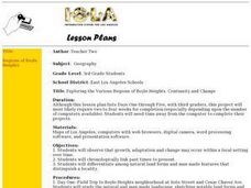
Exploring the Various Regions of Boyle Heights: Continuity and Change
Student study the local landscape of Boyle Heights, California and draw a sketch of the area. Students use map making skills in this activity. Studient make a portfolio of information and photographs they accumulate over time on the area.
Curated OER
Dr. Green's Rainforest Mystery
Third graders create a brochure describing all of the information researched about a specific animal. Using this information, create a 3-D model of the animal and its habitat that could later be used to design an appropriate living...
Curated OER
Canada...a Visual Journey
Students, in groups, research Canada's six natural regions (ecozones). They create a visual representation of each region on a large wall map of Canada and present it to the rest of the class.
Curated OER
Treasure of the Tar
High schoolers, using an atlas, locate the region known as the "Tar Sands" in the Central Plains of Canada. They hypothesize about the future economic potential of this natural resource. They create a poster about the Tar Sands industry...
Curated OER
Reindeer Herders
Students examine the life of of nomadic herders in Siberia. They read and discuss an article and maps from National Geographic, identify threats to this way of life, and write a letter to the Russian government identifying ways to...
Curated OER
Traveling with Flat Stanley
students use the internet to gather geographical data about a state of their choice. Using new vocabulary, they describe the features present in the state, its climate and attractions. They develop a PowerPoint presentation to share...
Curated OER
The Plains Indians
Students have a better understanding of another culture other than their own. This help them to see that there were other people living in this region before us.
Curated OER
Discovering the Northwest Territories Through the Five Themes of Geography
Young scholars use the Atlas of Canada to find basic geographical information about the Northwest Territories.
Curated OER
Australia: the Land Down Under
Students give a solid history and geographic explanation of the country of Australia and explain why it is important. They use some creativity in designing their own island, by using the physical features of this particular country.
Curated OER
Max Knows Mexicao, United States and Canada
Students utilize their map skills to explore the regions of North America. They explore the physical characteristics and climates of the regions. Students label their map and prepare a presentation of their findings.
Curated OER
Alberta And Saskatchwan: the View in 1905
Students analyze the differences between maps 1905 and current maps of Alberta and Saskatchewan. They use maps from the Canadian Council for Geographic Education to complete a guided inquiry. This lesson also has many extension activities.
Curated OER
Ecoregions of Texas
Students map the ecoregions in Texas and illustrate the vegetation native to the region. They will use their maps to investigate why prehistoric hunter-gatherers might have decided to live in one area over another, such as the ancient...
Other popular searches
- Texas Geographic Regions
- Canada Geographic Regions
- Georgia Geographical Regions
- Georgia Geographic Regions
- Us Geographic Regions
- Virginia Geographic Regions
- 5 Geographic Regions
- Canadian Geographic Regions
- Geographical Regions Clocks
- Geographical Regions Mexico
- Us Geographical Regions
- Pa Geographic Regions


