Curated OER
Map Skills
Students examine the nations, battlefields, troop movement of the Germans through Belgium and the location of both fronts during World War I by creating a map. They visualize the strength of the Germans early in the war.
Curated OER
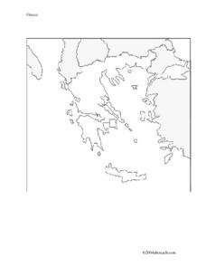
Map And Flag of Greece
In this Greece worksheet, students color and study a Greek flag. Students also color and label a map of Greece. This could be used in writing a report.
Curated OER
The Spread of Printing
Document the spread of printing, which occurred in the 1500s. Use the provided list of water ways, countries, and cities to label specified locations on the map.
Curated OER
Compass Rose for the New Millennium
Sixth graders are introduced to the concepts of a compass rose and how it used in relationship to reading maps in geography. The lesson is meant to build upon prior knowledge and skills.
Curated OER
The Expansion of Islam to 750
Track the expansion of Islam throughout the Mediterranean and Near East. Locate and label 17 different areas that adopted the tenets of Islam.
Curated OER
European Language Groups, 1850
Document the linguistic diversity and major language groups common to Europe in 1850. A map and a list of regions, countries, and water ways is provided.
Curated OER
My World
Students study maps. In this social studies lesson, students draw a map of either their room at home or the route they take to school. Students label items on their maps.
Curated OER
Eastern Europe in 1989
Major political shifts occurred in Eastern Europe during the late 1980s. Locate, identify, and label 90 different areas on the provided map. A list of cities, countries, and water ways is provided.
Curated OER
Things That Stick Out Or: How To Find Your Way Around on a Map
Students explain the meaning of and recognize the map outlines of a peninsula, an isthmus, and a cape.
Curated OER
Rivers Run Through It
Using a relief map of New York State, learners answer questions about the distance between different cities, identify bodies of water, and more. First, they discuss vocabulary related to the Hudson River area. Then, they complete a...
Super Teacher Worksheets
United States of America
Here is the perfect assessment to test your young learners on labeling the 50 states! Each state is given a number on a blank map of the United States, and a second page lists the numbers in order for learners to identify.
Cornell University
Too Much of a Good Thing?
Continuing their study of beneficial insects, young entomologists discover where in the world some of these bugs are. By labeling, coloring, and using the scale on a map, pupils explore the territories and arrival of the Asian lady...
Happy Housewife
State Notebooking Pages
When learning about US geography, it can hard to remember facts about 50 different states. Help your young scholars organize all of this information with a collection of easy-to-use note-taking guides.
Science Matters
Ring of Fire
Over a period of 35 years, earthquakes and volcanoes combined only accounted for 1.5 percent of the deaths from natural disasters in the United States. The 15th lesson in a 20-part series connects the locations of earthquakes and...
Curated OER
Africa Political Map
In this blank outline map worksheet, students explore the political boundaries of the continent of Africa, the countries located there, and label other geographic features.
Curated OER
Map Lesson Plan
Fourth graders locate and label major sites related to the Revolutionary War in the Hudson River Valley. They examine topographical features of each site and list a few of these features and list two advantages of each military site.
Curated OER
Australia Map Resource Sheet
In this Australia map resource worksheet, students use the map of Australia to supplement their study of the country. They see a map labeled with Australian cities, and the surrounding countries and water bodies.
Curated OER
Map of Norway
In this geography of Norway worksheet, students color and label a map with major cities and physical features. Students need to do their own research.
Curated OER
Map of Arctic Region
In this Arctic region geography instructional activity, students examine a map of the Arctic and color it. The latitude and longitude lines are shown as well as the labeled countries and oceans. The map shows an overhead view looking...
Curated OER
Map Keys
In this geography worksheet, students identify who a cartographer is and what they do specifically. They study an outline map of a fictitious island and then, respond to the three questions that follow. Finally, students add three more...
Curated OER
Exploring the World's Geography
Students discuss the seven continents of Earth and the diverse geography. After discussion, they create their own paper-mache globes which properly display all seven continents, the equator, and the prime meridian. They conduct research...
Curated OER
"Label Me" Texas Map
In this Texas map worksheet, students research, label and discuss the top ten major cities in Texas on a map, label the physical attributes and identify the surrounding states around Texas.
Curated OER
State or Region Project
Invite your youngsters to learn about a state or region through their choice of a creative project. The resource lists 15 project options that range from a 3-D map of the area, to a puppet show about the region. Pupils can also propose...
Curated OER
Utah History & Geography
Fourth graders calculate and determine the distances between counties in Utah. Using a map of Utah, they determine the distance between three county seats, the total distance round trip, and label a map with the distances.

