Curated OER
Outline Map of Japan
In this geography worksheet, students examine a black line outline map of Japan. There is a compass rose on the page. There are no labeled cities.
Curated OER
Latin American Relief Map
Students, in groups, research, design and construct a relief map of a section of Latin America using papier-mache. They show major landforms, elevations and notable bodies of water. They present their maps to the class.
Curated OER
Asoka’s Empire Worksheet
Learning about ancient history can be enhanced by incorporating geography. The class labels six geographic features on a map of India and respond to seven short answer questions about Asoka's reign.
Curated OER
Country Capitals
Students locate country capitals on a world map. For this map skills lesson, students review the definition of the word country and discuss what a capital is. Students locate and label capital cities on a world map using a map marker.
Curated OER
Name That Continent
Students practice locating the seven continents, four hemispheres, and four oceans using a large world map and a review song. They also import a world map to the Kid Pix computer program then type in proper labels on the map. There are...
Living Rainforest
Finding the Rainforests
From Brazil to Indonesia, young scientists investigate the geography and climate of the world's tropical rain forests with this collection of worksheets.
Curated OER
Freeform Texas Map
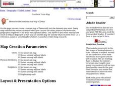
In this Texas map learning exercise, students research, label and discuss the most important cities in Texas, its physical attributes and the states that surround Texas.
Curated OER
Freeform Pennsylvania Map
For this Pennsylvania map worksheet, students research, study and label twenty important cities, physical attributes and the neighbors that surround Pennsylvania on a Pennsylvania map.
Curated OER
Map of Papua New Guinea
In this geography of Papua New Guinea worksheet, students color and label a map with major cities and physical features. Students will need to do their own research to label this blank map.
Curated OER
Map of Austria
In this geography of Austria worksheet, students color and label a map with major cities and important physical features. Neighboring countries are also shown but are not labeled.
Curated OER
Map of Australia
In this geography of Australia learning exercise, students color and label a map with major states, cities and physical features. The Australian state borders are shown but not labeled.
Curated OER
Vermont Map, Word Search, Scrambled Places and Crossword Puzzle
In this geography worksheet, students learn the important physical features and major cities in the state of Vermont by completing any of the 5 worksheets. There is a free form map, a "label me" map, word search, scrambled places and...
Curated OER
Introduction to the World Globe
Young scholars examine a globe and the world map to see what constitutes the differences. In this world map introductory lesson, students discuss what they see when they view the globe. Young scholars then, look at a world map and...
Curated OER
Midwestern States
For this United States geography worksheet, students study the image of the Midwestern states. Student then label the states with the following choices: Missouri, Iowa, South Dakota, Minnesota, Nebraska, Illinois, North Dakota, Kansas,...
Curated OER
Facts, Fictions and Perceptions of Regions
Students examine the different characteristics of the regions of the United States. They discuss places they have visited in the U.S., and in small groups conduct research on a selected region of the U.S. Each group labels a map of...
Curated OER
Where's the Sand?
Students identify the characteristics of deserts. In this geography lesson plan, students discuss the characteristics of a desert and label a map with the names of deserts.
Curated OER
Natural History of Costa Rica
Students use outline maps to become acquainted with Costa Rica. They see how it was formed and how its origin has created very diverse environments. Students then use atlases and compare their physical maps with maps of climate and the...
Curated OER
Maize to Maquiladoras: Movement from Mexico to Arizona
Fourth graders label maps of Arizona and Mexico to show the people, goods, and ideas that have moved between the two places. In this Arizona and Mexico lesson plan, 4th graders summarize the effects of the movement on Arizona life.
Curated OER
The Water Around Us
Students discuss importance of reading maps and knowing about the geography of the United States, and locate bodies of water on different types of maps and examine how they are used in the state or local community.
Curated OER
Put Me in My Place: Using Alphanumeric Grids to Locate Places
Students practice locating points on a large wall grid and create and label a neighborhood map. In this geography lesson, students spell and discuss places as the teacher places them on the map. They discuss the concept of an...
Curated OER
Continents and Oceans
Students identify oceans and continents and their locations on a map. They color-code and label their own map of the world's continents and oceans. They play the game Continents and Oceans to identify specific areas.
Curated OER
Summertime Travel
Third graders write about a summer event they participated in. For this paragraph writing lesson, the teacher models how to write about a place they have visited. Students then write their own paragraphs. Students will point out on...
Curated OER
Outlandish Landforms
Seventh graders examine landforms. In this world Geography lesson plan, 7th graders research and create a physical model of a chosen landform. They then draw a 2-d paper map of that model.
Curated OER
Using Four Main Directions in the Classroom
Young scholars identify the four cardinal directions. In this map skills geography lesson, students use a magnetic compass to label the four directions in the classroom. Young scholars use the four directions to locate objects in the...


