Curated OER
Europe at Exploration 1500
In this world empires and trade in 1500 worksheet, students examine a world empire map, world trade map, and Europe map. All maps display information from 1500.
Curated OER
Europe Labeled Map
In this Europe political map worksheet, students examine the national boundaries. The map also highlights each of the nation's capitals with a star. The countries and capital cities in this map are labeled.
Curated OER
European Country Map
In this Europe political map worksheet, students examine the national boundaries. The country names are labeled on the map.
Curated OER
Europe: Political Map
In this Europe political map learning exercise, students examine each country's boundaries. The map also highlights each of the nation's capitals with a star.
Curated OER
Europe Physical Map
In this Europe physical map worksheet, students make note of the major landforms and bodies of water located on the continent.
Curated OER
Europe Outline Map (Labled)
In this blank outline map worksheet, students study the political boundaries of the labeled European nations.
Curated OER
Europe 1914
In this Europe 1914 map worksheet, students note the 9 regions of the Europe labeled on the map and their relevance to World War II.
Curated OER
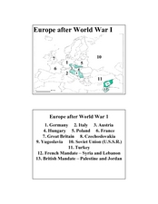
Europe after World War I
In this Europe after World War I map worksheet, students note the 11 regions of the Europe labeled on the map.
VIF Learning Center
Languages as Reflection of Cultures and Civilizations: French Speaking Countries
Expand your class's vision of the French-speaking world by conducting this research project. Pupils focus on building 21st-century skills while they look up information about a French country and put together presentations.


