Curated OER
America Will Be
Students work together to research and create different types of maps of the United States to be used as part of a geography trivia game.Groups research North American annual rainfall, climate, mountain ranges major rivers and state...
Curated OER
United States Map- Continent, Country, State
Students identify their continent, country, and state on a globe. In this geography lesson, students use a globe to identify the seven continents, the United States, and the state which they live in. Students define key terms.
Curated OER
World Map and Globe - Lesson 1 Introduction to the Globe
Students explore the earth with maps and globes. For this map lesson, students use maps and globes to locate oceans and continents.
Curated OER
Topographic Maps Worksheet
In this geography skills worksheet, students respond to 37 multi-part questions that require them to read and interpret topographic maps.
Curated OER
Video Boxes
Students create a video box about a Central American country. In this world history lesson, student research Central America and pick a country they want to investigate. They work in groups to create a video box that shows images about...
Curated OER
Exploring the Hudson in 1609
While this instructional activity focuses on a study of the Hudson River, it could be used as a template for a discussion of map skills, converting measurements, and plotting a route. The instructional activity includes vocabulary and...
Curated OER
Geography Words
This learning exercise uses maps of South America and Canada to combine basic geography vocabulary and using prepositions. Students use the maps to answer questions about the locations of various countries on the two maps. This would be...
Curated OER
Country Capitals
Learners locate country capitals on a world map. In this map skills lesson, students review the definition of the word country and discuss what a capital is. Learners locate and label capital cities on a world map using a map marker.
Core Knowledge Foundation
Volume 1 - A History of the United States: Precolonial to the 1800s
Volume One of the 299-page Core Knowledge History of the United States covers events from the Precolonial Period to the 1800s.
Curated OER
North American Mountain Ranges Map Quiz
In this online interactive geography quiz worksheet, students respond to 7 identification questions regarding North American mountain ranges.
Theodore Roosevelt Association
Roosevelt's Legacy: Conservation
The legacy of Theodore Roosevelt carries through modern American politics, economics, foreign policy, and society. But his proudest and most profound efforts were in the world of conservation, and in preserving the natural beauty of...
Curated OER
Exploring the World's Geography
Students discuss the seven continents of Earth and the diverse geography. After discussion, they create their own paper-mache globes which properly display all seven continents, the equator, and the prime meridian. They conduct research...
Curated OER
Motivating Activities for Geography Week
Here is a great way to pique your students' interest in geography, and help them learn about their world.
Curated OER
History/Geography
Students review North America, Africa, Europe and Asia. They identify Australia as the smallest continent. They identify Australia as an island continent nicknamed "the land down under." They color a map of Australia.
Curated OER
European Explorers of North and South America
Sixth graders explore the connection between the geography of America and the migration of the Native Americans to the American continents to the future conquering of the continents by the Europeans. They discuss the causes and effects...
Curated OER
The First North Americans
Students identify and interpret the different North American Indian groups, by region, and the type and impact of their interaction with Europeans.
Then they complete an overview of one main Native American group during the age of...
Curated OER
Exploring an Atlas
Students explore global geography by participating in an atlas activity. In this countries of the world lesson, students collaborate in small groups and analyze an atlas while researching continents, countries and demographics. Students...
Curated OER
Mexico: One Land, Many Cultures
Students, through a variety of activities, discover the geography and culture of Mexico. They make maps, read folktales, write a journal, create pinatas and other artistic pieces, and review the history of Mexico.
Curated OER
Directions, Directions
Third graders review cardinal directions, moving around the room so that they are standing in the part of the room that is nearest the north, south, east and west. They are asked what would you do if they are lost? Pupils work as a...
Curated OER
U.S. Archaeological Sites: Geography Practice
In this archaeological sites worksheet, students read about sites in the Unites States and use a map to complete a set of 7 short answer questions.
Curated OER
Mapping Population Changes In The United States
Students create a choropleth map to illustrate the population growth rate of the United States. They explore how to construct a choropleth map, and discuss the impact of population changes for the future.
PBS
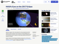
NASA's Eyes on the 2017 Eclipse
How did the 2017 eclipse look in Los Angeles—or Chicago? Experience both views, plus many more, using a lesson from PBS's Space series for middle schoolers. Scholars follow the movements of the sun, moon, and Earth during the most recent...
Curated OER
On the Road Again
Students trace the migration route of a gray whale. They color and label a map of North America, and using photocopy pictures of a gray whale, they move the whale along the migration route over a ten week period.
Curated OER
World Map and Globe
Students locate and identify continents and countries. For this world map lesson, students locate and identify one country on each continent.


