Curated OER
Seasonal Cloud Cover Variations
Students recognize different cloud types. They determine the seaonality of various types of clouds. They graph the data and determine if a correlation exists between season, cloud cover and type of clouds most prevalent during each season.
Curated OER
Thanksgiving Feast (Read the Charts)
Learners practice reading charts about foods country of origin. They interpret information and answer questions related to charts. They discover how food production adds to the economy.
Curated OER
Soneka's Village
Students read a letter about the characteristics of the Maasai culture. After identifying them, they discuss how to live a pastoralist way of life. In groups, they discuss the roles of men and women in the country and what it might be...
Curated OER
Geological Forces and Topography
Students discuss and research the Earth's geological processes. In this geology activity, students study maps of Utah and the United States to learn about geological features. Students then complete the research cards for each area of...
Curated OER
Technology Rich Native American Unit
Student groups retell stories from Iroquois storytellers. They role-play Iroquois women, men and children and explain their roles. They read "Knots on a Counting Rope" and make up their own stories. They create timelines. They visit a...
Curated OER
Reading Trees: Understanding Dendrochronology
Students examine tree-ring dating and discuss the lack of water the settlers in Jamestown faced. They create paper tree rings, simulate rain patterns, and describe the history of construction paper tree sequences.
Curated OER
Does Humidity Affect Cloud Formation?
Middle schoolers use NASA's S'COOL database to identify factors that affect cloud formation.
Curated OER
Using Charts and Graphs to Study East Asia's Modern Economy
Students examine East Asia's modern economy. In groups, classmates use the internet to compare the resources, products, and economy of specified countries. After collecting the data, pupils create charts, tables and graphs. They...
Curated OER
Map Skills: Explorers, Continents, and Oceans
Third graders use a software program to make and label a map of the world. On the map, they locate the seven continents, oceans and the countries of Europe. They also draw the routes of Christopher Columbus, Juan Ponce de Leon and...
Curated OER
Athabaskan Migration & Bering Strait
Students examine the various migration patterns of the Athabaskan. In groups, they discuss the Bering Strait Land Bridge theory of migration and take notes on a lecture from their teacher. To end the lesson, they brainstorm the...
Curated OER
Athabaskan Migration & Bering Strait
Students study Athabaskan migration patterns and the Bering Strait Land Bridge theory. They investigate the importance of the expansion of trade and compare the differences between American Indian oral tradition accounts of origin and...
Curated OER
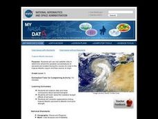
Troical Atlantic Aerosols
Learners explore the effect aerosols have upon he weather and climate. They observe NASA satellite images to explore and draw conclusions about aerosol transport. From studying the images, students track the path of aerosols. They...
Curated OER
Trouble in the Troposphere
Students Use data sets from MY NASA DATA to produce graphs comparing monthly and yearly ozone averages of several U.S. cities. They analyze and evaluate the data and predict trends based on the data. In addition, they discuss and...
Curated OER
People of the Desert
Students study the importance of caring for desert water sources. For this desert lesson, students investigate water resources that are available in deserts. They listen to a read aloud about the Sonoran Desert before working in groups...
Curated OER
George Washington and the Beginnings of the French and Indian War
Students read about the causes of the French and Indian War. For this French and Indian war lesson plan, students read about the physical and human problems that lead to the war. They also learn about George Washington's role in the war.
Curated OER
Painting a Neighborhood
Students explore the concept of neighborhoods and identify primary and secondary colors. In this colors and community lesson, students read the book Harold and the Purple Crayon and then discuss the concept of a neighborhood. Students...
Curated OER
Trout In The Classroom
Learners have trout in their classroom and complete journaling, checklists, temperature checking, and ammonia level recording. In this trout lesson plan, take weekly observation records of their trout.
Curated OER
States of Fitness
Learners participate in physical activities coordinating to divisions on a map.
Curated OER
Religious Freedom and Persecution throughout the World
High schoolers discuss the role of religion throughout the world. Using documents from the United Nations, they read through Article 18 and describe it in detail. In groups, they identify religions based on how much freedom or...
Curated OER
Earthquake Introduction
Students investigate basic principles and properties of earthquakes, including vocabulary, causes, and types of faults. They examine history of seismic activity in their home state, and complete "Locating Patterns of Distribution" lab.
Curated OER
Science: Trouble in the Troposphere
Students research a NASA Website and record information about an assigned city's tropospheric ozone residual monthly climate. In groups, they graph the information for the past year. They form new groups and compare their city's...
Curated OER
Start with a Chart
Young scholars use a given chart and the 50 state quarters to synthesize information about the 50 states and the dates that they were admitted into the union. Students complete a math worksheet while referring to the chart.
Curated OER
The English Settle America
Sixth graders compare immigration today with that of the colonial period. They locate colonies on a map and describe reasons their families immigrated to the United States.
