Curated OER
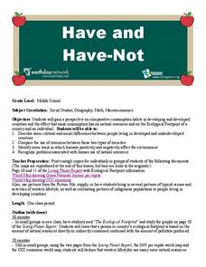
Environment: The Haves and the Have Nots
Students examine consumption habits in developed and developing countries and determine their effects on natural resources. In groups, they assess graphs on the Living Planet Report and observe the connection between consumption and...
Curated OER
Can You Give Me Directions To the Game?
Students become familiar with the use and capabilities of GIS and use it for research and mapping purposes. They heighten their ability to estimate travel times by incorporating distance, mode of travel and urban congestion into the...
Curated OER
Michigan's Lumbering history: Yesterday, Today, and Tomorrow
Fourth graders explore lumbering in Michigan. For this lumbering lesson, 4th graders examine the life of a modern day lumberjack and how technology can interfere with natural ecology. Students create a list of products from...
Curated OER
Making a Globe
Students examine the mercator projection or nautical chart and observe how global maps do not have the same distance as flat maps. They design handmade globes using the meridians and equator as guides to draw in the land. They paint and...
Curated OER
Land Bridge Theory
Fifth graders observe a map that includes where the land bridge was located and that its name was Beringia and look in the Social Studies books to read about the Land Bridge Theory. The class then brainstorms reasons why they think...
Curated OER
Introduction to the United States Map
Students identify the United States of America and it's states on a map. In this mapping lesson, students examine a globe and find the United States as well as a few land marks (Florida and the Great Lakes). Students then look at a...
Curated OER
Lessons from History
Students review key vocabulary in history and review a specific website. They write a paragraph summarizing an event they read about on this website. They analyze the importance of studying and learning from history.
University of Colorado
University of Colorado: Error, Accuracy, & Precision
A serious paper by serious geographers, discussing at full length the problems caused by error, inaccuracy, and imprecision in Geographical Information Systems. The definitive word in the real world.


