Arizona Cooperative Extension
Geocaching
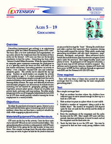
Using GPS units, small groups participate in a scavenger hunt to find an object that you have hidden. They use coordinates for stopping points along a pre-planned path to get to the final cache. This is a terrific activity to include in...
Curated OER
Can You Give Me Directions To the Game?
Learners become familiar with the use and capabilities of GIS and use it for research and mapping purposes. They heighten their ability to estimate travel times by incorporating distance, mode of travel and urban congestion into the...
Curated OER
Rivers And Capitals
Students become familiar with the use of GIS for research and become aware of the importance of rivers to cities. They also analyze the placement of cities and learn the names of rivers in the United States.
Curated OER
Indiana Tornado Project
High schoolers become familiar with the use of GIS for research, natural phenomena in Indiana, and analyzing collected information.
Curated OER
Absolute Location Using GPS Technology
GPS is great for identifying your position, but is it finding your relative or absolute location? Ninth graders explore the difference between absolute and relative location, use the standard grid system coordinate system, and use GPS to...
Curated OER
Got Park? Or if you build it, they will come!
Students use GIS and GPS technology to evaluate, research, locate, and recommend where a new park should be located that benefit the community.
Curated OER
GPS Treasure Hunt for Knowledge
Middle schoolers examine themselves as being part of a global community. For this global community lesson, students investigate GPS systems. Middle schoolers gain knowledge on how the device works. Students discover that satellites...
Curated OER
I Know Where You Are!
Learners study what a GPS is and use it to challenge themselves and find positions on a map. In this investigative lesson plan students find various points on a map using a GPS system and answer questions on a worksheet.
Curated OER
From Home to School, GPS Style
Students are introduced and increase proficiency in the use of the hand held GPS system. They explore the meaning of longitude and latitude lines, then identify the parts of the map.
Curated OER
"Where in the World is my School?"
Young scholars learn new vocabulary and discuss what GPS is and does. They locate their school using the equipment.
Curated OER
U.S. History: What Happened Here?
Students apply the global positioning system to create maps of local historical sites. By collaborating with local historical groups, they research events and relate them to broader, national history. In addition to writing essays...
Curated OER
Welcome to My World
Elementary schoolers discuss what a community is, and what their community has to offer them. They create posters, or flyers for the different businesses or places in their community to place around their school. After the students have...
Curated OER
How Can We Locate Specific Places On Earth?
Second graders discover how to use longitude and latitude to locate specific sites on Earth. They compare old and new ways of locating specific places, and discover how latitude and longitude coordinates are used to locate places on Earth.
Curated OER
Eagle Creek Park (A Hike)
Learners plot a hiking course using aerial photos and a topographic overlay and find the latitude and longitude of absolute locations. They measure the total distance of a hiked area and figure the area of the ground walked using Heron's...
Curated OER
Discovering the Past Using the Future: Remote Sensing and the Lost City of Ubar
High schoolers identify and locate specific locations on the Arabian Peninsula, the Rub al Khali Desert, and present day Oman. They identify other names for the lost city of Arabia as Ubar, the Atlantis of the Sands, Iran, and the city...
Curated OER
Discovering the Past Using the Future: Remote Sensing and the Lost City of Ubar
High schoolers use a video, maps, worksheets and Internet research to explore the role that sensing played in locating Ubar - the lost city of Arabia.


