Curated OER
Meet Geodesy-The Science Behind GPS
High schoolers discover how a datum of reference points are used to to describe a location. In this Earth Science lesson, students will simulate how a GPS accurately determines the location of reference points within a datum.
Curated OER
TE Lesson: GPS on the Move
Students participate in a scavenger hunt and a drawing activity to examine the use of Global Positioning Systems including a handheld GPS receiver for personal navigation. They practice using the GPS receivers while collecting data from...
Captain Planet Foundation
Frog Garden Party! Toads and Triangles in the Math Garden
It's frog party time! With frog banners, frog juice, and a triangle hunt, your garden party is sure to be both entertaining and educational. The lesson connects geometry, earth science, and delicious snacks to teach kids about ecosystems...
Curated OER
TE Lesson: Navigating at the Speed of Satellites
Students study the basic concepts of the Global Positioning System and how it increases the accuracy of navigation. They examine trilateration and how the speed of light is used to calculate distances.
Curated OER
The Grand Excursion GPS Map
Eighth graders investigate the uses of a global positioning system. They create waypoints and have to find them using the system. Students must review the geographical concepts of latitude and longitude. The media requirements of the...
Curated OER
GPS Art
Students design their own logo or picture and use a handheld GPS receiver to map it out. They write out a word or graphic on a field or playground, walk the path, and log GPS data. The results display their "art" on their GPS receiver...
Curated OER
M & M Addition
Eat your math manipulatives, are you serious? Yup, Learners listen to the story The M & M's Addition book, add single digit numbers to reach sums up to six, and demonstrate addition and subtraction number combinations using several...
Curated OER
GPS Scavenger Hunt
Middle schoolers go on a GPS scavenger hunt. They use GPS receivers to find designated waypoints and report back on what they found. They compute distances between waypoints based on the latitude and longitude, and compare with the...
Curated OER
Science Inquiry Lesson: Mapping Project
Students explore the methods of creating maps. They create a map of Animas River Park using a compass and measuring tape, develop a single map from the team map sections, and devise another map of the Animas River Park using a GPS unit.
Curated OER
Basic Mapping Skills
Establish and study the parts of a map with your class and, then they will work in small groups to create their own detailed map, including a legend. There are specific instructions to follow on what needs to be included.
Curated OER
GPS Treasure Hunt for Knowledge
Students examine themselves as being part of a global community. In this global community instructional activity, students investigate GPS systems. Students gain knowledge on how the device works. Students discover that satellites...
Curated OER
GPS Receiver Basics
Students practice using a GPS receiver. They walk in different directions and monitor their progress on maps. They enter specific locations and use information given to them to get them back to their original locations.
Curated OER
Math Manipulative: "Fraction Sticks"
Fifth graders use sets of fraction sticks to color in fractional amounts and determine how to compare pairs of fractions. In this math lesson, 5th graders insert the correct symbol given the fractions they are working with. Instructions...
Curated OER
Hide and Seek with Geocaching
Students locate objects using a Global Positioning System. For this global geography lesson, students explore latitude and longitude using a GPS in order to locate objects.
Curated OER
Fostering Geospatial Thinking: Space to Earth: Earth to Space (SEES)
High schoolers locate and access data to help them with their science inquiry. In this geographical positioning lesson students evaluate and compare data sets.
Curated OER
The Mathematical Dynamics of Celestial Navigation and Astronavigation
Students explore the different methods used in celestial Navigation and astronavigation. In this math lesson, students construct a sextant and demonstrate how it works.
Curated OER
Space Age Technology Comes to Earth
Students explore jobs related to agriculture. In this technology/agriculture instructional activity, students recognize the importance of natural resources and agriculture on the use of Range Rambler software. Students complete an...
Curated OER
This Building is Tall
Students calculate the perimeter of shapes. In this geometry lesson, students relate properties of polygons to the real world. They find length, midpoint and slope.
Curated OER
How Big Is The Playground?
Students calculate the standard and metric measurements of a playground. In this measurement instructional activity, students use GPS coordinates and graphing calculators to determine the dimensions of an area outside of the school in...
Curated OER
"Where in the World is my School?"
Students learn new vocabulary and discuss what GPS is and does. They locate their school using the equipment.
Curated OER
Pythagorean Theorem and Problem Solving
Pupils use the Pythagorean Theorem to solve problems. In this geometry instructional activity, students identify the properties of a right triangle. They find the missing side and angles of a right triangle.
Curated OER
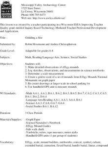
Gridding a Site
Students make observations of effigy mounds and record them in a notebook. In groups, they must determine the scale of measurement and create their own grid to scale part of the Effigy Mounds National Monument. They also practice using...
Curated OER
Finding our way
Tenth graders investigate the use of a GPS. In this math lesson, the students will use a GPS type system to determine positioning in two dimensions. They will complete questions out of a student workbook.
Curated OER
Where is Here?
Learners are shown the very basics of navigation. The concepts of relative and absolute location, latitude, longitude and cardinal directions are discussed, as well as the use and principles of a map and compass.

