Curated OER
Applications of GIS
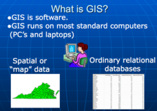
Don't be concerned that the title slide of this presentation mentions Virginia's Geospatial Extension Program; this slide show is very informative for any technology-focused curriculum when considering global information systems. It...
Curated OER
Can You Find Me Now?
Students locate points using longitude and latitude coordinates. They locate their home using longitude and latitude, explore the uses of GPS, and accurately use a GPS.
Curated OER
Drift Study
Students observe, work with charts, and work with GPS in order to determine the path lobster larvae travel based on local currents. In this currents lesson plan, students work with local fishermen to observe the natural currents.
Curated OER
TE Lesson: Navigating at the Speed of Satellites
Middle schoolers study the basic concepts of the Global Positioning System and how it increases the accuracy of navigation. They examine trilateration and how the speed of light is used to calculate distances.
Teach Engineering
Where Are the Plastics Near Me? (Field Trip)
With a piece of plastic here and a piece of plastic there, here a piece, there a piece, everywhere a piece. Teams go on a field trip in order to document the locations and kinds of plastic trash in an area near them. The eighth...
PBS
Inspector Detector
How do spacecraft detect magnetic fields? The fourth installment of a five-part unit has learners develop a device with magnets that allows for the detection of magnetic fields. They use a map of an imaginary planet to try out their...
Curated OER
Where in the World?
Learners explore how GPS works, the mathematics behind the technology, and how GPS is used. They find positions in one and two dimensions, and participate in a WebQuest that explores how math is used to find a location on Earth using GPS.
Curated OER
State Your Position
Middle schoolers practice using a global positioning system. They discuss the use of celestial objects as navigation points and its problems. They list the advantages and disadvantages of GPS as well.
Curated OER
Where is Here?
Students are shown the very basics of navigation. The concepts of relative and absolute location, latitude, longitude and cardinal directions are discussed, as well as the use and principles of a map and compass.
Curated OER
The Five Life Zone Research Project
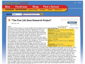
Students study five of the seven life zones in North America. In this journalism lesson students use the Scientific Method working in teams. They use lab equipment and technology to create a presentation on five of the seven life zones...
Curated OER
Compass Building Instructions
Learners build their own compass following a given procedure. In this technology lesson, students explain how a compass is used in navigation. They trace the history of its development.
University of Georgia
Freezing and Melting of Water
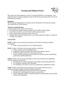
Examine the behavior of energy as water freezes and melts. An engaging activity provides a hands-on experience to learners. Collaborative groups collect data and analyze the graphs of the temperature of water as it freezes and then...
Curated OER
Fostering Geospatial Thinking: Space to Earth: Earth to Space (SEES)
Students locate and access data to help them with their science inquiry. In this geographical positioning lesson students evaluate and compare data sets.
Curated OER
Where Am I: Navigation and Satellites
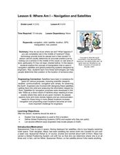
Students explore the concept of triangulation that is used in navigation satellites and global positioning systems designed by engineers. They determine ways these technologies can help people determine their position or the location of...
Curated OER
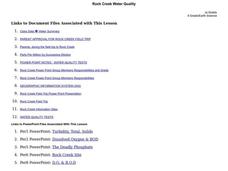
Rock Creek Water Quality
Ninth graders test water in a local creek using chemical kits and probes. They take GPS readings and digital photos. They calculate the Water Quality Index and create a spreadsheet of the test data.
Curated OER
Rocks in our Backyard
High schoolers examine igneous and sedimentary rocks. They observe and identify geological formations in their community, analyze igneous and sedimentary geological layers using a geological map, and use GPS to locate geological formations.
Curated OER
Rock Creek Water Quality
Ninth graders test water in a local creek using chemical kits and probes. They take GPS readings and digital photographs. They calculate the Water Quality Index and create a spreadsheet.
Curated OER
Creativity in Science
Students view a video segment and discuss the technology and preparation that go into a satellite launch. They identify data that satellites can provide and consider how many people are involved in a satellite launch.
Curated OER
Crimes on the Great Lakes
Students solve simulated crimes using real-time online information. They research data on items such as ship tracking through GPS, lake conditions, and weather systems. They also collect information about invasive plant and animal...
Curated OER
757 Glider Kit
Young scholars work together to complete a 757 Glider kit. They use a GPS to discover how it operates in all weather landings. They complete different obstacles with the glider as well.
Curated OER
Space Science:Wherever You Go, There You Are
Students explore navigation principles by observing, measuring, and interpreting data to determine locations. Using a compass, compass rose, and a transit, they plot courses and discover the workings of the Global Positioning System...
CK-12 Foundation
Location on the Earth: Longitude and Latitude
To what degree do learners understand coordinates? Get them some practice in Yosemite National Park in a simple, fun interactive. Pupils explore a map and locate coordinates of popular sights within the park, then answer questions to...
Curated OER
Find It!
Students analyze the basic concept of Global Positioning Systems using triangulation and measurement on a small scale in the classroom. They describe a satellite and how it helps in locating a person on Earth. They explain how...
Curated OER
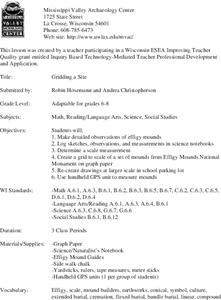
Gridding a Site
Students make observations of effigy mounds and record them in a notebook. In groups, they must determine the scale of measurement and create their own grid to scale part of the Effigy Mounds National Monument. They also practice using...


