Curated OER
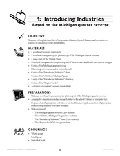
Introducing Industries
If you are looking for a way to explore Michigan's resources, physical features, and more, this lesson is for you. After discussing Michigan and the Great Lakes, learners fill out a graphic organizer identifying the state's natural...
Curated OER
Familiar Great Lakes Plants Word Search
In this word search worksheet, students locate the names of familiar plants that are found in the Great Lakes region. They use the pictures and labels which are shown on the page to locate the 17 names in the puzzle.
Curated OER
Great Lakes Wildlife Word Search
In this word search worksheet, students locate the names of a variety of wildlife that is found in the Great Lakes region. They use 18 pictures and their labels to find the names in the puzzle.
Curated OER
Michigan Food: From Farm to You
Students recognize Michigan on a map and understand how its climate is affected by the Great Lakes. In this Michigan food lesson, students play a trivia game to identify the produce of Michigan. Students relate the climate in each part...
Curated OER
North Carolina Salt Dough Map Social Studies Project
In this lesson, North Carolina Salt Dough Map, 4th graders create a salt dough map of North Carolina, Students use dough to form the shape of the state of North Carolina. Students label the three regions of North Carolina and all of...
Curated OER
What Do Maps Show?
This teaching packet is for grades five through eight, and it is organized around geographic themes: location, place, relationships, movement, and regions. There are four full lessons that are complete with posters, weblinks, and...
Curated OER
The Geography of the United States
Full of bright maps and interesting information, this presentation details U.S. Geography. Slides include basic facts about size, regions, topography, and demographics, as well as fascinating trivia about the United States, including...
Curated OER
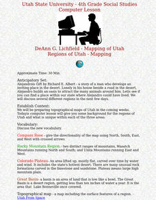
Regions of Utah - Mapping
Fourth graders draw a rudimentary map of the state of Utah, dividing it into the three regions: the Great Basin, the Colorado Plateau, and the Rocky Mountain Region.
Curated OER
Dead Sea Investigation: Middle East and African Connections
Students demonstrate comprehension of the physical characteristics of the Dead Sea region and its connection to the Red Sea and the African Great Rift Valley. They are given students the opportunity to understand the role of plate...
Scholastic
Perfect Postcards: Illinois
Connect the geography and history of Illinois using an art-centered activity on the railroads. The railroad connected once-distant places, particularly in the Midwest. Using research, class members create postcards of fictional...
K12 Reader
United States Geography
Encourage reading for information with a text about United States geography. Kids read a short passage about the landforms in the United States, including mountain ranges and natural resources, and answer five reading comprehension...
Curated OER
US Geography: The Midwest
Students investigate the geography and agricultural products of the Midwestern United States. In this US geography lesson, students watch and discuss a video that depicts the Midwest of the US as the breadbasket of the country. They make...
Curated OER
Landforms and Resources of the United States and Canada
For this North American geography worksheet, learners read about the physical features and resources of the United States and Canada. Students take notes and answer 3 short answer comprehension questions as they read the selection.
Curated OER
Geography of the United States
Students examine the population growth of the United States. In this Geography lesson, students construct a map of the fifty states. Students create a graph of the population of the USA.
Curated OER
Oklahoma
In this geography worksheet, students read a 2 page selection detailing the location, history and early statehood of Oklahoma. They answer 10 true or false questions based on the reading.
Curated OER
Utah Weather
Fourth graders diagram the weather in Utah through the use of a glyph. In this Utah weather instructional activity, 4th graders create weather glyphs of different areas in the state. Students answer questions about the weather and then...


