TeachEngineering
Teach Engineering: Nidy Gridy
Normally we find things using landmark navigation. When you move to a new place, it may take you awhile to explore the new streets and buildings, but eventually you recognize enough landmarks and remember where they are in relation to...
BBC
Bbc News: 'Big Bang' Experiment Starts Well
Watch a narrated animation on the Large Hadron Collider, its experiments, structure, and computer system. Then, browse this site's sections to explore facts about and functions of CMS, ATLAS, ALICE, LHCb, the LHC Computing Grid, and the...
BBC
Bbc: Bitesize Geography: Os Map Skills
A short tutorial on mapping tools and how to read maps. Covers features of maps, symbols, the compass, scale, distance, how height is represented, and grid references. Includes multiple-choice quiz at the end.
George Mason University
Chnm: Critical Infrastructure Protection Oral History Project
Project documents the history of the nation's efforts to protect what has come to be called critical infrastructure--the systems and structures that are vital to the smooth and safe functioning of our economy, society, and way of life.
PBS
Pbs Learning Media: Traffic Jam
This lesson challenges young scholars to solve congestion and traffic delays in an intersection through modifying traffic signal operation. Students are required to collect traffic data, optimize the timing of a traffic signal via the...
The Washington Post
Washington Post: Chuck Close
Follow the evolution and creative process of the monumental work done by artist Chuck Close.
Khan Academy
Khan Academy: Coordinate Plane Word Problems (Quadrant 1 Challenging)
Try some coordinate plane word problems focusing on quadrant 1. Miss the problem, and Kahn offers some tutorials for help.
Mathematics for Teaching
Mathematics for Teaching: Teaching Mathematics With Geo Gebra
Students complete activities using GeoGebra to explore geometry concepts such as the coordinates of points.
TeacherLED
Teacher Led Interactive Whiteboard Resource Two Quadrant Graph
Use this interactive white board activity to explore coordinate planes and graphing ordered pairs.
Khan Academy
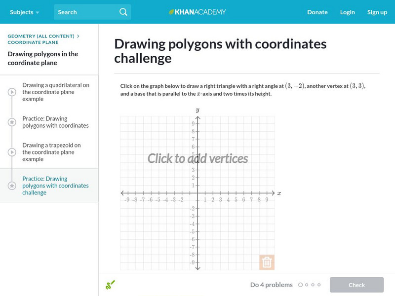
Khan Academy: Drawing Polygons With Coordinates
In this exercise, students practice drawing polygons with coordinates. Students receive immediate feedback and have the opportunity to get hints and try questions repeatedly.
Khan Academy
Khan Academy: Drawing Polygons With Coordinates 2
In this exercise, students practice drawing polygons with coordinates. Students receive immediate feedback and have the opportunity to get hints and try questions repeatedly.
Khan Academy
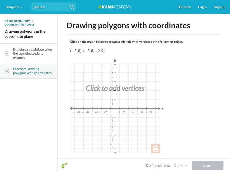
Khan Academy: Drawing Polygons With Coordinates
Practice drawing shapes on the coordinate plane. Students receive immediate feedback and have the opportunity to try questions repeatedly, watch a video or receive hints.
Khan Academy
Khan Academy: Area and Perimeter on the Coordinate Plane
Find the area and perimeter of quadrilaterals using their coordinates. Students receive immediate feedback and have the opportunity to try questions repeatedly, watch a video or receive hints.
ClassFlow
Class Flow: Slope
[Free Registration/Login Required] This lesson provides class experiences with whole group instruction on understanding slope.
ClassFlow
Class Flow: Slope Review
[Free Registration/Login Required] This flipchart provides another day of review of finding the slope of a line.
ClassFlow
Class Flow: Graphing Coordinates
[Free Registration/Login Required] In this lesson, students will learn step by step how to graph coordinates on a coordinate plane.
NOAA
Noaa: Be a Shipwreck Detective [Pdf]
Use your skills of investigation to examine a list of items recovered from a shipwreck. Draw conclusions about the ship and its demise based off of your observations.
Curated OER
Educational Technology Clearinghouse: Maps Etc: Southern California, 1911
A map of Southern California from 1911 showing the major cities and towns, railroads, National Park boundaries, National Forest boundaries, Indian reservation boundaries, mountain systems, lakes, rivers, and coastal features. A grid...
Curated OER
Educational Technology Clearinghouse: Maps Etc: California (Southern), 1920
A map of Southern California from 1920 showing the counties and county seats, major cities and towns, railroads, National Park boundaries, National Forest boundaries, Indian reservation boundaries, mountain systems, lakes, rivers, and...
Curated OER
Etc: Maps Etc: Northern and Central California, 1911
A map of Northern and Central California from 1911 showing the State capital of Sacramento, counties and county seats, major cities and towns, railroads, National Park boundaries, National Forest boundaries, Indian reservation...
Curated OER
Etc: Maps Etc: California (Northern and Central), 1920
A map of Northern and Central California from 1920 showing the State capital of Sacramento, counties and county seats, major cities and towns, railroads, National Park boundaries, National Forest boundaries, Indian reservation...
Curated OER
Educational Technology Clearinghouse: Maps Etc: China, 1920
A map from 1920 of China and the Empire of Japan at the time. The map shows political boundaries and foreign possessions, capitals, provincial capitals, major cities, treaty ports, existing and proposed railroads, canals, submarine...
Curated OER
Educational Technology Clearinghouse: Maps Etc: Colorado, 1911
A map from 1911 of Colorado showing the State capital of Denver, counties and county seats, major cities and towns, railroads, the Rockies and other mountain systems, lakes, and rivers. A grid reference in the margins of the map lists...
Curated OER
Educational Technology Clearinghouse: Maps Etc: Colorado, 1920
A map from 1920 of Colorado showing the State capital of Denver, counties and county seats, major cities and towns, railroads, the Rockies and other mountain systems, lakes, and rivers. A grid reference in the margins of the map lists...
Other popular searches
- Global Grid System
- Grid System Drawing
- Mapping Grid System
- Grid System Art
- Drawing With a Grid System
- Texas Grid System
- Grid System Worksheets
- Map Features Grid Systems
- Map Features "Grid Systems
- Map Features "Grid Systems"
- Alphanumeric Grid Systems


