Curated OER
Exploring Alaska's Seamounts - Volcanoes, Plates, and Chains
Students examine the formation of seamounts in the Gulf of Alaska. In this seamount lesson plan, student focus on how the Axial-Cobb-Eikelberg-Patton chain was formed. They learn the associated vocabulary, and watch a teacher...
Curated OER
Cartoons for the Classroom: Oil Spill Perspectives
With the BP oil spill still fresh on your scholars' minds, take the opportunity to analyze various perspectives on it through political cartoons. This critical-analysis handout features 2 cartoons on the incident. Background information...
Curated OER
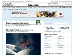
The Gulf Oil Spill in the Classroom
Students explore the concept of environmental stewardship. In this interdisciplinary activity, students investigate the media response to the Gulf oil spill as they examine live streaming video, interpret data, and share their personal...
Curated OER
An Oil Spill Primer for Students
In this Gulf oil spill worksheet, students examine a 4-page article regarding basic facts about the oil spill as well as photographs of clean-up efforts.
Curated OER
Mapping the United States
In this map of the United States worksheet, students label mountains, surrounding countries, oceans, and more. Students complete 12 tasks.
Curated OER
Cartoons for the Classroom: Oil Spill Perspectives
In this current events activity, students analyze a political cartoon about the BP oil spill and respond to 3 talking point questions.
Curated OER
Coral Reef Geography
In this coral reef geography worksheet, students find locations of reefs on a globe or map. There are 10 instructions to follow. There is no map provided--an atlas, globe or map is needed.
Curated OER
State to State Scavenger Hunt
In this states activity, students utilize the Internet to access one specific website to locate the answers to five fill in the blank statements about the states found on a United States map.
Curated OER
The Atlas Alphabet
In this atlas alphabet worksheet, students write the answer to the clue about things found in an atlas that start with each letter of the alphabet. Students write 26 answers.
Curated OER
Traveling Through North America
Students identify places and landmarks in North America, specifically Canada and the United States, by using and constructing maps. Six lessons on one page; includes test.
Curated OER
Lesson Plan on Migration
Fourth graders diagram written and oral directions of a Native American, European Viking, Right Whale or Humpback Whale migration route, the student diagram all directions only in the sequence given, with arrows indicating direction of...
Curated OER
The Expansion of The United States, 1846-1848
Students interpret historical maps,identify territories acquired by the United States in the 1840s. Also they identify states later formed from these territories. The primary sources for the lesson are the maps found in the lesson's...


