Curated OER
Hemispheres & Continents
Students learn in cooperative learning groups to determine how the equator and the Prime Meridian divide the earth into hemispheres and use Venn diagrams. Students will locate and label the hemispheres, continents, and oceans.
Curated OER
Rolling Around the Continents
Students practice throwing skills by rolling a ball at a target, and practice the location of the seven continents, the equator, and the northern and southern hemispheres.
Curated OER
Name That Continent
Learners practice locating the seven continents, four hemispheres, and four oceans using a large world map and a review song. They also import a world map to the Kid Pix computer program then type in proper labels on the map. There are...
Curated OER
G'Day Mate
Students understand that Australia is the smallest continent, locate it on a map and sing about the continents. In this Australia lesson, students listen to facts about Australia and complete a book about information they have learned.
Devine Educational Consultancy Services
Geography Student Workbook, Australia
Your youngsters will be experts on the geography of Australia after working with these activities and worksheets, which review the continent's weather, major landforms, dimensions, history, and climate.
Curated OER
Southern Hemisphere Map
In this Southern Hemisphere polar projection map worksheet, students examine this region of the world. The continents shown are labeled.
Curated OER
Northern Hemisphere Map
In this Northern Hemisphere polar projection map worksheet, students examine this region of the world. The continents shown are labeled.
Curated OER
Exploring the Continents Through the Arts
Students examine the continents and explore geographic components in the fifteen lessons of this unit. The location of the continents, the equator, the four major oceans, and the music, food, literature, dance, and drama from each of the...
Curated OER
Geography: Continents
First graders identify basic geographical facts about the world they live in and distinguish between land and water on a globe. They research the continents and information associated with each one focusing on building their map skills.
Curated OER
Leapin' Landmarks: Locating 10 Man-made Landmarks Around the World
Third graders label continents, oceans, and major mountain ranges on maps and use the maps to write an informational report about landmarks. In this landmarks lesson plan, 3rd graders write about 1 major landmark.
Curated OER
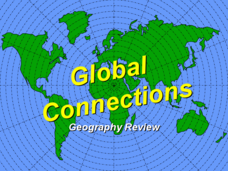
Global Connections Geography Review
In this beginning world geography PowerPoint, students answer basic questions about continents and oceans, as well as land and water that surround or can be found in the United States. Correct responses earn a mark on the interactive...
Curated OER
Western Hemisphere
Fourth graders use a database to compare countries in the western hemisphere. They describe a variety of regions in Texas and the Western Hemisphere such as political, population, and economic regions that result from patterns of human...
Curated OER
Where in the World? Oceans & Continents
In this geography worksheet, students answer 6 questions using a coded map as a reference, then students identify labeled geographic features.
Curated OER
Where In the World Am I?
Learners identify their location in the world after studying latitude, longitude, relative location, and absolute location. They use assigned web site to find information to make a flipbook that answers questions about their location in...
Curated OER
Maps and Globes: Where in the World are We?
Students explore maps and globes. In this introduction to map and globe concepts lesson, students identify features of physical maps, political maps, and globes. Students locate land and water, and recite a poem about the names of the...
Institute for Geophysics
Understanding Maps of Earth
Here is your go-to student resource on primary geography concepts, including facts about the surface of the earth and its hemispheres, latitude and longitude, globes, types of maps, and identifying continents and oceans.
NASA
Outline Maps
Don't miss this gold mine of blank maps for your next geography lesson! Regions include traditional continents such as Asia, Europe, and Africa, as well as other major world areas such as the Pacific Rim and the Middle East.
Curated OER
Making a Globe
Students examine the mercator projection or nautical chart and observe how global maps do not have the same distance as flat maps. They design handmade globes using the meridians and equator as guides to draw in the land. They paint and...
Curated OER
A Book Is A Window To the World
Second graders listen to pieces of literature that take place in different regions of the world. Using a map, they identify and locate the continents and oceans mentioned in the story. They describe the physical and human characteristics...
Curated OER
We've got the whole world in our hands
Students explore spatial sense in regards to maps about the globe. In this maps lesson plan, students label oceans, locate the continents and poles, follow directions, and explain the symbols on a map.
Curated OER
Early Explorers
Fifth graders investigate the routes taken by the early explorers. In this explorers lesson, 5th graders use interactive notebooks, discussion and maps to discover the routes taken. Students get into pairs and label maps, and create...
Curated OER
Learning European Geography
Sixth graders discover locations and countries in Europe by identifying them on a map. In this European geography lesson plan, 6th graders read the book The Lost Little Elephant, with their class and discuss the geography referenced in...
BrainPOP
Latitude and Longitude Differentiated Lesson Plan
Scholars warm-up their map skills with a discussion using location words to describe familiar places. An engaging video informs class members about latitude and longitude. Three leveled activities extend the learning experience for...
Curated OER
Rapping Regions in America
Students determine what designates a place as a region. They apply their criteria for a region to the US map. They work in groups to write a rap about their region that describes its organization, type and structure.


