Curated OER
Mapping Your Identity: A Back-To-School Ice Breaker
Identify the unique personal attributes of your class members. Begin by viewing the Visual Thesaurus and discussing displayed attributes associated with famous American leaders. Using these identity maps as models, pupils generate nouns...
Curated OER
Europe Maps
A series of maps depicts pre-WWI to post-WWII Europe for your geographers. They use reference materials to help them correctly fill in the countries and the borders as they changed through time. A great resource for a history lesson, or...
Curated OER
Eastern European Studies
One worksheet, three projects. Learners explore Eastern Europe and mark Eastern European countries on a map. They then collect and record census data on thirteen different countries, and write a 3-5 page expository essay on one of the...
Curated OER
Everyday Documents
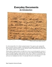
Almost more of a lesson than a worksheet, this particular resource has learners examine different types of historical documents. There is a historical docment embedded in the worksheet that learners study, and they also bring in...
Curated OER
Lewis and Clark
Students investigate Lewis and Clark. In this Lewis and Clark lesson, students search the Internet for information about Lewis and Clark and the Corps of Discovery. Students use maps to understand the explorations and decide which...
Curated OER
Connecting Cartography to Society
Older high schoolers use maps to study changes in society like migration, population loss, and economic shifts, and then connect events from historical events to present day mapping of their region (The resource focuses on Canada, but...
Curated OER
Play Doh Map of Your State
Students create a state map using Playdoh. In this hands-on state geography lesson, students work in groups to form a three-dimensional map of their state using Playdoh made at home following a (given) recipe. Students use four colors...
Mary Pope Osborne, Classroom Adventures Program
The Backpack Travel Journals
Strap on those backpacks, it's time to travel through history with this literature unit based on the first four books of The Magic Tree House series. While reading through these fun stories, children create story maps, record interesting...
Curated OER
Wagons West!
The first pioneers faced many obstacles on their journey west. Middle schoolers read different historical fiction texts (ideas are provided), make connections, and complete a detailed packet (included). Reading guides, journal ideas, and...
Curated OER
Project Organizer: Follow an Explorer
This is both a great idea and a great way to help your class organize a themed project. They use these worksheets to assist them in writing a creative historical narrative about the life and travels of an explorer. They'll compare and...
Curated OER
Understanding "The Stans"
Students explore and locate "The Stans" in Central Asia to create, write and illustrate maps, graphs and charts to organize geographic information. They analyze the historical and physical characteristics of Central Asia via graphic...
Curated OER
Local History: Mapping My Spot
Students explore maps to discover historical information about their local area. In this mapping and history lesson, students use panoramic maps of their own town/city to interpret historical information. Students also place themselves...
Curated OER
Westward Expansion : Mapping
Fifth graders travel along exploring the expeditions of John F. Fremont. In this Westward expansion lesson, 5th graders gain understanding of the events that shaped the west through the use of maps. Students use mapping skills to...
Curated OER
Paint My Counties: Map Coloring the Counties of Arizona
Fourth graders identify the counties of Arizona. For this social studies lesson, 4th graders color a county map of Arizona using the fewest number of colors possible. Students write a persuasive paragraph.
Polk County Public Schools
The French and Indian War
Sharpen those pencils and get to writing with a series of document-based questions about the French and Indian War. High schoolers focus on maps, letters, and other primary documents from the 18th century before answering writing prompts...
Curated OER
Arkansas Geography/History Relief Map
Sixth graders research a number of sources including the Internet to find information about the regions of Arkansas while locating sites of national historic interest. They located sites on maps while working at assigned websites. They...
Curated OER
Kid Maps: Reading and Creating Maps with Human Characteristics
Students look at maps. For this map lesson, students listen to the book My Map Book by Sara Fanelli and they see the difference between human characteristics (buildings, etc.) and natural characteristics (rivers, etc.). They create...
Curated OER
Red Dirt Groundbreakers
Discover Oklahoma's first farmers. Read about 14 different agriculture workers and their contribution to Oklahoma's farming. After reading, have your class complete several activities such as researching an agriculturist, writing a...
Curated OER
Robbing the 'Hood?
Students investigate historical figures and how they play a role in tourism by reading and discussing the article "When Robin Hood Supped, Was it Yorkshire Pudding?" In groups, students investigate issues related in the article in...
Curated OER
Pioneer Values in Willa Cather's My Antonia
Included in this resource are a variety of activities to do while reading Willa Cather's My Antonia. The activities, which range from mapping out Nebraska to writing activities about pioneer living, are all designed with one guiding...
Curated OER
Historical Figures
Second graders identify a historical figure, his or her societal contributions and basic biography using a Kidspiration graphic organizer and library resources. They use the Internet to conduct an historical treasure hunt in groups.
Curated OER
Historical Heroes and Character Sketches
Learners write a character sketch and present it in first person. In this historical heroes and character sketches activity, students "meet" Harriet Tubman (played by their teacher) and discuss her contributions. Learners read examples...
Curated OER
Mapping the West
Young scholars determine how Americans' perception of the geographical features of the West changed following the Lewis and Clark expedition. They analyze historical maps of the West.
Curated OER
The Water Nearby
Learners explore water located near where they live. In this map skills maritime lesson, students use Google Maps to find their school and the body of water closest to them. Learners research the body of water and answer questions about it.
Other popular searches
- Historical Maps Explorers
- Historical Maps Wwi
- Historical Maps Trade Routes
- Historical Maps Rome
- Historical Maps Mesopotamia
- Historical Maps Pirate
- Comparing Historical Maps
- Carthage Historical Maps
- Historical Maps Imperialism
- Historical Maps Inauguration
- Historical Maps Ussr
- Historical Maps" Ptolemy


