Curated OER
Europe Maps
A series of maps depicts pre-WWI to post-WWII Europe for your geographers. They use reference materials to help them correctly fill in the countries and the borders as they changed through time. A great resource for a history lesson, or...
Curated OER
Eastern European Studies
One worksheet, three projects. Learners explore Eastern Europe and mark Eastern European countries on a map. They then collect and record census data on thirteen different countries, and write a 3-5 page expository essay on one of the...
Curated OER
Everyday Documents
Almost more of a lesson than a worksheet, this particular resource has learners examine different types of historical documents. There is a historical docment embedded in the worksheet that learners study, and they also bring in...
Curated OER
Trails West: Westward Expansion Maps
In this United States historical map worksheet, students examine the trails that settlers of the Western United States took during the period of Western Expansion. Major cities on the routes are labeled.
Curated OER
Colonial America 1776 Map
In this United States historical map worksheet, students examine the colonial boundaries in 1776 as well as the Proclamation Line of 1763.
Curated OER
The 13 British Colonies Map
In this United States historical map learning exercise, students examine the 13 colonial boundaries and noted major cities.
Curated OER
Trails West Map
In this United States historical map worksheet, students examine the trails that settlers of the Western United States took during the period of Western Expansion.
Mathematics Assessment Project
Historic Bicycle
"Ordinary" bicycles are not so ordinary. Learners use given information to determine the circumference of wheels for a historic Ordinary or Penny Farthing bicycle. Pupils then determine the number of times each wheel turns when the...
Curated OER
Project Organizer: Follow an Explorer
This is both a great idea and a great way to help your class organize a themed project. They use these worksheets to assist them in writing a creative historical narrative about the life and travels of an explorer. They'll compare and...
Curated OER
United States of America: 1860
In this United States historical map worksheet, students examine the boundaries of the states and territories of the nation in 1860. This map is unlabeled.
Curated OER
United States of America: 1860
In this United States historical map worksheet, students examine the boundaries of the labeled states and territories of the nation in 1860.
Curated OER
Lewis & Clark Map
In this Lewis and Clark expedition map instructional activity, students examine the route of the expedition and the separate return routes of both Lewis and Clark.
Polk County Public Schools
The French and Indian War
Sharpen those pencils and get to writing with a series of document-based questions about the French and Indian War. High schoolers focus on maps, letters, and other primary documents from the 18th century before answering writing prompts...
Curated OER
Historical Map - United States: The Changing Frontier
In these United States frontier worksheets, students study the map of the United States frontier for various sections of time in the history of the United States. Students then finish a crossword puzzle using the various parts of the...
Curated OER
Worksheet for Analysis of a Map
For this primary source analysis worksheet, students respond to 6 short answer questions that require them to analyze the maps of their choice.
Curated OER
How to Interpret a Map
In this social studies activity, students find all the important facts on a map. Students find any map and fill out the chart and answer 12 questions about what they find.
Curated OER
The Spread of Printing
Document the spread of printing, which occurred in the 1500s. Use the provided list of water ways, countries, and cities to label specified locations on the map.
Curated OER
United States 1860
In this United States historical map worksheet, students examine the state and territorial boundaries as well as the large cities of the nation in 1860.
Curated OER
The 13 British Colonies
In this British colonies historical map activity, students examine the political boundaries of the 13 original colonies.
Curated OER
The Louisiana Purchase
In this historical map worksheet, students analyze a map of the Louisiana Purchase. Students answer 4 multiple choice questions about the map.
Curated OER
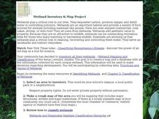
Wetland Inventory and Map Project
In this wetlands inventory and map project worksheet, students do research on the wetlands and complete a map project about it. Students follow 6 sets of directions with Internet links.
Curated OER
Tree Inventory and Map Project
In this tree inventory and map project worksheet, students follow the directions on how to take inventories of trees and create a map from it. Students follow 4 sets of directions.
Curated OER
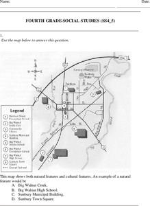
Fourth Grade Social Studies
In this social studies worksheet, 4th graders answer multiple choice questions on state maps, city maps, road maps, political maps, and more. Students complete 25 multiple choice questions.
It's About Time
Where are the Volcanoes?
Middle school geologists map the volcanoes closest to themselves, learn about map distortion, and infer possible future volcano locations. A focus on latitude, longitude, and volcanoes beneath the ocean helps connect the lesson.
Other popular searches
- Historical Maps Explorers
- Historical Maps Wwi
- Historical Maps Trade Routes
- Historical Maps Rome
- Historical Maps Mesopotamia
- Historical Maps Pirate
- Comparing Historical Maps
- Carthage Historical Maps
- Historical Maps Imperialism
- Historical Maps Inauguration
- Historical Maps Ussr
- Historical Maps" Ptolemy


