Curated OER
What Do We Learn From the Repartiation of Alaska Native Artifacts?
Students observe and evaluate evidence of Alaska Native cultural symbols and artifacts. They research historical data from a variety of primary resources, including the Harriman expedition journals, related web sites, oral accounts,...
Curated OER
Renaissance: Rebirth to Revolution
Sixth graders use a variety of resources to research the Middle Ages and Renaissance over a nine-week period. Working in cooperative teams, they become experts on specific topics. Students hold a Renaissance Faire and role-play as...
Curated OER
U.S. Post Office Mural Walking Tour
Students discover a sense of community by examining Post Office murals located in cities and small towns throughout the United States. They explore the significance of the murals by contacting and communicating with local Postmasters....
Curated OER
The Díne (Navajo) Native American Tribe
Students participate in a variety of activities to become familiar with the Navajo Indians. In this Díne (Navajo) Native American tribe lesson, students understand where the Navajo tribe lived and find them on a map. Students discuss the...
Curated OER
Foods and Languages of the World
Students study world cultures with an emphasis on languages and cultures. For this world cultures lesson, students study the countries of Spain, China, Italy, and the United States. Students read the story Everybody Cooks Rice and move...
Curated OER
The Iditarod: The Last Great Race
Students investigate the Iditarod. In this last great race lesson, students explore and research the Iditarod race which takes place in Alaska. Students explore a variety of websites and images to gather background information. A...
Curated OER
America's Heartland
Fifth graders investigate imports and exports to discover its importance to America as a world power. In this Imports and exports lesson, 5th graders discuss how climate and natural resources aid a country in becoming a world...
Curated OER
Activity on United States Moon Landing: Apollo 11
High schoolers use the World Wide Web to access additional information needed to complete a set of questions. They demonstrate an understanding of latitude and longitude by interpreting a lunar map.
Curated OER
Simple Thermodynamics of Transportation
Students watch videos about various modes of transportation, they examine the energy transformations that occur in each, and they be introduced to the laws of thermodynamics.
Curated OER
A New Red Menace?
Students research and analyze the current political situation of North Korea. They read and discuss an article, conduct research, participate in a simulation of an international round table, and write a response essay.
PBS
Predicting/Making a Hypothesis
Students analyze information from a variety of sources in order to create a hypothesis about the origin of an interesting family artifact.They create alternative hypotheses based upon available information to demonstrate that some...
Curated OER
The Sound of Music in Kenya
Students study Kenya's culture and see how people and things can be different and similar at the same time. They create a pictograph of objects from each culture that are used in similar ways and examine a few Swahili words.
Curated OER
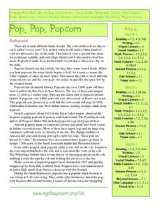
Pop Around the World
Students study the origin of popcorn. They locate countries where it is grown on a world map. They color the world map and glue kernels of popcorn onto the countries from which popcorn originated. They write the names of common items...
Curated OER
Can We Be Both Conservationists and Consumers?
High schoolers explore their role as consumers and conservationists and what roles they play in today's economic climate. They explore resource allocation issues. Students analyze data and draw comparisons between historical and...
Curated OER
How Has Transportation Changed Since the 1899 Harriman Alaska Expedition?
Students recognize modes of transportation. They research historical data from a variety of primary and secondary sources including the Harriman expedition journals, related web sites, and photographs from the expedition. Students...
Curated OER
Creating the "Perfect" Horse
Students examine the relationship between a horse and its rider. In this behavior and interactions lesson students research the Internet to learn about horse behavior and biology then write a paper and present it to the class.
Curated OER
Navigation
Students explain that globes are the best way to show positions of places, but flat maps are portable and can show great detail. They make a mercator projection of the route Lewis and Clark took on their journey.
Curated OER
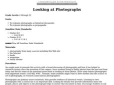
Looking at Photographs
Students evaluate photographs as historical documents and photographs as propaganda.
Curated OER
Play Doh Map of Your State
Young scholars create a state map using Playdoh. In this hands-on state geography lesson, students work in groups to form a three-dimensional map of their state using Playdoh made at home following a (given) recipe. Young scholars...
Council for Economic Education
Cost/Benefit Analysis: Three Gorges Dam
Middle schoolers, in groups, take various roles in evaluating the costs/benefits of the Three Gorges Dam project on the Yangtze River in China.
Curated OER
Geographic Luck
Learners examine why some countries are rich while others remain poor. They view a video on the website, Guns, Germs and Steel, analyze primary sources to conduct research about plants and animals, and create a game based on their research.
Curated OER
Transportation Museum
Young scholars develop and organize their own transportation museum in the classroom. They brainstorm a list of vehicles and bring in models to display or draw a picture to display.
PBS
Taking a Field Trip
Learners examine the importance of taking a field trip. They make predictions and practice making environmentally sound decisions. They watch a video clip about enhancing historical experiences.
Curated OER
Learning About Location: Charting the Path of the George W. Elder
Young scholars acquire a working knowledge of the geographical concepts: absolute location, relative location, longitude and latitude. They analyze primary sources that shows the physical and human characteristics of the places along...

