Curated OER
Matching Worksheet: Geography
For this vocabulary worksheet, students match geography words to their definition. Students identify the definition to words dealing with the physical and human features of land, and terms dealing with interpreting a map. They solve 12...
Curated OER
Physical Features
Students draw physical land features using ClarisWorks or Kid Pix, write their definitions, create slideshow, and create class geography book.
Curated OER
Geography of the Study of the Spanish-speaking People of Texas
Students identify the physical features, demographic characteristics, and history of the four Texas towns featured in Russell Lee's photo essay, "The Spanish-Speaking People of Texas." They conduct Internet research, and create a travel...
Curated OER
California Geography
Fourth graders explore geography of four distinct regions of California: mountains, coast, central valley, and desert. They locate California on map, identify state's boundaries and borders, and explore agriculture, a major economic...
Curated OER
D. A. M. Agriculture Lesson Plan
Students explore agricultural concepts and how humans modify the physical environment. They participate in card sorting activities to determine agricultural concepts: Dependence, Adaptation, Modification (D. A. M.). Students identify...
Geography 360°
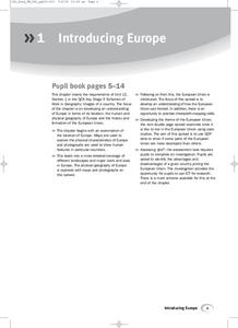
Introducing Europe
Provide your learners with a comprehensive introduction to Europe with this great set of worksheets. Map activities include matching European countries to their capitals and places on a political map, as well as...
Curated OER
The Big Circle
Learners explore geography by participating in a mapping activity. In this concentric ring instructional activity, students utilize a poster board, string and markers to identify their current location within the entire world. Learners...
Curated OER
Utah's Harvest
Fourth graders recognize the importance of the physical geography on a community. In this commodities lesson, 4th graders graph the five most important commodities of Utah. Students understand why these commodities are so...
Curated OER
Year 3 Geography
In this social studies worksheet, learners find the words that are related to the concepts found in Geography and the answers are found at the bottom of the page.
Curated OER
Kid Maps: Reading and Creating Maps with Human Characteristics
Students look at maps. In this map lesson, students listen to the book My Map Book by Sara Fanelli and they see the difference between human characteristics (buildings, etc.) and natural characteristics (rivers, etc.). They...
Curated OER
Walking the Five Themes - Your Community to Ours
Young scholars in two classrooms share information about their communities in classrooms throughout the year. In groups, they identify the physical and human characteristics of each area and how they change through time. They also...
Curated OER
Agriculture in the Desert
Students explore human migration. In this human migration lesson, students investigate multiple factors contributing to the growth of major Arizona cities. Students discover the processes, patterns, and functions of human settlement.
Curated OER
5 Themes Awareness of Current Event Issues
Students identify the 5 themes of geography as being location, place, human-environmental interaction, movement and region. They explain a current event from the perspective of each theme and their interrelationship..
Curated OER
Island Inquiry: Based on the Northern Mariana Islands Quarter
Students research two physical and/or human characteristic topics of the Northern Mariana Islands in groups of four students. In this social studies lesson plan, students analyze how to write magazine articles and research the two...
Curated OER
Trading Information
Students create a trading card about a state bordering the Mississippi River. Using traditional and internet research, students generate a list of interesting facts about their chosen state using the five themes of geography. They use...
Curated OER
Finding Your Way On the Farm
Third graders explore the food industry by viewing a presentation about farming. In this farming geography instructional activity, 3rd graders view globes and maps while identifying the prime geographical locations for fertile land....
Curated OER
Location of Cities 201
Young scholars work in pairs to locate the ancient cities on a world atlas using the longitude and latitude measurements. They examine the physical and human futures that explain their locations.
Curated OER
Geography, Map Skills & the Internet:
Students research various websites focusing on Italy while enhancing student utilization of computer, keyboards and the Internet. They discuss their findings on the geography, history, topography, and culture.
Curated OER
The Human Face of Flagstaff
Students make a brochure for Flagstaff, Arizona. In this geography lesson, students look at a map of Arizona and the Flagstaff Chamber of Commerce sheet to find natural and human features of the city. They create a brochure describing...
Curated OER
Lesson Plan: Five Themes of Geography
After learning the five themes of geography, learners take an Internet trip and categorize information found into one of the five themes. They answer five questions about the places explored. That is about all there is to this lesson; it...
Curated OER
Community Map of The Giver
Pupils read "The Giver" after finishing the unit on inventions and inventors. Using the information in the novel, they develop a geographic map illustrating the community in the story. They identify human and physical features and...
Curated OER
Human Migration in the United States
Students investigate the factors involved in human migration in the United States. Students analyze maps of different regions in the United States to determine how a variety of factors influence human settlement and development.
Curated OER
The Historical Geography of Mesopotamia
Students show how the geography of the Mesopotamia region has impacted the beginnings of civilization. They show how this area has long been the site of the rise and fall of great empires, and how the geography of this region has a lot...
Curated OER
Latitude and Longitude: Geography and Geometry!
Second graders use latitude and longitude coordinates to pinpoint an exact location on the map. In this geography instructional activity, 2nd graders utilize handouts from the Maritime Museum in order to gain practice in finding...


